Maps of Scotland
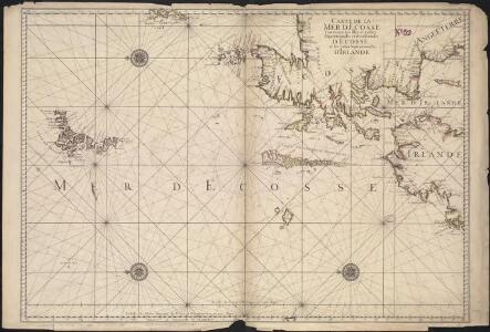
Carte de la mer d'Ecosse contenant les isles et costes septentrionales et occidentales d'Ecosse et les costes septentrionales d'Irlande
1 : 1200000
Le royavme d'Escosse
1 Karte : Kupferdruck ; 45 x 59 cm Nolin; Du Tralage; Coronelli; Mondhare; Jean chez Mondhare et Jean rue St. Jean de Beauvais
Royaume d'Escosse
1 Karte : Kupferdruck ; 37 x 51 cm Fer chez l'autheur dans l'isle du Palais sur le quay de l'Orloge a la sphere royale
Le royavme d'Escosse
1 Karte : Kupferdruck ; 45 x 60 cm Nolin; Coronelli chez I. B. Nolin sur le quay de l'Horloge du Palais proche la rue de Harlay a l'enseigne de la place des Victoires
Composite: Scotland.
1 : 700000 Lizars, Daniel
Scotland.
1 : 3000000 Seaman, James V.
Composite: Scotland or North Britain.
1 : 447000 Campbell, Robert, Lieutenant
Scotland.
1 : 2100000 Darton, William
Karte von Scotland
1 : 900000 Skotsko Dorret, J. Schraembl, Franz Anton F.A. Schraembl
Karte von Scotland
1 : 900000 Skotsko Dorret, J. Schraembl, Franz Anton F.A. Schraembl
Scotland.
1 : 1350000 Weiland, C. F. (Carl Ferdinand), d. 1847
Carte du royaume d'Ecosse
1 Karte : Kupferdruck ; 75 x 51 cm Hérisson; Basset; Perrier; Dien; Basset chez Basset rue Jacques no. 670 au coin de celle des Mathurins
Andrews's new and accurate travelling map of the roads of Scotland, shewing the distances between the towns &c.
1 : 1
Scotland.
1 : 1500000 Colton, G.W.
Composite: Scotland.
1 : 500000 Cary, John, ca. 1754-1835
Scotland.
1 : 1550000 Lavoisne, M.
Das Königreich Scotland
1 Karte : Kupferdruck ; 20 x 27 cm Reilly F. J. J. von Reilly
Karte von Scotland
1 Karte : Kupferdruck ; 54 x 50 cm Schrämbl; Dorret; Stenger zu finden in eigenem Verlage Schrämbl
L'Escosse royaume
1 Karte : Kupferdruck ; 39 x 49 cm Sanson; Fortin chez Fortin ing.r mécanicien du roi pour les globes rue de la Harpe près celle du Foin
A new [and] accurate map of Scotland or North Britain
1 Karte : Kupferdruck ; 41 x 34 cm Bowen s.n.
A correct map of Scotland from new surveys
1 Karte auf 2 Blättern : Kupferdruck ; 75 x 59 cm Dorret s.n.
L'Escosse royaume
1 Karte : Kupferdruck ; 39 x 50 cm Sanson; Mariette chez Pierre Mariette rue St. Iacques a l'esperance
Scotia regnvm cum insulis adjacentibus
2 Karten auf einem Blatt : Kupferdruck ; zusammen 40 x 52 cm Gordon; Blaeu Joan Blaeu
Isles britanniques
1 Karte : Kupferdruck ; 31 x 42 cm Mentelle; Tardieu; André Mentelle
Composite: Scotland.
1 : 486830 Stanford, Edward
Scotia Regnum / Per Gerardum Mercatorem ...
Mercator, Gerhard, 1512-1594
Black's new large map of Scotland.
Black, Adam, 1784-1874 Black, Charles
Naturalist's Map of Scotland. By J.A. Harvie-Brown... and J.G. Bartholomew
Harvie-Brown, J.A. Bartholomew, John G., 1860-1920
The Kingdome of Scotland / performed by Iohn Speed.
Speed, John, 1552?-1629
Scotiae Regni Antiqvissimi Accvrata Descriptio / Io Leslavs, Epus Rossen. Scotiae Regni Antiquissimi Accurata Descriptio.
Leslie, John, 1527-1596
A new and accurate map of Scotland divided into shires from the most authentick surveys.
Meuros, James
Les Isles Orcadney, ou Orkney ; Schetland, ou Hetland ; et de Fero, ou Farre, tirées de divers memoirs / par Sanson d'Abbev.
Sanson, Nicolas, 1600-1667
Scotiae Regnum [north sheet] / per Gerardum Mercatorem.
Mercator, Gerhard, 1512-1594
L' Escosse Royaume en ses deux Principales Parties ; qui sont Decà, et Del à le Taý, et Chaque Partie Subdivisée et leures Provinces qu'ils appellent Shirif-domes, Stewarties &c. / par Sanson d'Ab
Sanson, Nicolas, 1600-1667
A new chart of the sea coast of Scotland with the islands thereof.
J. Mount and T. Page
Le Royaume d'Ecosse divisé en shires ou comtes.
de Vaugondy, Gilles Robert
Scotland divided into its Shires / by H. Moll.
Moll, Herman, d. 1732
Extimae Scotiae pars septentrionalis in qua provinciae Rossia, Sutherlandia, Cathenesia, et Strath-Naverniae.
Jansson, Jan, 1588-1664
A new map of Scotland, from the latest authorities.
Cary, John, 1755-1835
Map of Scotland from the latest surveys.
Stockdale, John
Black's new large map of Scotland.
Black, Adam, 1784-1874 Black, Charles
Scotland.
Society for the Promotion of Christian Knowledge
Black's new large map of Scotland.
Black, Adam, 1784-1874 Black, Charles
Black's new large map of Scotland.
Black, Adam, 1784-1874 Black, Charles
Map of Scotland from the latest surveys.
Stockdale, John
Philp's Comic Map of Scotland.

This map of Scotland, constructed and engraved from the best authorities...
Kirkwood, James, 1745/6-1827 & Sons
A new and complete map of Scotland and islands thereto belonging.
Kitchin, Thomas? Bowles, Carrington?
A commercial map of Scotland.
Knox, John, 1720-1790
Stanford's map of Scotland.
Stanford, Edward
Scotia.
Porcacchi, Thomaso, ca. 1530-1585?
A Chart Describing the Coast of Scotland from Berwick to Dungsby Head wth the Isles of Orkney Shetland & ye Western Islands.
Anon
A new and correct map of Scotland or North Britain, drawn from the most approved surveys.
Campbell, Robert
Andrews's new and accurate travelling map of the roads of Scotland
Andrews, John, fl. ca. 1766-1800
A new map of Scotland, from the latest authorities.
Cary, John, 1755-1835
Map of Scotland constructed from original materials.
Arrowsmith, Aaron, 1750-1823
Map of Scotland from the latest surveys.
Stockdale, John
Stanford's map of Scotland.
Stanford, Edward
Scotia Regnum.
Blaeu, Willem Janszoon, 1571-1638
A Display of the Coasting Lines of six several maps of North Britain [Adair, Moll, Gordon of Straloch, Senex, Inselin, Sanson] / by I. Cowley.
Cowley, J. (John)
Scotland.
Playfair, James
This map of Scotland, constructed and engraved from the best authorities...
Kirkwood, James, 1745/6-1827 & Sons
Map of Scotland from the latest surveys.
Stockdale, John
Scotland, drawn from a series of angles and astronomical observations...
Ainslie, John, 1745-1828
Scotland / by Robt. Morden.
Morden, Robert d. 1703
Scotland, drawn from a series of angles and astronomical observations...
Ainslie, John, 1745-1828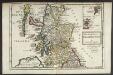
The North Part of Great Britain / by Hermann Moll.
Moll, Herman, d. 1732.
Scotland with its islands...
Wyld, James, 1790-1836
A pocket companion of ye roads of ye North part of Great Britain called Scotland ... / by Herman Moll.
Moll, Herman, d. 1732
Scotiae tabula / Abraham Ortelius.
Ortelius, Abraham, 1527-1598
Map of Scotland constructed from original materials.
Arrowsmith, Aaron, 1750-1823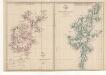
Scotland.
Weller, Edward
Scotland.
Weller, Edward
A new & correct map of North Britain.
Elphinstone, John, 1706-1753
Scotland, drawn from a series of angles and astronomical observations...
Ainslie, John, 1745-1828
Lorna, Knapdalia, Cantire, Jura, Ila, Glota, et Buthe insulae.
Jansson, Jan, 1588-1664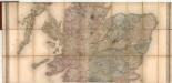
A map of Scotland divided into counties shewing the principal roads, railways, rivers, canals... on a scale of five miles to an inch.
Carrington, Frederick A. Carrington, G.W.
Ascozia.
Raif, Mahmoud Abdurrhaman
Map of Scotland from the latest surveys.
Stockdale, John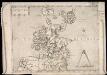
Scotia. Regno di Scotia.
Forlani, Paolo?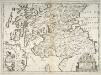
Scotia : parte settentrionale ; parte meridionale / descritta, e dedicata dal P. Cosmgrafo Coronelli, Al Reuereudissimo Padre Maestro Tomaso Maria Peire Teo logo di S.A.R. dela Duca di Sauoia.
Coronelli, Vincenzo, 1650-1718
Scotland.
Johnston, Alexander Keith, 1804-1871
The north-part of England and the south-part of Scotland. Quartermaster's map.
Jenner, Thomas, fl. 1618-1673 Hollar, Wenceslaus, 1607-1677
Lochabria, omnesq, Insulae versus Occidentem sitae, ut Visto, Mulla, aliaeque.
Jansson, Jan, 1588-1664
Airey's Railway Map of Scotland.
Airey, John
Scotia : parte settentrionale ; parte meridionale / descritta, e dedicata dal P. Cosmgrafo Coronelli, Al Reuereudissimo Padre Maestro Tomaso Maria Peire Teo logo di S.A.R. dela Duca di Sauoia.
Coronelli, Vincenzo, 1650-1718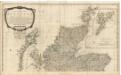
A new and correct map of Scotland or North Britain, with all the post and military roads.
Campbell, Robert
A Mapp of Scotland : made by R. Gordon, Author of Blaeu's Atlas of Scotland / corrected and Improved by Rob. Morden. To which is added Alphabetical Tables For the Ready finding out any Place in the Ma
Morden, Robert d. 1703.
A general map of Scotland and islands thereto belonging.
Dorret, James, fl. 1744-1761
L'Eccosse suivant les nouvelles observations publies a Londres en 1735 par Bowles.
Le Rouge, George Louis, fl. 1740-1780
Scotland.
Moll, Herman, d. 1732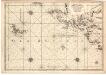
Carte de la mer d'Escosse contenant les isles et costes septentrionales et occidentales d'Escosse...
Bellin, J. N.
Scotia regnum cum insulis adjacentibus / Robertus Gordonius a Straloch descripsit.
Blaeu, Willem Janszoon, 1571-1638 Santen, Dirck Jansz van 1637 or 8-1708
The north part of Great Britain called Scotland : with considerable inprovements [sic] and many remarks not extant in any map. / According to the newest and exact observations by Hermann Moll.
Moll, Herman, d. 1732.
Black's new large map of Scotland.
Black, Adam, 1784-1874 Black, Charles
An accurate map of Scotland drawn from all the particular surveys...
Dorret, James, fl. 1744-1761
A map of Scotland drawn chiefly from the topographical surveys of John Ainslie...
Faden, William, 1750-1836
Map of Scotland from the latest surveys.
Stockdale, John
A commercial map of Scotland.
Knox, John, 1720-1790
Scotia Regnum / Gule Hole sculp.
Hole, William, d. 1624
Stanford's map of Scotland.
Stanford, Edward
Scotland, drawn from a series of angles and astronomical observations...
Ainslie, John, 1745-1828
Nouvelle Carte d'Ecosse, où l'on fait observer l'Etat de la Noblesse : les Villes, et les Bourgs qui deputent au Parlement, et Diverses autres remarques propres à Conduire à l'Inteligence de l'Histoir
Châtelain, Zacharias.
Map of Scotland constructed from original materials.
Arrowsmith, Aaron, 1750-1823
A general map of Scotland and islands thereto belonging.
Dorret, James, fl. 1744-1761
A new map of Scotland, from the latest authorities.
Cary, John, 1755-1835
Magnae Britannia : pars septentrionalis qua regnum Scotiae in suas partes et subja centes insulas divisum / Accurata tabula ex archetypo Vischeriano desumta exhibetur imatatore Iohan. Bapt. Homanno, N
Homann, Johann Baptist, 1663-1724
Tourist's map of Scotland... showing the new county boundaries.
Bartholomew, John G., 1860-1920
L' Escosse delà le Taý, divisée en ses Provinces &c. tirées de toutes les Cartes particulieres de Timot Pont, de R. Gordon a Straloch / par Sanson d'Abbev[ille].
Sanson, Nicolas, 1600-1667
Library or travelling map of Scotland.
Johnston, Alexander Keith, 1804-1871
Vraye & exacte description Hydrographique des costes maritimes d'Escosse & des Isles Orchades Hebrides avec partie d'Angleterre & d'Irlande servant a la navigation / Par N. de Nicolay D'au
Nicolay, Nicolas de, 1517-1583
Map of Scotland from the latest surveys.
Stockdale, John
Map of Scotland from the latest surveys.
Stockdale, John
Scotland, drawn from a series of angles and astronomical observations...
Ainslie, John, 1745-1828
Ainslie's travelling map of Scotland shewing the distances from one stage to another.
Ainslie, John, 1745-1828
A map of Scotland drawn chiefly from the topographical surveys of John Ainslie...
Faden, William, 1750-1836
Scotia Provinciae intra Flumen Taum, et Murra fyrth sitae, utpote Moravia, Badenocha, Atholia, Aberdonia, Baneia, et Mernis.
Jansson, Jan, 1588-1664
A new map of Scotland, from the latest authorities.
Cary, John, 1755-1835
A chart of the Coast of Scotland with all its islands : drawn according to the Globular Projection.

A Mapp of the Kingdome of Scotland / by Ric. Blome ; R. Palmer, sculp.
Blome, Richard, d. 1705
Scotland.
Johnston, Alexander Keith, 1804-1871
Scotiae pars septentrionalis.
Hondius, Hendrik, 1597-1651
Scotland, drawn from a series of angles and astronomical observations...
Ainslie, John, 1745-1828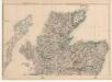
Scotland.
Weller, Edward
Charte von Scotland.
Stieler, August
Exactissima Regni Scotiae Tabula tam in septentrionalem et meriodionalem quam in minores earundem provincias insulesq, et undique praetensas accurate divisa / per Nicolaum Visscher.
Visscher, Nicolaes, 1649-1702
Black's new large map of Scotland.
Black, Adam, 1784-1874 Black, Charles
The Kingdome of Scotland / performed by Iohn Speed.
Speed, John, 1552?-1629
A New Map of North Britain with the Islands thereunto belonging ; / done from some late Surveys of part of the East and West Coasts, and from Modern Accounts of the Country and other Authorities ment
Cowley, J. (John) Seale, R. W., fl. 1734
Karte von Scotland nach Dorret.
von Reilly, Franz
Scotiae provintiae inter Taum Fluvium, et Septentrionales oras Angliae.
Jansson, Jan, 1588-1664
Map of Scotland from the latest surveys.
Stockdale, John
Map of Scotland from the latest surveys.
Stockdale, John
Black's new large map of Scotland.
Black, Adam, 1784-1874 Black, Charles
A new chart of the sea coast of Scotland with the islands thereof.
W. & J. Mount & T. Page
Scotland.
Hebert, Lewis
Stanford's map of Scotland.
Stanford, Edward
Geographical and statistical map of Scotland.
Walker, John, 1759-1830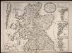
Le Royaume d'Escosse divisé en deux parties ... dressé par le P. Coronelli ... / corrigé et augmenté sur les Mémoires du Sr. Tillemon ... Dedié à le Prince de Galles, fils de Jacques II.
Coronelli, Vincenzo, 1650-1718 Nolin, Jean Baptiste
A new map of Scotland for ladies needlework.
Whittle, James Laurie, Robert
A correct map of Scotland from new surveys.
Dorret, James, fl. 1744-1761
[Scotiae Regnum south sheet] / per Gerardum Mercatorem per privilegio.
Mercator, Gerhard, 1512-1594
Map of the Highlands of Scotland denoting the districts or counties inhabited by the Highland Clans.
Lizars, William Home, 1788-1859
Scotland, drawn from a series of angles and astronomical observations...
Ainslie, John, 1745-1828
Ecclesiastical map of Scotland.
Arrowsmith, Aaron, 1750-1823
Novissima Regni Scotiae septentrionalis et meridionalis tabula, divisae in ducatus, comitatus, vice-comitatus, provincias, praefecturas, dominia et insulas / auctore Carolo Allard.
Allard, Carel, 1648-ca. 1709
Scotland, drawn from a series of angles and astronomical observations...
Ainslie, John, 1745-1828
Betts's improved educational maps: Scotland.
Betts, Henry D.
Scotland, drawn from a series of angles and astronomical observations...
Ainslie, John, 1745-1828
A general map of Scotland and islands thereto belonging.
Dorret, James, fl. 1744-1761
A general map of Scotland and islands thereto belonging.
Dorret, James, fl. 1744-1761
Black's new large map of Scotland.
Black, Adam, 1784-1874 Black, Charles
Black's new large map of Scotland.
Black, Adam, 1784-1874 Black, Charles
A chart of the Coast of Scotland with all its islands : drawn according to the Globular Projection.

Scotia Regnum divisum in Partem Septentrionalem et Meridionalem Subdivisas in Comitatus, Vice comitatus Provincias Praefecturas Dominia et Insulas / per F. de Wit.
Wit, Frederik de.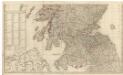
A new and correct map of Scotland or North Britain, with all the post and military roads.
Campbell, Robert
Map of Scotland constructed from original materials.
Arrowsmith, Aaron, 1750-1823
Black's new large map of Scotland.
Black, Adam, 1784-1874 Black, Charles
A true and exact Hydrographical description of the Sea coast and Isles of Scotland made in Voyage round the same by that great and mighty James the 5th. [First] published at Paris by Nicholay D'aulphi
Adair, John, ca. 1650-1722
A new and complete map of Scotland and islands thereto belonging.
Kitchin, Thomas? Bowles, Carrington?
Scotland.
Arrowsmith, John, 1790-1873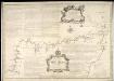
A Map of the North Coast of Britain, from Row Stoir of Assynt, to Wick in Caithness : By a Geometrical Survey with the Harbours, Rocks, & an Account of the Tides in the Pentland Firth, done at the
Bryce, Alexander fl. ca. 1744 Cooper, Richard, 1705-1764
Scotland, entworfen und gezeichnet.
Weiland, Carl Ferdinand
Black's new large map of Scotland.
Black, Adam, 1784-1874 Black, Charles
A new and complete map of Scotland and islands thereto belonging.
Kitchin, Thomas? Bowles, Carrington?
A new and complete map of Scotland and islands thereto belonging.
Kitchin, Thomas? Bowles, Carrington?
L' Escosse decà le Taý, divisée en ses Provinces &c. tirées de toutes les Cartes particulieres qu'en ont faict Timothée Pont, Robert Gordon a Straloch / par Sanson d'Abbev[ille].
Sanson, Nicolas, 1600-1667
Map of Scotland from the latest surveys.
Stockdale, John
[Scotiae pars australis]
Hondius, Hendrik, 1597-1651
Black's new large map of Scotland.
Black, Adam, 1784-1874 Black, Charles
Tabula Leogi et Haraiae ac Skiae vel Skianae Insularum.
Jansson, Jan, 1588-1664
A map of Scotland divided into counties shewing the principal roads, railways, rivers, canals... on a scale of five miles to an inch.
Carrington, Frederick A. Carrington, G.W.