Maps of Noord-Brabant
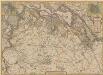
Pars Septentrionalis Brabantiae, Et Circumiacentium Provinciarum. [Karte] Bergen Op Den Zoom [Nebenkarte] Breda [Nebenkarte], in: Novus atlas absolutissimus, Bd. 3, S. 37.
1 Karte aus Atlas Janssonius Offizin
Kaart van Noord Braband
1 : 580000 volgens de nieuwste en naauwkeurigste stukken zamengesteld en in het koper gebragt door Dl. Veelwaard, Junior. Te Haarlem : bij de Erven F. Bohn

Le Brabant Hollandois et Partie du Comté de Hollande &c.
1 : 260000 Mollova mapová sbírka Nolin, Jean-Baptiste Nolin, Jean Baptiste
Tabula ducatus Brabantiae continens marchionatum sacri imperii et dominium Mechliniense
1 : 230000 Brabantsko Danckerts, Justus Ioannum Danckerum
Brabantiae pars septentrionalis
1 : 172000 Brabantsko Hondius, Henricus H. Hondii
Brabantiae pars septentrionalis
1 : 170000 Brabantsko Hondius, Henricus sumptibus Henrici Hondy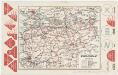
Noord-Brabant, uit: [Provinciale fietskaart ...]
Annotatie: Boven en onder het kaartbeeld verkeersborden voor wielrijders; Provincienaam op voorkant geflankeerd door provinciewapen en wapen van de provinciehoofdstad, waaronder een stadsbeeld met fietser in klederdracht; Kaart van Overijssel ontbreekt Deventer : Burgers E.N.R
Brabantiae ducatus cum adjacentibus provinciis
1 : 310000 Brabantsko Visscher, Nicolaus Schenk, Pieter P. Schenk
Brabantiae Ducatus cum Adjacentibus Provinciis
1 : 316000 Mollova mapová sbírka Visscher, Nicolaes Jansz. Schenk, Pieter Visscher, Nicolaus II.
Ducatus Brabantiae Tabula
1 : 225000 Mollova mapová sbírka Danckerts, Johannes Danckerts, Johannes
Brabant Septentrionale.
1 : 220000 Robert de Vaugondy, Gilles, 1688-1766
De Zuider Deelen Der Provincien van Holland en Untrecht; Het Graafschap Zeeland, Hollands Brabant, Het Gebied van Antwerpen en Staats Vlaanderen. Ofte Het Noorder Deel van De Stoel des Oorlogs In Nederland tot Parys toe
1 : 250000 Mollova mapová sbírka Allard, Abraham Allart, Abraham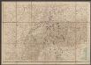
Le Duché De Brabant. qui comprend les Quartiers de Louvain, Brusselles, Anvers, Et Bosleduc. [...] [Karte], in: Atlas nouveau, contenant toutes les parties du monde [...], Bd. 2, S. 27.
1 Karte aus Atlas Sanson, Nicolas Jaillot, Alexis Hubert und Mortier, Pieter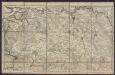
Partie septentrionale du duché de Brabant
1 : 125000 Paris : Dezauche
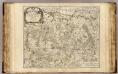
Le Brabant Espagnol qui comprend les Quartiers de Bruselles, de Louvain et partie de celuy d'Anvers
1 : 260000 Mollova mapová sbírka Sanson, Guillaume Jaillot, Alexis Hubert
Le Brabant Hollandois qui comprend Quartier de Bos-le-Duc, le Marquisat de Berg-Op-Zoom, et la Baronie de Breda
1 : 240000 Mollova mapová sbírka Sanson, Guillaume Jaillot, Alexis Hubert
Ducatus Brabantiae nova tabula
1 : 233000 Brabantsko Homann, Johann Baptist a Ioh. Bapt. Homanno
DUCATUS BRABANTIAE Nova Tabula
1 : 230000 Brabantsko Homann, Johann Baptist a Ioh. Bapt. Homanno
Ducatus Brabantiae nova tabula
1 : 230000 Brabantsko Homann, Johann Baptist a Ioh. Bapt. Homanno
Ducatus Brabantiae nova tabula
1 : 230000 Brabantsko Homann, Johann Baptist a Ioh. Bapt. Homanno
Nova tabula geographica exhibens ducatum Brabantiae
1 : 230000 Brabantsko Lotter, Tobias Conrad Lotter, Matthäus Albrecht sumptibus Tobiae Conradi Lotter
Nova tabula geographica exhibens ducatum Brabantiae
1 : 230000 Brabantsko Lotter, Tobias Conrad Lotter, Matthäus Albrecht sumptibus Tobiae Conradi Lotter
Nova tabula geographica exhibens ducatum Brabantiae
1 : 230000 Brabantsko Lotter, Tobias Conrad Lotter, Matthäus Albrecht sumptibus Tobiae Conradi Lotter
Brabantiae Ducatus S. R. Imperii Marchionatus Mechliniaeq;
1 : 270000 Mollova mapová sbírka Mortier, Cornelis Covens, Johannes I
Nova tabula geographica exhibens Ducatum Brabantiae cum pertinentiis et adjacentibus regionibus
1 : 250000 Matth. Albr. Lotter sculps. Aug. Vindel. : sumptibus et studio elaborata Tobiae Conradi Lotter
Brabantiae Ducatus cum adjacentibus Provinciis
1 : 316000 Mollova mapová sbírka Seutter, Matthäus Seutter, Matthäus

![Pars Septentrionalis Brabantiae, Et Circumiacentium Provinciarum. [Karte] Bergen Op Den Zoom [Nebenkarte] Breda [Nebenkarte], in: Novus atlas absolutissimus, Bd. 3, S. 37.](https://images-2.georeferencer.com/images/iiif/293537960343/full/,300/0/native.jpg)

