Maps of French Southern and Antarctic Lands

Mare di India [Karte], in: Novus atlas absolutissimus, Bd. 9, S. 98.
1 Karte aus Atlas Janssonius Offizin
Mar di India [Karte], in: Het vijfde Deel Des Grooten Atlas : Vervatende De Water-Weereld, S. 82.
1 Karte aus Atlas Jansson, Jan Jansson, Jan
Physikalische Karte vom Indischen Meere
Erster Band, enthaltend in vier Abtheilungen die Erscheinungen der anorganischen Natur: 1. Meteorologie und Klimatographie. 2. Hydrologie und Hydrographie. 3. Geologie. 4. Tellurischer Magnetismus Humboldt, Alexander von Verlag von Justus Perthes
Physical Chart of the Indian Ocean
The physical atlas Johnston, Alexander Keith William Blackwood & Sons
Indian Ocean.
1 : 26000000 Johnston, Alexander Keith, 1804-1871
Physikalische Karte vom Indischen Meere.
1 : 44000000 Berghaus, Heinrich
Amérique ou Nouveau Continent
1 Karte : Kupferdruck ; 45 x 52 cm, Gesamtgrösse 47 x 67 cm Nolin; Basset; Basset chez Basset rue St. Jacques
N & S America.
1 : 21000000 Jefferys, Thomas
L'Amerique ou le Nouveau Continent
1 Karte : Kupferdruck ; 43 x 58 cm Nolin; Jenvilliers; Cochin chez l'auteur quay de l'Horloge du Palais a l'enseig.ne de la place des Victoires
L'America divisa ne' suoi principali stati
1 Karte : Kupferdruck ; 30 x 40 cm Zatta; Zuliani presso Antonio Zatta
L'Amerique septentrionale [et] meridionale
1 Karte : Kupferdruck ; 45 x 56 cm Valck chez Gerard Valck sur le dam
L'America secondo leultime osservazioni divisa né suoistati principali / Gio. Ma. Cassini Somo. inc.
from Whole Gio. Ma. Cassini Somo. inc.,
Composite: America.
1 : 24000000 Lizars, Daniel
Indian Ocean cables, wireless stations.
1 : 40000000 Philip, George
America.
1 : 55000000 Reichard, C. G.
Composite: North & South America.
1 : 21000000 Jefferys, Thomas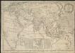
Map of the European settlements in the East Indies and on the eastern coast of Africa including part of Europe
1 : 33000000
Pilot chart of the Indian Ocean
1 : 18000000 Indický oceán (oblast) Maury, Matthew Fontaine Hydrographic Office
Pilot chart of the Indian Ocean
1 : 18000000 Indický oceán (oblast) Maury, Matthew Fontaine Hydrographic Office
Indischer Ocean
E. von Sydow's Schul-Atlas in sechs und dreissig Karten Sydow, Emil von bei Justus Perthes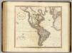
America.
1 : 42000000 Cary, John, ca. 1754-1835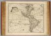
America.
1 : 50000000 Bowen, Emanuel
L'Ameriqve autrement le Novveav Monde et Indes Occidentales
1 Karte : Kupferdruck ; 36 x 37 cm Duval chez l'autheur au coin de la rüe de Harlay proche le palais
L'Ameriqve autrement le Novveav Monde et Indes Occidentales
1 Karte : Kupferdruck ; 37 x 37 cm Duval; L'Huilier chez l'autheur proche le fort l'Evesque
Indian Ocean
1 : 20000000 Austrálie National Geographic Society
America.
1 : 26000000 Kiepert, Heinrich, 1818-1899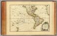
L'Amerique.
1 : 60000000 Janvier, Jean
OEstliche Halbkugel
Afrika
America.
1 : 8000000 Seymour, J.H.
![Mare di India [Karte], in: Novus atlas absolutissimus, Bd. 9, S. 98.](https://images-2.georeferencer.com/images/iiif/037759222615/full/,300/0/native.jpg)

