Maps of Asia

Nova Totius Terrarum Orbis Geographica Ac Hydrographica Tabula [Karte], in: Theatrum orbis terrarum, sive, Atlas novus, Bd. 1, S. 24.
1 Karte aus Atlas Blaeu, Joan Blaeu, Willem Janszoon
Pharmacognostische Karte zur Pharmacopoea Germanica
1 : 85000000 Schelenz, H. E. [Buchh. des Waisenhauses]
Planiglob in Mercators Projection, zur Uebersicht der Erdfläche und der Seereisen
Hand-Atlas über alle Theile der Erde nach dem neuesten Zustande und über das Weltgebäude Stieler, Adolf bei Justus Perthes
Nova Totius Terrarum Orbis Geographica Ac Hydrographica Tabula [Karte], in: Novus Atlas, das ist, Weltbeschreibung, Bd. 1, S. 16.
1 Karte aus Atlas Blaeu, Joan Blaeu, Willem Janszoon
Nova Totius Terrarum Orbis Geographica Ac Hydrographica Tabula [Karte], in: Le théâtre du monde, ou, Nouvel atlas contenant les chartes et descriptions de tous les païs de la terre, Bd. 1, S. 26.
1 Karte aus Atlas Blaeu, Willem Janszoon und Blaeu, Joan Blaeu, Willem Janszoon
Museumskart 162: Atlasillustrasjon
Christoph Weigel
[1] Nova orbis tabula, uit: Atlas sive Descriptio terrarum orbis
Annotatie: Gedigitaliseerde versie. Amsterdam. Heiloo : Picturae (vervaardiger), 2015. tiff-bestand. Gedigitaliseerd: 07-01-2015; Origineel: Universiteitsbibliotheek Vrije Universiteit (XL.05127.-) ; Netherlands; Titelpagina ontbreekt Wit, Frederik de Amsterdam : Frederick de Wit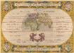
Aevi Veteris, Typus Geographicus. [Karte], in: Theatrum orbis terrarum, S. 359.
1 Karte aus Atlas Ortelius, Abraham
Orbis Terrarum Nova Et Accuratissima Tabula. [Karte], in: Novus atlas absolutissimus, Bd. 1, S. 17.
1 Karte aus Atlas Janssonius Offizin
World in Hemispheres.
1 : 72000000 Johnston, W. & A.K.
[Planiglob in Mercators Projection, zur Uebersicht der Erdfläche und der Seereisen]
Stieler's Hand-Atlas Stieler, Adolf bei Justus Perthes
Atlas über die Entwicklung von Industrie und Handel der Schweiz in dem Zeitraume vom Jahr 1770 bis zum Jahr 1870
1 : 45000000 1 Atlas ([3], VIII Bl.) im Auftrage der schweizerischen Commission für die additionellen Ausstellungen in Wien, bearbeitet von Dr. Hermann Wartmann Wurster Randegger & Co., Winterthur
World.
1 : 110000000 Lavoisne, M.
Mappemonde.
Levasseur, E.
Western Hemisphere.
1 : 123000000 Lucas, Fielding Jr.
Welt-Karte, Globular-Proj.
1 : 150000000 Radefeld, Carl Christian Franz, 1788-1874
Planiglob zur Ubersicht der Verbreitung der Indo-Germanen .
1 : 140000000 Berghaus, Heinrich
Welt-Karte, Mercators Proj.
1 : 125000000 Radefeld, Carl Christian Franz, 1788-1874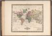
World on Mercators Projection.
1 : 80000000 Tanner, Henry S.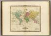
The World On Mercators Projection.
1 : 80000000 Tanner, Henry S.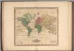
World on Mercators Projection.
1 : 80000000 Tanner, Henry S.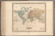
World on Mercators Projection.
1 : 80000000 Tanner, Henry S.
World on Mercators Projection.
1 : 80000000 Tanner, Henry S.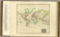
Hydrographical chart of the World.
1 : 82000000 Thomson, John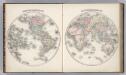
Western Hemisphere. Eastern Hemisphere.
1 : 60000000 Colton, G. Woolworth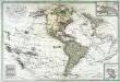
Carte de l'Amerique septentrionale et méridionale
1 Karte auf 2 Blatt : Kupferdruck ; 50 x 75 cm Lotter; Lotter Lotter
Principal Mountains, Plateaus, & Plains of The World.
1 : 100000000 Johnson, A.J.
Facsimile: World by Mercator.
Mercator, Gerardus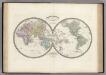
Mappemonde en deux Hemispheres.
Levasseur, E.
![Nova Totius Terrarum Orbis Geographica Ac Hydrographica Tabula [Karte], in: Theatrum orbis terrarum, sive, Atlas novus, Bd. 1, S. 24.](https://images-2.georeferencer.com/images/iiif/483388009430/full/,300/0/native.jpg)

