Maps of India
India Orientalis [Karte], in: Gerardi Mercatoris Atlas, sive, Cosmographicae meditationes de fabrica mundi et fabricati figura, S. 535.
1 Karte aus Atlas Mercator, Gerhard Montanus, Petrus
Les Indes Orientales.
1 : 29000000 Lattre, Jean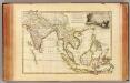
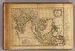
Indes Orientales.
1 : 16250000 Bonne, Rigobert, 1727-1794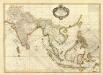
Composite: Indes.
1 : 10000000 Bonne, Rigobert, 1727-1794
India int. Gangem merid. India ext. Gangem, Sinarum situs
1 : 7600000 Ganga (Indie a Bangladéš) Reichard, Christian Gottlieb Campius, D. a D. Campio
Hindoostan, Farther India, China, Tibet.
1 : 17500000 Mitchell, Samuel Augustus
Hindoostan, Farther India, China, Tibet.
1 : 17500000 Mitchell, Samuel Augustus
Hindoostan, Farther India, China, Tibet.
1 : 17500000 Mitchell, Samuel Augustus Jr.
Hindoostan, Farther India, China, Tibet.
1 : 17500000 Williams, W. (Wellington)
Carte des possessions anglaises de l'Inde, comprenant les établissements anglais dans l'Indoustan, l'Indo-Chine et la Chine / par A.H. Dufour ; gravée par Regnier et Dourdet
1 : 7800000 Dufour, Auguste Henri; Regnier, ...; Dourdet, ... Paris : Paulin et le Chevalier
Ost-Indien.
1 : 18500000 Stulpnagel, F.v.
Ostindien.
1 : 22000000 Reichard, C. G.
Hindoostan, Farther India, China, Tibet.
1 : 17500000 Williams, W. (Wellington)
Map Of Hindoostan, Farther India, China, and Tibet.
1 : 17600000 Mitchell, Samuel Augustus
Ostindien
Neuester Schul-Atlas Walch, Johann im Verlag bei Joh. Walch
Ostindien
Allgemeiner Atlas [Walch, Johannes] im Verlag bei Johannes Walch
Ost-Indien
Hand-Atlas über alle Theile der Erde und über das Weltgebäude Stieler, Adolf Justus Perthes
Ost-Indien
Handatlas über alle Theile der Erde und über das Weltgebäude Stieler, Adolf Justus Perthes
Ostindien und China
1 : 25000000 Himálaj Kocen, Blaž Eduard Hölzel
Ost-Indien mit den Inseln
Hand-Atlas über alle Theile der Erde nach dem neuesten Zustande und über das Weltgebäude Stieler, Adolf bei Justus Perthes
Map of Hindoostan, Farther India, China, and Tibet
1 : 18000000 Mitchell, Samuel Augustus Jr.
Ostindien und China
E. von Sydow's Schul-Atlas in sechs und dreissig Karten Sydow, Emil von bei Justus Perthes
Ost-Indien mit den Inseln
Hand-Atlas über alle Theile der Erde nach dem neuesten Zustande und über das Weltgebäude Stieler, Adolf bei Justus Perthes

Ostindien mit den Inseln
Schul-Atlas über alle Theile der Erde nach dem neuesten Zustande, und über das Weltgebäude Stieler, Adolf bei Justus Perthes
India
1 : 19000000 Asie jihovýchodní Spruner, Karl von Justus Perthes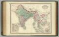
Hindoostan and Farther India.
1 : 10200000 Johnson, A.J.
Hindoostan and Farther India.
1 : 10200000 Johnson, A.J.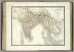
![India Orientalis [Karte], in: Gerardi Mercatoris Atlas, sive, Cosmographicae meditationes de fabrica mundi et fabricati figura, S. 535.](https://images-2.georeferencer.com/images/iiif/345332266091/full/,300/0/native.jpg)

