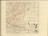
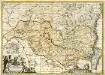
Maps of Hoya de Huesca / Plana de Uesca

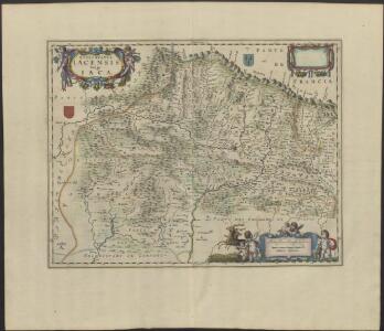
EPISCOPATUS | IACENSIS | Vulgo | IACA
Auctore Joanne Baptista Labanna [Amsterdam : Joan Blaeu]
Pamplonae, et Iacetanorum Episcopatus. [Karte], in: Novus atlas absolutissimus, Bd. 6, S. 67.
1 Karte aus Atlas Janssonius Offizin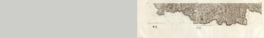
Composite 17: Carte de France.
1 : 86400 Cassini family; Cassini, Cesar-Francois, 1714-1784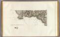
108+ Cauterets.
1 : 86400 Cassini family; Cassini, Cesar-Francois, 1714-1784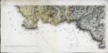
[Cauterets]
1 Blatt : 28 x 69 cm s.n.
Massif de Gavarnie et du Mont Pedru
1 : 20000 Pyreneje (Francie a Španělsko : pohoří) Schrader, Franz Henry Barrere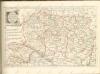

44) XIII.N.E. ''Navarre'', uit: Carte géologique de France
1 : 500000 Annotatie: Voor aanwezige bladen zie bladoverzicht [S.l : s.n.]
Regni Navarræ accurata tabula
1 Karte : Kupferdruck ; 36 x 47 cm Wit ex officina I. Covens et C. Mortier
Navarra regnvm
1 Karte : Kupferdruck ; 40 x 48 cm Janssonius Joannes Janssonius
Navarra regnvm
1 Karte : Kupferdruck ; 40 x 48 cm Valck; Schenk apud G. Valk et P. Schenk
Regni Navarræ accurata tabula
1 Karte : Kupferdruck ; 36 x 47 cm Wit F. de Wit
Royavme de Navarre
1 Karte : Kupferdruck ; 53 x 40 cm Sanson; Mariette; Somer chez Pierre Mariette rue St. Iacques a l'Esperance
Navarra regnvm
1 Karte : Kupferdruck ; 40 x 48 cm Blaeu G. Blaeu exc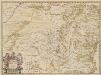
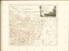
Episcopatus Oscensis Descriptio. [Karte], in: Novus atlas absolutissimus, Bd. 6, S. 58.
1 Karte aus Atlas Janssonius Offizin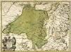
Episcopatus Oscensis descriptio
1 Karte : Kupferdruck ; 36 x 50 cm Valck; Schenk Gerard Valck und Pieter Schenk
EPISCOPATUS | OSCENSIS | Vulgo | HUESCA
Auct. I. Baptista Labanna [Amsterdam : Joan Blaeu]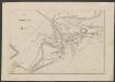
Navarra Regnum. [Karte], in: Le théâtre du monde, ou, Nouvel atlas contenant les chartes et descriptions de tous les païs de la terre, Bd. 2, S. 207.
1 Karte aus Atlas Blaeu, Willem Janszoon und Blaeu, Joan Blaeu, Willem Janszoon
Navarra regnum
1 Karte : Kupferdruck ; 51 x 44 cm Güssefeld; López Homännische Erben
Mapa del reyno de Navarra
1 Karte auf 4 Blättern : Kupferdruck ; 76 x 76 cm López; Horta s.n.
Navarra Regnum. [Karte], in: Novus Atlas, das ist, Weltbeschreibung, Bd. 2, S. 214.
1 Karte aus Atlas Blaeu, Joan Blaeu, Willem Janszoon
NAVARRA | REGNVM
G. Blaeu exc.

Navarra Regnum. [Karte], in: Novus atlas absolutissimus, Bd. 6, S. 25.
1 Karte aus Atlas Janssonius Offizin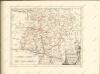
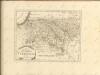
Episcopatus Balbastrensis et comitatus Ribagorcæ
1 Karte : Kupferdruck ; 36 x 51 cm Valck; Schenk apud Gerardum Valk et Petrum Schenk