Maps of Mont-de-Marsan

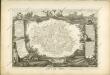
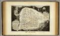
L'EVESCHÉ | D'AIRE
tracé par le | S.R. PIERRE DE VAL | Secretaire de Monseign.r l'Evesque. [Amsterdam : Joan Blaeu]
L'Evesché D'Aire [Karte], in: Novus atlas absolutissimus, Bd. 4, S. 171.
1 Karte aus Atlas Janssonius Offizin
L'Evesche d'Aire
1 : 120000
L'eveché d'Aire
1 : 160000 Duval, Pierre Schenk, Pieter â Gerardo Valk, et Petro Schenk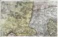
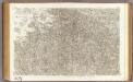
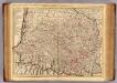
[Roquefort - Mont-de-Marsan]
1 Blatt : 56 x 89 cm s.n.
[Aire - Orthez]
1 Blatt : 57 x 90 cm s.n.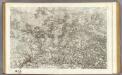
106 Roquefort, Mont-de-Marsan.
1 : 86400 Cassini family; Cassini, Cesar-Francois, 1714-1784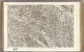
107 Aire, Orthez.
1 : 86400 Cassini family; Cassini, Cesar-Francois, 1714-1784
Département des Landes
1 Karte : Kupferdruck ; 48 x 48 cm Houdan; Dumez chez Dumez directeur de l'atlas national rue de la Harpe no. 26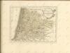
Dept. Des Landes.
1 : 563000 Levasseur, Victor.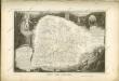
Bearn, Bigorre, Armagnac.
1 : 414000 L'Isle, Guillaume de, 1675-1726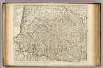
Bearn, Bigorre, Armagnac.
1 : 414000 L'Isle, Guillaume de, 1675-1726
Le Pais De Bearn. [Karte], in: Novus atlas absolutissimus, Bd. 4, S. 168.
1 Karte aus Atlas Janssonius Offizin
Principatus Benearnia. La Principaute De Bearn. [Karte], in: Le théâtre du monde, ou, Nouvel atlas contenant les chartes et descriptions de tous les païs de la terre, Bd. 2, S. 141.
1 Karte aus Atlas Blaeu, Willem Janszoon und Blaeu, Joan Blaeu, Willem Janszoon
Principatus Benearnia. La Principaute De Bearn. [Karte], in: Theatrum orbis terrarum, sive, Atlas novus, Bd. 2, S. 126.
1 Karte aus Atlas Blaeu, Joan Blaeu, Willem Janszoon
Principatus Benearnia. La Principaute De Bearn. [Karte], in: Novus Atlas, das ist, Weltbeschreibung, Bd. 2, S. 140.
1 Karte aus Atlas Blaeu, Joan Blaeu, Willem Janszoon
Le Pais De Bearn. [Karte], in: Gerardi Mercatoris et I. Hondii Newer Atlas, oder, Grosses Weltbuch, Bd. 2, S. 128.
1 Karte aus Atlas Mercator, Gerhard und Hondius, Jodocus Jansson, Jan
Le pays de Bearn
1 Karte : Kupferdruck ; 11 x 15 cm Sebastian Cramoisy
Le pais de Bearn
1 Karte : Kupferdruck ; 36 x 48 cm Janssonius; Hamersvelt apud Ioannem Ianssonium
Le pais de Bearn
1 Karte : Kupferdruck ; 36 x 47 cm Schenk; Valck; Hamersvelt apud G. Valk et P. Schenk
Le pais de Bearn
1 Karte : Kupferdruck ; 36 x 48 cm Hondius; Hamersvelt Henricus Hondius
Le pais de Bearn
1 : 330000 Béarn (Francie) Hamersveldt, Everard S. van P. Schenk et G. Valk
Le pais de Bearn
1 : 320000 Béarn (Francie) Hamersveldt, Everard S. van
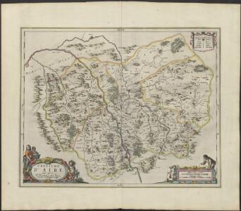
Département du Gers
1 Karte : Kupferdruck ; 48 x 48 cm Houdan; Dumez chez Dumez directeur de l'atlas national rue de la Harpe no. 26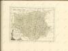
Dept. Du Gers.
1 : 571000 Levasseur, Victor.