Maps of Humboldt County

Wilder Creek Ranch
1 : 24000
Denio
1 : 62500
Denio
1 : 62500
Denio
1 : 100000
Denio
1 : 100000
Denio
1 : 100000
Denio
1 : 100000
Disaster
1 : 250000
Disaster
1 : 250000
Disaster
1 : 250000
Disaster
1 : 250000
Disaster
1 : 250000
Disaster
1 : 250000
Vya
1 : 250000
Vya
1 : 250000
Vya
1 : 250000
Vya
1 : 250000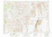
Vya
1 : 250000
From the Humboldt Mountains to the Mud Lakes.
1 : 760320 Beckwith, E.G.
DeGroot's Map Of Nevada Territory.
1 : 776160 Holt, Warren
Nevada.
1 : 3100000 Holdredge, Sterling M.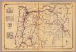
Oregon.
1 : 2000000 Rand McNally and Company
Oregon.
Rand McNally and Company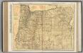
Oregon.
1 : 1014000 Rand McNally and Company
Oregon.
1 : 1238000 Hammond, C.S.
Oregon.
1 : 770000 Cram, George Franklin
Nevada.
1 : 2200000 Cram, George Franklin; Davis, Ellis Arthur
Nevada.
1 : 1750000 Rand McNally and Company
State Of Nevada.
1 : 1013760 U.S. General Land Office

