Maps of La Paz County
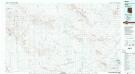
Little Horn Mountains
1 : 100000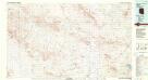
Little Horn Mountains
1 : 100000
Engesser Pass
1 : 62500
Engesser Pass
1 : 62500
Palomas Mts
1 : 62500
Palomas Mts
1 : 62500
Dendora Valley
1 : 62500
Dendora Valley
1 : 62500
Dendora Valley
1 : 62500
Hyder
1 : 62500
Hyder
1 : 62500
Hyder
1 : 62500
Hyder
1 : 62500
Kofa Butte
1 : 62500
Kofa Butte
1 : 62500
Kofa Butte
1 : 62500
Little Horn Mts
1 : 62500
Little Horn Mts
1 : 62500
Eagletail Mts
1 : 62500
Eagletail Mts
1 : 62500
Eagletail Mts
1 : 62500
Cortez Peak
1 : 62500
Cortez Peak
1 : 62500
Engesser Pass SW
1 : 24000
Palomas Mountains SW
1 : 24000
Neversweat Ridge
1 : 24000
Palomas Mountains SE
1 : 24000
Oatman Mountain
1 : 24000
Dendora Valley
1 : 24000
Hyder SE
1 : 24000
Hyder SE
1 : 24000
Baragan Mtn
1 : 24000
Hyder SE
1 : 24000

