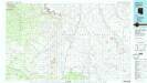
Maps of Cameron

Maps of Cameron

$title$

Cameron

1 : 100000
$title$

S P Mountain

1 : 62500
$title$

S P Mountain

1 : 62500
$title$

Ebert Mtn

1 : 62500
$title$

Ebert Mtn

1 : 62500
$title$

Grandview Point

1 : 62500
$title$

Grandview Point

1 : 62500
$title$

Coconino Point

1 : 62500
$title$

Cameron

1 : 62500
$title$

Cameron

1 : 62500
$title$

Ebert Mountain

1 : 24000
$title$

Chapel Mountain

1 : 24000
$title$

East of S P Mountain

1 : 24000
$title$

S P Mountain

1 : 24000
$title$

Wupatki SW

1 : 24000
$title$

Standing Rocks

1 : 24000
$title$

Wupatki SE

1 : 24000
$title$

White Water Tank

1 : 24000
$title$

Black Falls 4 SW

1 : 24000
$title$

Black Falls 4 SE

1 : 24000
$title$

Rock Head

1 : 24000
$title$

Dog Knobs

1 : 24000
$title$

Lockwood Canyon

1 : 24000
$title$

Campbell Francis Wash

1 : 24000
$title$

Additional Hill

1 : 24000
$title$

Gray Mountain

1 : 24000
$title$

Wupatki NE

1 : 24000
$title$

Wupatki NE

1 : 24000
$title$

Badger Spring

1 : 24000
$title$

Black Falls NE

1 : 24000
© MapTiler © OpenStreetMap contributors
How does it work?
These instructions will show you how to find historical maps online.
Getting started
Type the place name in the search box to find the exact location. You can further adjust the search by zooming in and out.
Zoom
Zoom in and out with the buttons or use your mouse or touchpad natively.
Exact Area tool
Click here and draw a rectangle over the map to precisely define the search area.
Set filters
Narrow your search with advanced settings, such as Years (from/to), Fulltext, Publisher, etc.
Results
See the results of your search on the right side. You can scroll down to find more maps of this location.
?

Download OldMapsOnline Mobile