Maps of Ashland

Ashland
1 : 62500
Ashland
1 : 62500
Ashland
1 : 62500
Siskiyou Pass
1 : 24000
Mount Ashland
1 : 24000
Siskiyou Pass
1 : 24000
Siskiyou Pass
1 : 24000
Siskiyou Pass
1 : 24000
Ashland
1 : 24000
Ashland
1 : 24000
Emigrant Lake
1 : 24000
Emigrant Lake
1 : 24000
Medford
1 : 125000
Medford
1 : 125000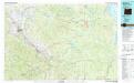
Medford
1 : 100000
Ashland
1 : 250000
Ashland
1 : 250000
Ashland
1 : 250000
Ashland
1 : 250000
Ashland
1 : 250000
Ashland
1 : 250000
Ashland
1 : 250000
Ashland
1 : 250000
Plate LXXI. Ashland Quadrangle. Oregon. Land Classification and Density of Standing Timber.
1 : 250000 Thompson, A.H.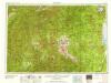
Medford
1 : 250000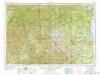
Medford
1 : 250000
Medford
1 : 250000
Lower Oregon and Upper California.
1 : 1077120 Tennent, Thomas
Irrigation map of southern California.
1 : 506880 U.S. Dept. of Agriculture, Bureau of Public Roads, Irrigation Investigations.|~|"Revised and redrawn 1920 in cooperation with California State Dept. of Engineering; College of Agriculture, University of California; California State Water Commission."|~|Covers the area from Owens Lake over to Santa Barbara County, south to the Mexican border.|~|Includes location map and inset of Owens Valley.|~|Relief represented by shading.|~|Shows agricultural areas, irrigated areas, irrigation canals, boundaries of irrigation districts, principal hydroelectric plants, U.S. Geological Survey and private stream gauging stations, and rainfall stations.|~|UCLA Catalog Record United States. Bureau of Public Roads. The Bureau

