Maps of Tuolumne County

Strawberry
1 : 24000
Strawberry
1 : 24000
Long Barn
1 : 62500
Long Barn
1 : 62500
Long Barn
1 : 62500
Big Trees
1 : 125000
Big Trees
1 : 125000
Big Trees
1 : 125000
Big Trees
1 : 125000
Big Trees
1 : 125000
Big Trees
1 : 125000
Big Trees
1 : 125000
Big Trees
1 : 125000
Big Trees
1 : 125000
Big Trees
1 : 125000
Big Trees
1 : 125000
Big Trees
1 : 125000
Big Trees, Calif.
1 : 125000 USGS (U.S. Geological Survey)
San Andreas
1 : 100000
Campfire Rings in the Backcountry of Yosemite National Park, 1972.
1 : 63630 Holmes, Joseph Edward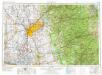
Sacramento
1 : 250000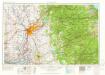
Sacramento
1 : 250000
Sacramento
1 : 250000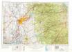
Sacramento
1 : 250000
Sacramento
1 : 250000
Sacramento
1 : 250000
Sacramento
1 : 250000
Sacramento, Amador, Calaveras, San Joaquin, Tuolumne, Stanislaus, Merced, and Mariposa Counties.
1 : 443529 Blum, George W.
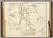
Mining District of California.
1 : 595000 Jackson, William A.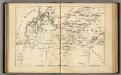
Central California.
1 : 2471040 Holdredge, Sterling M.