Maps of Hamilton County

Cincinnati
1 : 250000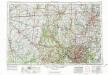
Cincinnati
1 : 250000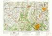
Cincinnati
1 : 250000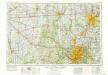
Cincinnati
1 : 250000
Butler, Clermont, Hamilton, Montgomery, Preble and Warren counties.
1 : 300000 Walling, H. F.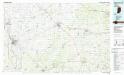
Greensburg
1 : 100000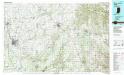
Greensburg
1 : 100000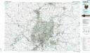
Cincinnati
1 : 100000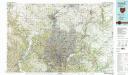
Cincinnati
1 : 100000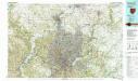
Cincinnati
1 : 100000
OKI regional land use : 1975
1 : 5000 Ohio-Kentucky-Indiana Regional Planning Authority OKI Regional Planning Authority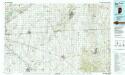
New Castle
1 : 100000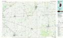
New Castle
1 : 100000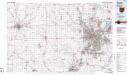
Dayton
1 : 100000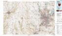
Dayton
1 : 100000
Columbus
1 : 125000
Map of Shelby County.
1 : 100000 Baskin, Forster and Company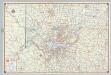
Shell Metropolitan Cincinnati and Vicinity.
1 : 139392 Shell Oil Company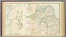
Cincinnati, Covington, Newport.
1 : 45000 United States. War Department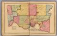
Hamilton County.
1 : 76032 Harrison, Robert H.; Titus, Clarence O.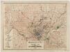
Regional plan map of Cincinnati, Ohio
1 : 62500 Technical Advisory Corporation (New York, N.Y.) Technical Advisory Corp.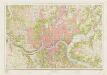
Cincinnati and vicinity : Ohio --Ky
1 : 24000 Geological Survey (U.S.) [Geological Survey]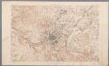
[Recto], uit: Ohio-Kentucky, Cincinnati quadrangle : topography / geo[graphy] T. Hawkins and W.J. Peters ; topography by Chas. E. Cooke
1 : 62500 Annotatie geografische gegevens: Opname: 1898 Hawkins, T.; Peters, W. J.; Cooke, Chas. E. [Washington, D.C. : U.S. Geological Survey]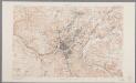
Ohio-Kentucky, Cincinnati quadrangle : topography / geo[graphy] T. Hawkins and W.J. Peters ; topography by Chas. E. Cooke
1 : 62500 Annotatie geografische gegevens: Opname: 1898, herzien in 1912 (bebouwing) Hawkins, T.; Peters, W. J.; Cooke, Chas. E. [Washington, D.C. : U.S. Geological Survey]
Map of Decatur County (with) St. Omer, New Point, Clarksburgh, St. Paul.
1 : 126720 Baskin, Forster and Company
Map of Wayne County.
1 : 105000 Baskin, Forster and Company
Map of Rush County.
1 : 100000 Baskin, Forster and Company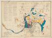
Official city plan map Cincinnati, Ohio
1 : 24000 Technical Advisory Corporation (New York, N.Y.) Technical Advisory Corp.
Map of Hancock County (with) Charlottesville, Greenfield, Fortville.
1 : 126720 Baskin, Forster and Company

