Maps of Sud

Carte nouvelle de l'empire de la Russie, comprise en Europe / dirigée par Mr. Philippe, censeur roy
1 : 7900000 1 Karte : Kupferdruck ; 37 x 24 cm Philippe de Prétot, Etienne André [Nyon]
Gouv. 39. Minsk
1 : 2300000 1 Karte : Lithographie ; 26 x 19 cm Schlieben, W.E.A. von [Georg Joachim Göschen]
L' Ingria e la Carelia Russia / Ab. Borghi disegno ; Pasquali scrisse
1 : 1300000 1 Karte : Kupferdruck ; 30 x 23 cm Borghi, Bartolomeo Presso Pazzini Carli
L' empire de Russie, comprenant la Moscovie, le royaume de Casan etc. / [Le Rouge, Georges Louis]
1 : 11000000 1 Karte : Kupferdruck ; 21 x 27 cm Le Rouge, Georges-Louis [Verlag nicht ermittelbar]
L' impero di Russia nell'Europa diviso nelli suoi governi
1 : 11000000 1 Karte : Kupferdruck ; 30 x 22 cm Presso Pazzini Carli
Gouv. 40 Wolhynien, 41. Podolien
1 : 2300000 1 Karte : Lithographie ; 26 x 19 cm Schlieben, W.E.A. von [Georg Joachim Göschen]
Partie méridionale de la Russie d'Europe / gravé par Chamouin ; ecrit par Giraldon
1 : 8000000 1 Karte : Kupferdruck ; 21 x 29 cm Chamouin, Jean Baptiste Marie [Verlag nicht ermittelbar]
Europaeisches Russland
1 : 18000000 1 Karte : Lithogr. (mehrfarb.) ; 22 x 19 cm Sydow, Emil von Justus Perthes
Black Sea / the illustrations drawn & engraved by H. Winkles ; the map drawn & engraved by J. Rapkin
1 : 6336000 1 Karte : Kupferdruck ; 23 x 31 cm Winkles, Henry The London Printing and Publishing Company
The dominions of Moscovy in Europe / By Herman Moll Geographer
1 : 14000000 1 Karte : Kupferdruck ; 17 x 24 cm Moll, Hermann [Verlag nicht ermittelbar]
Novaja karta naměstničestv / Soč. J. Treskot
1 : 10900000 1 Karte : Kupferdruck ; 30 x 19 cm Truskot, Ivan Fomič [Verlag nicht ermittelbar]
Gouv. 34. Wilna, 35. Grodno, 36. Bialystock
1 : 2300000 1 Karte : Lithographie ; 26 x 19 cm Schlieben, W.E.A. von [Georg Joachim Göschen]
Principatus Valachiae, Moldaviae et Transylvaniae divisus in singulares populos cum finitimis regionibus, distincte ostenduntur
1 : 1120000 Moldavsko Valk, Gerhard Valk, Leonard G. et L. Valk
The dominions of Moscovy or Russia / by H. Moll Geographer
1 : 38000000 1 Karte : Kupferdruck ; 17 x 24 cm Moll, Hermann [Verlag nicht ermittelbar]
Gouv. 30. Kherson, 33. Bessarabien
1 : 2300000 1 Karte : Lithographie ; 22 x 26 cm Schlieben, W.E.A. von [Georg Joachim Göschen]
Nova et accurata Turcicarum et Tartaricarum Provinciarum / excudit à Matth. Seuttero, S.C.M. Geogr
1 : 5400000 1 Karte : Kupferdruck ; 18 x 24 cm Lotter, Tobias Conrad anjezo im Verlag bey T.C. Lotter
Gouv. 37. Witebsk, 38. Mohilew
1 : 2300000 1 Karte : Lithographie ; 26 x 19 cm Schlieben, W.E.A. von [Georg Joachim Göschen]
Prima pars mappae integri tractus confinium (cujus divisio correspondet cum novissima scriptura, sub dato 14. augusti[)] quae continet confinium mediatum cum Turcis, per Valachiam et Moldaviam in Transilvania ad usum tractationis pacis
1 : 295000 Rumunsko
J.7. Bucuresti (Bukarest), uit: [Übersichtskarte von Europa 1:750.000]
1 : 750000 Wien : K.u.K. Militärgeographisches Institut
Gouv. 1. St. Petersburg, 8. Pskow
1 : 2200000 1 Karte : Lithographie ; 26 x 19 cm Schlieben, W.E.A. von [Georg Joachim Göschen]
Bukuresti (Bukarest)
1 : 750000 Bukurešť (Rumunsko) Goldmann, R. K. u. k. Militärgeographisches Institut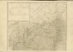

Charte der Wallachen Bulgarien's und Thracien's
Bulharsko Haubenstricker
Moldau, historisch
Moldau (Fürstentum), Bessarabien Zwick, J.
Generalkarte Von Siebenbürgen. Nach geometrisch gemessenen Karten und andern zuverlaessigen Hilfsmitteln verjüngt, und graduirt von Herrn A. von Wenzely. Herausgegeben von Herrn F. A. Schraembl
1 : 430000 Siebenbürgen Produkt, Straßennetz Wenzely, Anton; Schraembl, Franz Anton
G. Freytags Detailkarte von Nord-Rumänien (Moldau) und der Bukowina
1 : 400000 Bukovina (Rumunsko a Ukrajina) G. Freytag & Berndt

Carte de la Transilvanie

[Šumla]
Bulgarien Šumen Russisch-Türkischer Krieg <1806-1812>