Maps of Pacifica

San Francisco Peninsula.
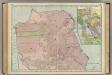
1 : 140000 Relief shown by contours, spot heights, and landform drawings. Includes note. "U.S.C. & G.S. 3055." "Plate no. 1179." "Electrotype copy no. 1, U.S.C.S." United States Coast Survey., P. Witzel (Peter), Rose Research [Washington, D.C.] : U.S. Coast Survey, 1869.
San Francisco, system of circuit, radial arteries.
1 : 106000 Bennett, Edward H.; Burnham, Daniel Hudson
Map of the northern portion of San Francisco County / compiled from survey's, June 1st, 1852, by Clement Humphreys, County Surveyor.
1 : 147520 Relief shown by hachures and spot heights. Covers area from Point San Bruno northward. Oriented with north to the left. San Francisco (Calif.). Office of the County Surveyor. [San Francisco, Calif. : Office of the County Surveyor]
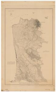
San Francisco Peninsula
1 : 40000 United States Coast Survey Coast Survey Office
San Francisco Peninsula.
1 : 40000 United States Coast Survey
South San Francisco.
1 : 7200 South San Francisco Land & Improvement Co.
City And County Of San Francisco.
1 : 32800 Wackenreuder, V.
Bancroft's official guide map of city and county of San Francisco : compiled from official maps in surveyor's office
1 : 30000 A.L. Bancroft & Company The Bancroft Co.
Geological map San Francisco.
1 : 40000 Wood, Harry O.
Geological profiles, San Francisco.
1 : 40000 Wood, Harry O.
San Francisco intensity of earthquake.
1 : 40000 Wood, Harry O.
The "Chevalier" ... Map of San Francisco.
1 : 9600 Chevalier, August
Map of the City and County of San Francisco
1 : 35000 O'Shaughnessy, M. M. (Michael Maurice), 1864-1934 Board of Public Works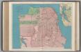
San Francisco.
1 : 26000 Rand McNally and Company
Shell San Francisco and Vicinity.
1 : 285120 Shell Oil Company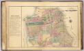
San Francisco.
1 : 32000 William P. Humphreys & Co.
San Francisco street map.
1 : 38000 Standard Oil Company of California
San Francisco and vicinity
1 : 30800 Southern Pacific Company Southern Pacific Company
Map of the City & County of San Francisco : carefully compiled from recent surveys, including all new additions of cities, towns, and villas, delineating the lines of ranchos, private claims water works, railroads, &c. &c
1 : 15840 Butler, James, fl. 1863-1864 Britton & Co.
San Francisco from latest surveys.
1 : 31680 Langley, Henry G.
San Francisco showing areas recommended for public places, parks, park connections, highways.
1 : 27120 Burnham, Daniel Hudson
San Francisco showing existing highways, park areas, public places.
1 : 27120 Burnham, Daniel Hudson
San Francisco plan.
1 : 19200 Burnham, Daniel Hudson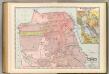
San Francisco.
1 : 25000 Rand McNally and Company
San Francisco.
1 : 24000 Langley, Henry G.
Bancroft's Official Guide Map Of City And County Of San Francisco.
1 : 30000 Bancroft, A.L.
San Francisco.
1 : 18000 San Francisco (Calif.). Board of Public Works
Britton & Rey's Guide Map of the City of San Francisco.
1 : 24000 Britton & Rey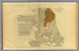
San Francisco burnt area, 1906.
1 : 22200 California. State Earthquake Investigation Commission