Maps of Egg
Meilen, Egg: Genossenschaftswaldung Pfannenstiel: Oberi Bergweid, Underi Bergweid, Höhe, Cholrüti, Chnabenhans (Knabenhans), Badholz, Stollenholz, Hochwacht;
1 : 2500 Ohne Erstellungsdatumsangabe. Ausgangsplan: Übersichtsplan zur Privatwaldzusammenlegung der Korporation Pfannenstiel-Meilen aus dem Jahr 1909. Ausgangsplan Aufnahme: Pfister, F., Geometer, Vermessungs- und Tiefbaubüro, in Horgen Ausgangsplan Zeichnung: von Orelli, Adolf, von Zürich, in Zürich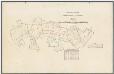
Meilen, Egg: Genossenschaftswaldung Pfannenstiel: Oberi Bergweid, Underi Bergweid, Höhe, Cholrüti, Chnabenhans (Knabenhans), Badholz, Stollenholz, Hochwacht; Grundriss
1 : 2500 Mit Verzeichnis der Flächeninhalte der acht Waldabteilungen. Ohne Datumsangabe. Aufnahme und Zeichnung vermutlich: Pfister, F., Geometer, Vermessungs- und Tiefbaubüro, in Horgen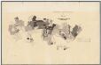
Meilen, Egg: Genossenschaftswaldung Pfannenstiel: Oberi Bergweid, Underi Bergweid, Höhe, Cholrüti, Chnabenhans (Knabenhans), Badholz, Stollenholz, Hochwacht; Grundriss
1 : 2500 Mit Angabe des Alters des Baumbestandes. Ohne Datumsangabe. Aufnahme und Zeichnung vermutlich: Pfister, F., Geometer, Vermessungs- und Tiefbaubüro, in Horgen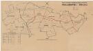
Meilen, Egg: Genossenschaftswaldung Pfannenstiel: Oberi Bergweid, Underi Bergweid, Höhe, Cholrüti, Chnabenhans (Knabenhans), Badholz, Stollenholz, Hochwacht; Grundriss
1 : 2500 Mit Verzeichnis der Flächeninhalte der acht Waldabteilungen. Aufnahme und Zeichnung vermutlich: Pfister, F., Geometer, Vermessungs- und Tiefbaubüro, in Horgen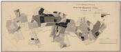
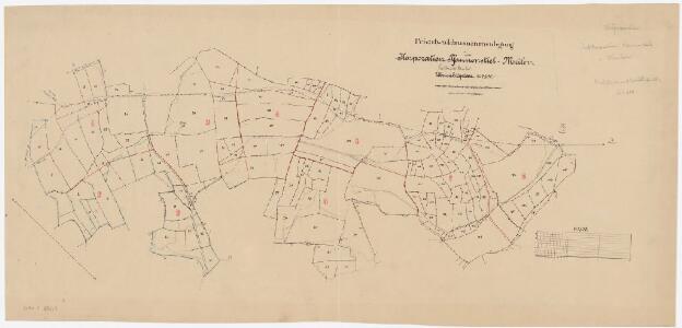
Meilen, Egg: Genossenschaftswaldung Pfannenstiel: Oberi Bergweid, Underi Bergweid, Höhe, Cholrüti, Chnabenhans (Knabenhans), Badholz, Stollenholz, Hochwacht; Übersichtsplan
1 : 2500 Mit Angabe des Alters des Baumbestandes. Aufnahme: Pfister, F., Geometer, Vermessungs- und Tiefbaubüro, in Horgen Zeichnung: von Orelli, Adolf, von Zürich, in Zürich
Egg: Gemeinde- und Genossenschaftswaldungen Vorderegg: Gemeindewaldung Egger Berg, Bühl; Grundriss
1 : 2400 Mit Verzeichnis der Flächeninhalte. Auftraggebung: Forstkommission Aufnahme und Zeichnung: Bosshard, Heinrich, andere Schreibweisen: Bosshardt, Bossart, (1748-1815), Bauer und Geometer, von Rümikon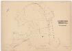
Meilen, Egg: Genossenschaftswaldung Pfannenstiel: Bergweid; Grundriss (Originalplan 1)
1 : 1000 Aufnahme und Zeichnung: Pfister, F., Geometer, Vermessungs- und Tiefbaubüro, in Horgen Verifizierung: Peter, Johannes, Adjunkt des Kantonsgeometers, von Zürich, in Zürich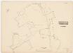
Meilen, Egg: Genossenschaftswaldung Pfannenstiel: Bergweid; Grundriss (Reinplan 1)
1 : 1000 Aufnahme und Zeichnung: Pfister, F., Geometer, Vermessungs- und Tiefbaubüro, in Horgen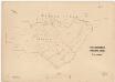
Meilen, Egg: Genossenschaftswaldung Pfannenstiel: Stollen, Hirzenberg; Grundriss (Originalplan 3)
1 : 1000 Aufnahme und Zeichnung: Pfister, F., Geometer, Vermessungs- und Tiefbaubüro, in Horgen Verifizierung: Peter, Johannes, Adjunkt des Kantonsgeometers, von Zürich, in Zürich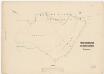
Meilen, Egg: Genossenschaftswaldung Pfannenstiel: Stollen, Hirzenberg; Grundriss (Reinplan 3)
1 : 1000 Aufnahme und Zeichnung: Pfister, F., Geometer, Vermessungs- und Tiefbaubüro, in Horgen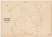
Meilen, Egg: Genossenschaftswaldung Pfannenstiel: Bergweid; Grundriss (Originalplan 2)
1 : 1000 Aufnahme und Zeichnung: Pfister, F., Geometer, Vermessungs- und Tiefbaubüro, in Horgen Verifizierung: Peter, Johannes, Adjunkt des Kantonsgeometers, von Zürich, in Zürich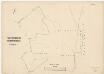
Meilen, Egg: Genossenschaftswaldung Pfannenstiel: Bergweid; Grundriss (Reinplan 2)
1 : 1000 Aufnahme und Zeichnung: Pfister, F., Geometer, Vermessungs- und Tiefbaubüro, in Horgen
Egg: Gemeinde- und Genossenschaftswaldungen Vorderegg: Genossenschaftswaldung Egger Berg; Grundriss (Tab. 1)
1 : 2400 Auftraggebung: Forstkommission Aufnahme und Zeichnung: Obrist, Kaspar (1791-1869), Forstmeister des 1. Kreises des Kantons Zürich und Geometer, von Zollikon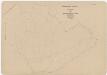
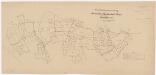
Meilen, Egg: Genossenschaftswaldung Pfannenstiel: Handriss (I)
1 : 1000 Aufnahme und Zeichnung: Pfister, F., Geometer, Vermessungs- und Tiefbaubüro, in Horgen
Egg: Genossenschaftswaldung Hinteregg: Grundriss (Tab. I)
1 : 2400 Aufnahme und Zeichnung: Obrist, Kaspar (1791-1869), Forstmeister des 1. Kreises des Kantons Zürich und Geometer, von Zollikon
Meilen: Dem Amt Küsnacht gehörendes Lehen in Bünishofen; Grundrisse und Tabelle
Lehenmann: Caspar Mettler. Mit Angabe der Namen, Grössen und Qualität der einzelnen Güter. Ohne Datumsangabe. Vermutlich: Bosshard, Heinrich, andere Schreibweisen: Bosshardt, Bossart, (1748-1815), Bauer und Geometer, von Rümikon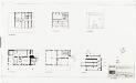
Egg: Pfannenstiel, Restaurant Hochwacht: Grundrisse und Querschnitt
1 : 100 Mit Legende. Bearbeitung: Bd.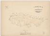
Meilen, Egg: Genossenschaftswaldung Pfannenstiel: Bergweid, Stollen, Hirzenberg, Badholz; Grundriss
1 : 2500 Aufnahme und Zeichnung: Pfister, F., Geometer, Vermessungs- und Tiefbaubüro, in Horgen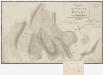
Herrliberg: Staats-, Gemeinde-, Genossenschafts- und Privatwaldungen: Hinterberg, Vorderberg, Guldenen, Zimmermett (Zimbermett), Chüelenmorgen; Grundrisse
1 : 2400 Mit Verzeichnis der Flächeninhalte. Aufnahme und Zeichnung: Obrist, Kaspar (1791-1869), Forstmeister des 1. Kreises des Kantons Zürich und Geometer, von Zollikon
Herrliberg: Staats-, Gemeinde-, Genossenschafts- und Privatwaldungen: Gebiet um bzw. zwischen Guldenen, Bergweid, Sellholz, Zimmermett (Zimbermett), Chüelenmorgen, Bannholz; Grundrisse
1 : 2400 Aufnahme und Zeichnung: Obrist, Kaspar (1791-1869), Forstmeister des 1. Kreises des Kantons Zürich und Geometer, von Zollikon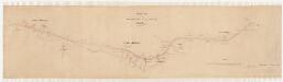
Egg: Projektierte Strasse vom hinteren Radrain über den vorderen Radrain bis im Fischer; Situationsplan
1 : 1000 Mit Angabe der Namen von Grundeigentümern. Mit Originalvermerk: Verfügung vom 20. Februar 1897. Bachofen, H., Geometer
Egg: Genossenschaftswaldung Hinteregg: Grundriss (Tab. II)
1 : 2400 Aufnahme und Zeichnung: Obrist, Kaspar (1791-1869), Forstmeister des 1. Kreises des Kantons Zürich und Geometer, von Zollikon
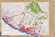
Egg: Definition der Siedlungen für die eidgenössische Volkszählung am 01.12.1970; Siedlungskarte
1 : 5000 Auf Ausgangskarte angebrachte farbige Einzeichnungen und Eintragungen. Mit Legende. Ohne Erstellungsdatumsangabe. Vermutlich: S., R.
Egg: Definition der Siedlungen für die eidgenössische Volkszählung am 01.12.1960; Siedlungskarte Nr. 62
1 : 5000 Auf Ausgangskarte angebrachte farbige Einzeichnungen und Eintragungen. Ohne Erstellungsdatumsangabe.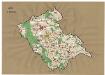
Egg: Definition der Siedlungen für die eidgenössische Volkszählung am 01.12.1950; Siedlungskarte
1 : 10000 Auf Ausgangskarte angebrachte farbige Einzeichnungen und Eintragungen. Ohne Erstellungsdatumsangabe.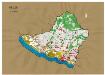
Meilen: Definition der Siedlungen für die eidgenössische Volkszählung am 01.12.1950; Siedlungskarte
1 : 10000 Auf Ausgangskarte angebrachte farbige Einzeichnungen und Eintragungen. Ohne Erstellungsdatumsangabe.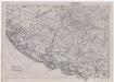
Meilen: Gemeinde; Übersichtsplan (Schweizerische Grundbuchvermessung)
1 : 5000 Fotomechanische Reproduktion und Druck: E. Collioud und Co., in Bern
Egg: Gemeinde; Übersichtsplan (Schweizerische Grundbuchvermessung)
1 : 5000
Meilen: Gemeinde; Übersichtsplan (Schweizerische Grundbuchvermessung)
1 : 5000