Maps of Unterengstringen

Altstetten bis Schlieren: Limmat von der Hönggerbrücke bis unterhalb der Unterengstringerbrücke: Blatt II: Unterengstringen, Oberengstringen und Schlieren; Situationsplan (Limmat-Gebiet Nr. 2)
1 : 2500 Messtischblatt. Mit Hochwasserstand von 1880 und mit Legende. Sieber, A.
Schlieren, Oberengstringen, Unterengstringen: Von der Fähre bis zur Brücke in Unterengstringen, projektierte Limmatkorrektion; Situationsplan (Limmat-Gebiet Nr. 39)
1 : 1000 Kilometer 9.500 bis 8.400. Mit Angabe der Namen der Grundeigentümer. Zweifel, H., Ingenieur Verifikation: Frei, A.
Oberengstringen bis Schlieren: Limmat oberhalb der Engstringerbrücke, Abrechnung der Akkordarbeit von Schulthess
1 : 500 Kilometer 8.920 bis 8.425. Zweifel, H., Wüst, H.
Unterengstringen: Limmat und Umgelände von Paradies und Limmatbrücke bis zum westlichen Dorf; Situationsplan

Oberengstringen: Genossenschaftswaldung: Von der Limmatkorrektion bei der Allmend und Oberwerd betroffene Genossenschaftswaldungen; Grundriss
1 : 1000 Erstellt auf der Basis der im Jahr 1883 von H. Zweifel, Ingenieur, durchgeführten Planaufnahme. Honegger, Huldreich, Forstadjunkt im Zürcher Oberforstamt, von Zürich, in Zürich
Unterengstringen: Projektierte Zufahrt zur Limmatbrücke von der Zürcherstrasse bis zur Limmat; Situationsplan
1 : 1000 Mit Angabe der Namen von Grundeigentümern. Aufnahme: Hüni, David, von Riesbach
Schlieren, Oberengstringen: Bei der Oberengstringer Fähre, Gemeindebann von Schlieren mit Marken; Situationsplan
1 : 700 Fehr, Joh.
Oberengstringen: Genossenschaftswaldungen entlang der Limmat; Grundriss
1 : 1000 Erstellt auf der Basis des im Jahr 1883 von Ingenieur Zweifel verfertigten Plans zur Limmatkorrektion. Honegger, Huldreich, Forstadjunkt im Zürcher Oberforstamt, von Zürich, in Zürich
Schlieren, Dietikon, Unterengstringen: Limmat von der Engstringerbrücke bis zur Grenze zwischen Schlieren und Dietikon, linkes Ufer: Blatt I; Situationsplan (Limmat-Gebiet Nr. 4)
1 : 1000 Messtischblatt. Mit Angabe der Namen der Grundeigentümer. Ohne Datumsangabe. Vermutlich: Brandenberger, W.
Unterengstringen, Oberengstringen: Hönggerstrasse von der Brücke bei Unterengstringen bis zur Zürcherstrasse; Situationsplan
1 : 1000 Mit Angabe der Namen von Grundeigentümern. Aufnahme: Frei, A., Ingenieur
Vorlagen für die Topographische Karte des Kantons Zürich (Wild-Karte): Bezirk Zürich: Ortsplan: Unterengstringen
1 : 5000 Bürkli, Julius (andere Schreibweise: Bürkly), Ingenieur, von Zürich
Altstetten bis Schlieren: Engstringer Fabrikkanal von Landsrain bis Mühlegiessen: Blatt 4; Situationsplan
1 : 500 Aufnahme und Zeichnung: Fehr, Johannes, andere Schreibweise: Feer, (1796-1830), Sohn von Johannes Fehr (1763-1823), Ingenieur, von Zürich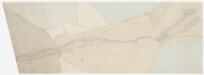
Altstetten bis Schlieren: Engstringer Fabrikkanal von Landsrain bis Mühlegiessen: Blatt 3; Situationsplan
1 : 500 Messtischblatt. Ohne Datumsangabe. Vermutlich: Fehr, Johannes, andere Schreibweise: Feer, (1796-1830), Sohn von Johannes Fehr (1763-1823), Ingenieur, von Zürich
Schlieren, Unterengstringen: Projektierte Strasse von der Badenerstrasse in Schlieren bis zur Limmat; Situationsplan
1 : 1000 Mit Angabe der Namen von Grundeigentümern. Aufnahme: Hüni (vermutlich: Hüni, David, von Riesbach)
Vorlagen für die Topographische Karte des Kantons Zürich (Wild-Karte): Bezirk Zürich: Ortsplan: Oberengstringen
1 : 5000 Keller, Rudolf, Ingenieur, von Hottingen
Altstetten bis Schlieren: Engstringer Fabrikkanal von Landsrain bis Mühlegiessen: Blatt 3; Situationsplan
1 : 500 Aufnahme und Zeichnung: Fehr, Johannes, andere Schreibweise: Feer, (1796-1830), Sohn von Johannes Fehr (1763-1823), Ingenieur, von Zürich
Unterengstringen: Projektierte Staatsstrassen; Handriss
Mit Legende. Ohne Datumsangabe.
Oberengstringen: Gemeinde; Übersichtsplan (Schweizerische Grundbuchvermessung)
1 : 5000 Mit Gemeindewappen von Oberengstringen und Zürcher Kantonswappen. Aufnahme: Arter, Alfred, Grundbuchgeometer; Deppeler, R., Grundbuchgeometer Fotomechanische Reproduktion und Druck: Art. Institut Orell Füssli AG, in Zürich
Oberengstringen: Gemeinde; Übersichtsplan (Schweizerische Grundbuchvermessung)
1 : 5000
Oberengstringen: Gemeinde; Übersichtsplan (Schweizerische Grundbuchvermessung)
1 : 5000
Oberengstringen: Gemeinde; Übersichtsplan (Schweizerische Grundbuchvermessung)
1 : 5000 Mit Legende.
Oberengstringen: Definition der Siedlungen für die eidgenössische Volkszählung am 01.12.1970; Siedlungskarte
1 : 5000 Auf Ausgangskarte angebrachte farbige Einzeichnungen und Eintragungen. Mit Legende. Ohne Erstellungsdatumsangabe. Ausgangskarte: Übersichtsplan (Schweizerische Grundbuchvermessung) der Gemeinde Oberengstringen. Ausgangskarte: Meliorations- und Vermessungsamt des Kantons Zürich
Unterengstringen: Kloster Fahr, Zulaufkanal der Klostermühle; Situationsplan und Querprofile
1 : 2500 Aufnahme: Herzog, G.; Zweifel, H.
Schlieren: Zehntenbezirk, zehntenpflichtig dem Spitalamt Zürich: Tab. II: Nordwestlicher Teil; Grundriss und tabellarische Beschreibung
1 : 215 Mit Verzeichnis der geografischen Beschreibungen, der Beschaffenheit und der Flächeninhalte der Güter. Dänniker, J. Martin
Höngg, Oberengstringen: Projektierte Strasse von Höngg bis zur Paradiesstrasse-Gabelung; Situationsplan (Blatt 2)
1 : 1000 Mit Angabe der Namen von Gebäudeeigentümern.
Schlieren bis Würenlos AG: Oberhalb der Unterengstringer-Brücke bis unterhalb der Grenze zwischen Schlieren und Dietikon, Limmatkorrektion beim Kloster Fahr; Situationsplan
1 : 1000 Kilometer 8.500 bis 6.700. Aufnahme: Brandenberger, W.; Keller, W.
Altstetten bis Schlieren: Limmat von der Hönggerbrücke bis unterhalb der Unterengstringerbrücke: Blatt I: Unterengstringen und Schlieren; Situationsplan (Limmat-Gebiet Nr. 2)
1 : 2500 Messtischblatt. Mit Hochwasserstand von 1880. Aufnahme: Raths, J., Ingenieur
Altstetten bis Schlieren: Limmat von der Hönggerbrücke bis unterhalb der Unterengstringerbrücke: Blatt III: Altstetten und Schlieren; Situationsplan (Limmat-Gebiet Nr. 2)
1 : 2500 Messtischblatt. Mit Hochwasserstand von 1880. Aufnahme: Raths, J., Ingenieur
Unterengstringen bis Würenlos AG: Von unterhalb des Kloster Fahr bis unterhalb der rechtsufrigen Grenze zwischen den Kantonen Zürich und Aargau, Limmatkorrektion: Blatt V: Dietikon; Situationsplan (Limmat-Gebiet Nr. 1)
1 : 2000 Messtischblatt. Revision: Raths, Ingenieur


