Maps of Zürich

Projektiertes Kantonsspital Zürich: Nordwestlicher Flügel, Keller; Grundriss

Fluntern: Projektiertes Kantonsspital, Hautpgebäude, Gurte des linken Flügels; Grundriss
Mit Notizen. Blattmann, Steinmetz
Projektiertes Kantonsspital Zürich: Linker Seitenflügel, Dachkonstruktion; Grundriss und Schnitte

Projektiertes Kantonsspital Zürich: Linker Seitenflügel, zweite Balkenlage; Grundriss

Zürich: Kantonsspital, Anbau des aseptischen Operationssaals; Grundriss
1 : 50 Mit Zusammenstellung der Bau- und Einrichtungskosten. Fietz, Hermann, Kantonsbaumeister, von Männedorf
Projektiertes Kantonsspital Zürich: Seitenflügel, dritte Balkenlage; Grundriss
Projektiertes Kantonsspital Zürich: Seitenflügel, zweite Balkenlage; Grundriss
1 : 100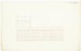
Projektiertes Kantonsspital Zürich: Nördlicher Seitenflügel, erste Balkenlage; Grundriss

Projektierte Poliklinik und Kantonsapotheke: Erdgeschoss; Grundriss (Nr. 36)
1 : 200 Weber, O., Bauinspektor
Poliklinik und Kantonsapotheke, Schmelzbergstrasse: 1. Stock; Grundriss
1 : 100 Beschluss des Regierungsrates vom 18.06.1892. Zeichnung: Weber, Otto, Hochbauinspektor des Kantons Zürich, von Dürnten
Poliklinik und Kantonsapotheke, Schmelzbergstrasse: Untergeschoss; Grundriss
1 : 100 Beschluss des Regierungsrates vom 18.06.1892. Zeichnung: Weber, Otto, Hochbauinspektor des Kantons Zürich, von Dürnten
Poliklinik und Kantonsapotheke, Schmelzbergstrasse: Erdgeschoss; Grundriss
1 : 100 Beschluss des Regierungsrates vom 18.06.1892. Zeichnung: Weber, Otto, Hochbauinspektor des Kantons Zürich, von Dürnten
Poliklinik und Kantonsapotheke: Projektierter Umbau; Aufstockung, 3. Stock; Grundriss (Nr. 54)
1 : 100 Hess, Friedrich, Architekt und Professor
Poliklinik und Kantonsapotheke: 1. Stock; Grundriss (Nr. 46)
1 : 100 Plan baupolizeilich genehmigt am 14.06.1892 vom Gemeinderat Fluntern. Ohne Erstellungsdatumsangabe.
Poliklinik und Kantonsapotheke: Untergeschoss; Grundriss (Nr. 45)
1 : 100 Plan baupolizeilich genehmigt am 14.06.1892 vom Gemeinderat Fluntern. Ohne Erstellungsdatumsangabe.
Poliklinik und Kantonsapotheke: 1. Stock und Dachgeschoss; Grundrisse (Nr. 38)
1 : 200 Zeichnung: Sch., W.
Zürich: Kantonsspital, Küche (Bautrakt X), Geschoss G; Grundriss
1 : 50 Mit Legende. Architektengemeinschaft für das Kantonsspitalprojekt Zürich, AKZ
Poliklinik und Kantonsapotheke: 1. Stock; Grundriss (Nr. 57)
1 : 50 Ohne Datumsangabe.
Poliklinik und Kantonsapotheke: Untergeschoss; Grundriss (Nr. 55)
1 : 50
Poliklinik und Kantonsapotheke: Erdgeschoss; Grundriss (Nr. 56)
1 : 50 Ohne Datumsangabe.
Fluntern: Kantonsspital, Waschhaus; Grundriss und Schnitte

Poliklinik und Kantonsapotheke: Fundament; Grundriss (Nr. 63)
1 : 50
Laboratorium des Kantonschemikers: Grundriss (Keller) und Querschnitt (Nr. 101)
1 : 100
Laboratorium des Kantonschemikers: 2. Stock und Dachgeschoss; Grundrisse (Nr. 103)
1 : 100
Projektiertes Kantonsspital Zürich: 3. Stock; Grundriss
1 : 450 Mit Legende. Wegmann, Gustav Albert (1812-1858), Architekt, von Zürich; Zeugheer, Leonhard (1812-1866), Architekt, von Zürich
Projektiertes Kantonsspital Zürich: Keller; Grundriss
1 : 450 Mit Legende. Wegmann, Gustav Albert (1812-1858), Architekt, von Zürich; Zeugheer, Leonhard (1812-1866), Architekt, von Zürich
Poliklinik und Kantonsapotheke: Erdgeschoss und 1. Stock; Grundrisse (Nr. 40)
1 : 200
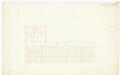
Projektiertes Kantonsspital Zürich: Erdgeschoss und 1. Stock; Grundrisse

Projektiertes Kantonsspital Zürich: Erdgeschoss und 1. Stock; Grundrisse
Wegmann, Gustav Albert (1812-1858), Architekt, von Zürich; Zeugheer, Leonhard (1812-1866), Architekt, von Zürich


