Maps of Sebranice
Katastrální mapa obce Dolní Újezd a osad Václavky a Jiříkov 13
1 : 2880
Katastrální mapa obce Horní Újezd VIII
1 : 2880
Indikační skica mapy stabilního katastru pro obec Sebranice a osadu Třemošná I
1 : 2880
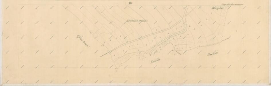
Indikační skica mapy stabilního katastru pro obec Kaliště I
1 : 2880
Katastrální mapa obce Horní Újezd VII
1 : 2880
Unter Augezd (Dolnj Augezd) - c1404-1-006 - Kaiserpflichtexemplar der Landkarten des stabilen Katasters
1 : 2880
Unter Augezd (Dolnj Augezd) - c1404-1-010 - Kaiserpflichtexemplar der Landkarten des stabilen Katasters
1 : 2880
Unter Augezd (Dolnj Augezd) - c1404-1-004 - Kaiserpflichtexemplar der Landkarten des stabilen Katasters
1 : 2880
Unter Augezd (Dolnj Augezd) - c1404-1-009 - Kaiserpflichtexemplar der Landkarten des stabilen Katasters
1 : 2880
Unter Augezd (Dolnj Augezd) - c1404-1-007 - Kaiserpflichtexemplar der Landkarten des stabilen Katasters
1 : 2880
Unter Augezd (Dolnj Augezd) - c1404-1-002 - Kaiserpflichtexemplar der Landkarten des stabilen Katasters
1 : 2880
Unter Augezd (Dolnj Augezd) - c1404-1-001 - Kaiserpflichtexemplar der Landkarten des stabilen Katasters
1 : 2880
Unter Augezd (Dolnj Augezd) - c1404-1-008 - Kaiserpflichtexemplar der Landkarten des stabilen Katasters
1 : 2880
Unter Augezd (Dolnj Augezd) - c1404-1-003 - Kaiserpflichtexemplar der Landkarten des stabilen Katasters
1 : 2880
Unter Augezd (Dolnj Augezd) - c1404-1-005 - Kaiserpflichtexemplar der Landkarten des stabilen Katasters
1 : 2880
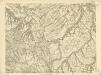
Náčrt mapy revíru Vysoký Les
1 : 3000
Ober Augezd (Hornj Augezd) - c2167-1-001 - Kaiserpflichtexemplar der Landkarten des stabilen Katasters
1 : 2880
Ober Augezd (Hornj Augezd) - c2167-1-005 - Kaiserpflichtexemplar der Landkarten des stabilen Katasters
1 : 2880
Ober Augezd (Hornj Augezd) - c2167-1-003 - Kaiserpflichtexemplar der Landkarten des stabilen Katasters
1 : 2880
Ober Augezd (Hornj Augezd) - c2167-1-004 - Kaiserpflichtexemplar der Landkarten des stabilen Katasters
1 : 2880
Ober Augezd (Hornj Augezd) - c2167-1-002 - Kaiserpflichtexemplar der Landkarten des stabilen Katasters
1 : 2880
Kalischt (Kalisstie) - c2986-1-001 - Kaiserpflichtexemplar der Landkarten des stabilen Katasters
1 : 2880
Kalischt (Kalisstie) - c2986-1-002 - Kaiserpflichtexemplar der Landkarten des stabilen Katasters
1 : 2880
Sebranitz (Sebranic) - c6759-1-001 - Kaiserpflichtexemplar der Landkarten des stabilen Katasters
1 : 2880
Sebranitz (Sebranic) - c6759-1-002 - Kaiserpflichtexemplar der Landkarten des stabilen Katasters
1 : 2880
Sebranitz (Sebranic) - c6759-1-003 - Kaiserpflichtexemplar der Landkarten des stabilen Katasters
1 : 2880
Indikační skica mapy stabilního katastru pro obec Dolní Újezd a osady Jiříkov a Václavky XI
1 : 2880

Mapa velkostatku Litomyšl
1 : 14500