Maps of Luže

Katastrální mapa pro obec Zdislav
1 : 2880
Indikační skica mapy stabilního katastru pro obec Zdislav
1 : 2880
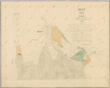
Zdislau (Zdislaw) - c9233-1-001 - Kaiserpflichtexemplar der Landkarten des stabilen Katasters
1 : 2880
Zdislau (Zdislaw) - c9233-1-002 - Kaiserpflichtexemplar der Landkarten des stabilen Katasters
1 : 2880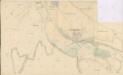
Katastrální mapa pro městys Luže
1 : 2880
Mapa dominikálních luk a polí na panství Košumberk
1 : 2880
Náčrt mapy pozemků panství Košumberk
1 : 3000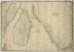
Mapa košumberského revíru
1 : 3650
Mapa polesí Košumberk
1 : 10000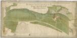
Mapa dominikálních pozemků panství Košumberk
1 : 2634
Lusche (Luže) - c4326-1-001 - Kaiserpflichtexemplar der Landkarten des stabilen Katasters
1 : 2880
Lusche (Luže) - c4326-1-002 - Kaiserpflichtexemplar der Landkarten des stabilen Katasters
1 : 2880
Lusche (Luže) - c4326-1-003 - Kaiserpflichtexemplar der Landkarten des stabilen Katasters
1 : 2880
Koschumberg - c3409-1-001 - Kaiserpflichtexemplar der Landkarten des stabilen Katasters
1 : 2880
Koschumberg - c3409-1-002 - Kaiserpflichtexemplar der Landkarten des stabilen Katasters
1 : 2880
Stěpanow - c7776-1-003 - Kaiserpflichtexemplar der Landkarten des stabilen Katasters
1 : 2880
Stěpanow - c7776-1-004 - Kaiserpflichtexemplar der Landkarten des stabilen Katasters
1 : 2880
Stěpanow - c7776-1-002 - Kaiserpflichtexemplar der Landkarten des stabilen Katasters
1 : 2880
Stěpanow - c7776-1-001 - Kaiserpflichtexemplar der Landkarten des stabilen Katasters
1 : 2880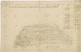
Náčrt mapy pozemků vrchnostenského dvora v Bělé
1 : 3793
Indikační skica mapy stabilního katastru pro obec Štěpánov a osadu Zbožnov I
1 : 2880
Indikační skica mapy stabilního katastru pro obec Štěpánov a osadu Zbožnov
1 : 2880
Katastrální mapa pro obec Štěpánov a osadu Zbožnov
1 : 2880
Mapa vrchnostenského dvora v Bělé a vsí Štěpánov a Zbožnov
1 : 3626
Mapa cest a silnic polesí Košumberk
1 : 10000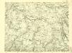
III. vojenské mapování 4056/1
1 : 25000
III. vojenské mapování 4056/1
1 : 25000