Maps of Pokřikov

Katastrální mapa pro obec Rychmburk
1 : 2880
Katastrální mapa pro obec Pokřikov
1 : 2880
Indikační skica mapy stabilního katastru pro obec Pokřikov III
1 : 2880
Katastrální mapa pro obec Otradov
1 : 2880
Indikační skica mapy stabilního katastru pro obec Otradov I
1 : 2880
Katastrální mapa obce Rychmburk (Předhradí)
1 : 2880
Mapa vrchnostenského dvora Daletice a vsi Lešany
1 : 3853
Richenburg (Richunburk) - c6167-2-004 - Kaiserpflichtexemplar der Landkarten des stabilen Katasters
1 : 2880
Richenburg (Richunburk) - c6167-2-007 - Kaiserpflichtexemplar der Landkarten des stabilen Katasters
1 : 2880
Richenburg (Richunburk) - c6167-2-002 - Kaiserpflichtexemplar der Landkarten des stabilen Katasters
1 : 2880
Richenburg (Richunburk) - c6167-2-006 - Kaiserpflichtexemplar der Landkarten des stabilen Katasters
1 : 2880
Richenburg (Richunburk) - c6167-2-005 - Kaiserpflichtexemplar der Landkarten des stabilen Katasters
1 : 2880
Richenburg (Richunburk) - c6167-2-003 - Kaiserpflichtexemplar der Landkarten des stabilen Katasters
1 : 2880
Richenburg (Richunburk) - c6167-2-001 - Kaiserpflichtexemplar der Landkarten des stabilen Katasters
1 : 2880
Pokrzikow - c5966-1-003 - Kaiserpflichtexemplar der Landkarten des stabilen Katasters
1 : 2880
Pokrzikow - c5966-1-002 - Kaiserpflichtexemplar der Landkarten des stabilen Katasters
1 : 2880
Pokrzikow - c5966-1-001 - Kaiserpflichtexemplar der Landkarten des stabilen Katasters
1 : 2880
Ottradow - c5594-1-001 - Kaiserpflichtexemplar der Landkarten des stabilen Katasters
1 : 2880
Ottradow - c5594-1-003 - Kaiserpflichtexemplar der Landkarten des stabilen Katasters
1 : 2880
Ottradow - c5594-1-002 - Kaiserpflichtexemplar der Landkarten des stabilen Katasters
1 : 2880
Ottradow - c5594-1-004 - Kaiserpflichtexemplar der Landkarten des stabilen Katasters
1 : 2880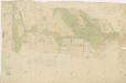
Náčrt mapy pozemků dvora v Krouně
1 : 2634
Katastrální mapa pro obec Pokřikov
1 : 2880
III. vojenské mapování 4056/3
1 : 25000
Přehledová mapa karlštejnských revírů
1 : 25000
Gradkartenblatt
1 : 25000 Hlinsko-oblast (Chrudim, Česko) Hallada, Alois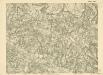
III. vojenské mapování 4056/3
1 : 25000

Mapa dominikální osady Pláňavy
1 : 2880


