Maps of Luže

Katastrální mapa pro městys Luže
1 : 2880
Lusche (Luže) - c4326-1-001 - Kaiserpflichtexemplar der Landkarten des stabilen Katasters
1 : 2880
Lusche (Luže) - c4326-1-002 - Kaiserpflichtexemplar der Landkarten des stabilen Katasters
1 : 2880
Lusche (Luže) - c4326-1-003 - Kaiserpflichtexemplar der Landkarten des stabilen Katasters
1 : 2880
Mapa polesí Košumberk
1 : 10000
Mapa cest a silnic polesí Košumberk
1 : 10000
Radim - c6346-1-003 - Kaiserpflichtexemplar der Landkarten des stabilen Katasters
1 : 2880
Radim - c6346-1-001 - Kaiserpflichtexemplar der Landkarten des stabilen Katasters
1 : 2880
Radim - c6346-1-002 - Kaiserpflichtexemplar der Landkarten des stabilen Katasters
1 : 2880
Mapa košumberského revíru
1 : 3650
Náčrt mapy pozemků panství Košumberk
1 : 3000
Wolletitz (Wolletic) - c8760-1-003 - Kaiserpflichtexemplar der Landkarten des stabilen Katasters
1 : 2880
Wolletitz (Wolletic) - c8760-1-001 - Kaiserpflichtexemplar der Landkarten des stabilen Katasters
1 : 2880
Wolletitz (Wolletic) - c8760-1-002 - Kaiserpflichtexemplar der Landkarten des stabilen Katasters
1 : 2880
Katastrální mapa pro městys Luže
1 : 2880
Mapa dominikálních luk a polí na panství Košumberk
1 : 2880
Indikační skica mapy stabilního katastru pro obec Voletice a osadu Domanice
1 : 2880
Náčrt mapy pozemků vrchnostenského dvora v Bělé
1 : 3793
Indikační skica mapy stabilního katastru pro obec Zdislav
1 : 2880
Mapa polesí Luže
1 : 10000
Gradkartenblatt
1 : 25000 Chrast (Chrudim, Česko) Hallada, Alois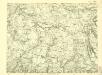
III. vojenské mapování 4056/1
1 : 25000
III. vojenské mapování 4056/1
1 : 25000


Vys. Mýto
1 : 75000 Vysoké Mýto (Česko : oblast) Vojenský zeměpisný ústav
Hohenmauth und Leitomischl
1 : 75000 Litomyšl (Česko : oblast) Storch K. u. k. Militärgeographisches Institut
III. vojenské mapování 4056
1 : 75000
Mapa horo- a vodopisná okresu chrudimského a nasavrckého
1 : 100000 Chrudim-oblast (Česko) Homolka, Josef Výbor ku popisu okresu chrudimského a nasavrckého


