Maps of Domanín
Domanín o. Jindřichův Hradec 1
1 : 2880
Domanin - c1424-1-006 - Kaiserpflichtexemplar der Landkarten des stabilen Katasters
1 : 2880
Domanin - c1424-1-007 - Kaiserpflichtexemplar der Landkarten des stabilen Katasters
1 : 2880
Domanin - c1424-1-002 - Kaiserpflichtexemplar der Landkarten des stabilen Katasters
1 : 2880
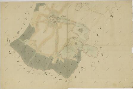
Domanin - c1424-1-001 - Kaiserpflichtexemplar der Landkarten des stabilen Katasters
1 : 2880
Domanin - c1424-1-004 - Kaiserpflichtexemplar der Landkarten des stabilen Katasters
1 : 2880
Domanin - c1424-1-003 - Kaiserpflichtexemplar der Landkarten des stabilen Katasters
1 : 2880
Domanin - c1424-1-005 - Kaiserpflichtexemplar der Landkarten des stabilen Katasters
1 : 2880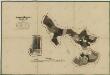
Porostní mapa polesí Zámecké 1
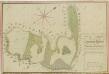
Geometrický plán pozemků domanínské hájovny, přilehlých činžovních pozemků a rybníků
Geometrický plán pozemků domanínské hájovny, přilehlých činžovních pozemků a rybníků

Mapy činžovních pozemků III. sekce třeboňského velkostatku pro obce: Břilice, Domanín, Herda, Holičky, Kojákovice, Spolí, Třeboň 1
1 : 2880
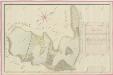
Domanín o. Jindřichův Hradec 1
1 : 2880
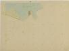
Domanín o. Jindřichův Hradec 1
1 : 2880
Domanín o. Jindřichův Hradec 1
1 : 2880
Mapy činžovních pozemků III. sekce třeboňského velkostatku pro obce: Branná, Břilice, Domanín, Herda, Holičky, Kojákovice, Spolí 1

Mapy činžovních pozemků III. sekce třeboňského velkostatku pro obce: Branná, Břilice, Domanín, Herda, Holičky, Kojákovice, Spolí, Třeboň 1
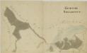
Domanín o. Jindřichův Hradec 1
1 : 2880
Brouillon hospodářské mapy polesí Zámecký-lesní úseky Radlice, Kalinova, Lejsek, a u Rudy 1

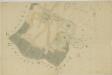
Záměrná mapa rybníků a lesů u Branné

Porostní mapa polesí Domanín 1
1 : 10000
Porostní mapa polesí Domanín 1
1 : 10000
Mapa lesních cest v polesí Domanín 1
1 : 10000
Porostní mapa polesí Domanín 1
1 : 10000
Porostní obrysová mapa polesí Zámecké 1
Kojákovice o. České Budějovice 1
1 : 2880
Porostní obrysová mapa polesí Domanín 1
1 : 15000
Branna - c0470-1-006 - Kaiserpflichtexemplar der Landkarten des stabilen Katasters
1 : 2880
Branna - c0470-1-003 - Kaiserpflichtexemplar der Landkarten des stabilen Katasters
1 : 2880
Branna - c0470-1-007 - Kaiserpflichtexemplar der Landkarten des stabilen Katasters
1 : 2880
Branna - c0470-1-008 - Kaiserpflichtexemplar der Landkarten des stabilen Katasters
1 : 2880
Branna - c0470-1-009 - Kaiserpflichtexemplar der Landkarten des stabilen Katasters
1 : 2880
Branna - c0470-1-004 - Kaiserpflichtexemplar der Landkarten des stabilen Katasters
1 : 2880
Branna - c0470-1-002 - Kaiserpflichtexemplar der Landkarten des stabilen Katasters
1 : 2880
Branna - c0470-1-005 - Kaiserpflichtexemplar der Landkarten des stabilen Katasters
1 : 2880