Maps of Kladruby

Katastrální mapa města Kladruby
1 : 2880
Situační plán luk u Žižkova mlýna
1 : 5835
Hospodářská mapa revíru Jirná
1 : 6170
Kladrau (Kladruby) - c3114-1-001 - Kaiserpflichtexemplar der Landkarten des stabilen Katasters
1 : 2880
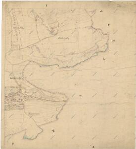
Kladrau (Kladruby) - c3114-1-005 - Kaiserpflichtexemplar der Landkarten des stabilen Katasters
1 : 2880
Kladrau (Kladruby) - c3114-1-002 - Kaiserpflichtexemplar der Landkarten des stabilen Katasters
1 : 2880
Kladrau (Kladruby) - c3114-1-007 - Kaiserpflichtexemplar der Landkarten des stabilen Katasters
1 : 2880
Kladrau (Kladruby) - c3114-1-006 - Kaiserpflichtexemplar der Landkarten des stabilen Katasters
1 : 2880
Kladrau (Kladruby) - c3114-1-003 - Kaiserpflichtexemplar der Landkarten des stabilen Katasters
1 : 2880
Kladrau (Kladruby) - c3114-1-004 - Kaiserpflichtexemplar der Landkarten des stabilen Katasters
1 : 2880
Porostní mapa Zámeckého revíru
1 : 19075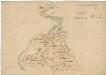
Plán pozemků Zámeckého dvora
1 : 9263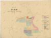
Plán pozemků Zámeckého dvora
1 : 5928
Hospodářská mapa Zámeckého revíru sekce Jirná-Hněvnice
1 : 5760
Hospodářská mapa pro Zámecký revír
1 : 10536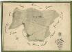
Hospodářská mapa revíru Jirná
1 : 5690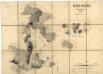
Porostní mapa Zámeckého revíru
1 : 11520
[Kartenblatt]
1 : 25000 Heřmanova Huť (Česko : oblast) Reichsamt für Landesaufnahme
III. vojenské mapování 4150/1
1 : 25000
Gradkartenblatt
1 : 25000 Kladruby-oblast (Tachov, Česko) Boruszczak, Theodor
Přehledová mapa velkostatku Kladruby
1 : 52300


Mieser Vicariat
Stříbro-oblast (Česko)
Bischofteinitz und Nürschan
1 : 75000 Horšovský Týn (Česko : oblast) Mulacz, J. K. u. k. militär-geographisches Institut
Bischofteinitz und Nürschan
1 : 75000 Horšovský Týn (Česko : oblast) Mulacz, J. K. u. k. Militärgeographisches Institut
Bischofteinitz und Nürschan
1 : 75000 Horšovský Týn (Česko : oblast) K. u. k. Militärgeographisches Institut
III. vojenské mapování 4150
1 : 75000
Stříbro a okolí
1 : 75000 Stříbro (Česko : oblast) Vojenský zeměpisný ústav