Maps of Tlumačov

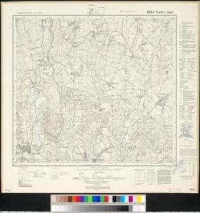
Meßtischblatt 6643 : Furth i. Wald, 1942
1 : 250000 Furth i. Wald. - Aufn. 1926, erkund. 1938 u. 1940, bericht. 1941, Ausg. 1942. - 1:25000. - München: Hauptvermessungsabt. XIII, 1942. - 1 Kt.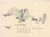
Porostní mapa revíru Filipova Hora
1 : 23040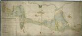
Mapa lesů panství Kout a Trhanov
1 : 5319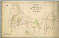
Hospodářská mapa revíru Mlýneček
1 : 5835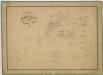
Hospodářská mapa revíru Filipova Hora a Spálenec
1 : 5973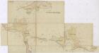
Hospodářská mapa revíru Spálenec
1 : 5835
Hospodářská mapa revíru Mlýneček
1 : 2875
Přehledná mapa revíru Filipova Hora
1 : 11506
Mapy lesních porostů velkostatku Kout - revír Mlýneček
1 : 11670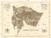
Mapa porostů revírů
1 : 11520 Folmava (Česká Kubice, Česko) Brož, Jaroslav Krejčí, Jan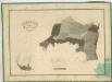
Hospodářská mapa revíru Filipova Hora
1 : 5760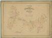
Hospodářská mapa revíru Mlýneček
1 : 5835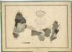
Hospodářská mapa revírů Filipova Hora a Mlýneček
1 : 5760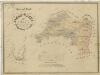
Porostní mapa revírů Filipova Hora a Spálenec
1 : 11670
Alt Preneth - c7314-2-004 - Kaiserpflichtexemplar der Landkarten des stabilen Katasters
1 : 2880
Alt Preneth - c7314-2-001 - Kaiserpflichtexemplar der Landkarten des stabilen Katasters
1 : 2880
Alt Preneth - c7314-2-010 - Kaiserpflichtexemplar der Landkarten des stabilen Katasters
1 : 2880
Alt Preneth - c7314-2-007 - Kaiserpflichtexemplar der Landkarten des stabilen Katasters
1 : 2880
Alt Preneth - c7314-2-011 - Kaiserpflichtexemplar der Landkarten des stabilen Katasters
1 : 2880
Alt Preneth - c7314-2-003 - Kaiserpflichtexemplar der Landkarten des stabilen Katasters
1 : 2880
Alt Preneth - c7314-2-008 - Kaiserpflichtexemplar der Landkarten des stabilen Katasters
1 : 2880
Alt Preneth - c7314-2-006 - Kaiserpflichtexemplar der Landkarten des stabilen Katasters
1 : 2880
Alt Preneth - c7314-2-005 - Kaiserpflichtexemplar der Landkarten des stabilen Katasters
1 : 2880
Alt Preneth - c7314-2-012 - Kaiserpflichtexemplar der Landkarten des stabilen Katasters
1 : 2880
Alt Preneth - c7314-2-009 - Kaiserpflichtexemplar der Landkarten des stabilen Katasters
1 : 2880
Alt Preneth - c7314-2-002 - Kaiserpflichtexemplar der Landkarten des stabilen Katasters
1 : 2880
Alt und Neu-Klitschau - c3160-1-005 - Kaiserpflichtexemplar der Landkarten des stabilen Katasters
1 : 2880
Alt und Neu-Klitschau - c3160-1-008 - Kaiserpflichtexemplar der Landkarten des stabilen Katasters
1 : 2880
Alt und Neu-Klitschau - c3160-1-004 - Kaiserpflichtexemplar der Landkarten des stabilen Katasters
1 : 2880
Alt und Neu-Klitschau - c3160-1-006 - Kaiserpflichtexemplar der Landkarten des stabilen Katasters
1 : 2880
Alt und Neu-Klitschau - c3160-1-003 - Kaiserpflichtexemplar der Landkarten des stabilen Katasters
1 : 2880
Alt und Neu-Klitschau - c3160-1-002 - Kaiserpflichtexemplar der Landkarten des stabilen Katasters
1 : 2880
Alt und Neu-Klitschau - c3160-1-001 - Kaiserpflichtexemplar der Landkarten des stabilen Katasters
1 : 2880
Alt und Neu-Klitschau - c3160-1-009 - Kaiserpflichtexemplar der Landkarten des stabilen Katasters
1 : 2880