Maps of Görwihl

Meßtischblatt [8314] : Görwihl, 1925
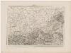
1 : 250000 Görwihl. - Hrsg. 1882, bericht. 1897, wichtigere Nachtr. 1925. - 1:25000. - Karlsruhe: Kunstdr. Künstlerbund, 1925. - 1 Kt.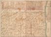
Delineatio Der vom Rothen Haus uber den Schwarzwald bis Feldburg 14 Stund lang alt und um gezogener Linien , Verhackh, und aufgeworffenen Schanzen, und Redouten
Mollova mapová sbírka
Le Flambeau de la Guerre Allumee au Rhin
Mollova mapová sbírka Delisle, Guillaume Schenk, Peter II
[Geologische Karte der Umgebungen von Waldshut]
1 : 50000 Schill, Julius Chr. Fr. Müller'sche Hofbuchhandlung
Prodromus tentaminis typometrici maioris rempublicam Basileensem
1 Karte : Typometrie ; 18 x 22 cm Haas; Preuschen Wilhelm Haas
Canton Basel sive pagus Helvetiae Basileensis cum confinibus
1 Karte : Kupferdruck ; 46 x 55 cm Walser edentibus Homannianis Heredibus
Hans Konrad Gyger's Züricher-Cantons-Carte 1667
1 : 32000 1 Karte in 56 Teilen Hans Konrad Gyger
Hans Konrad Gyger's Züricher-Cantons-Carte
1 : 32000 Blatt 50 Gyger, Hans Conrad ; Zeller-Werdmüller, Heinrich Hofer & Burger
Nova descriptio ditionis Tigurinae regionumque finitimarum
1 : 95000 1 Karte auf 6 Bl. Joh. Conradus Gygerus, P. delineavit ; Joh. Georgius Gygerus, F. in aes incidi ; curavit per Johannem Meyerum Ao. 1685
Le Theatre de la Guerre Sur le Haut Rhein
1 : 142000 Mollova mapová sbírka Sanson, Guillaume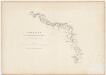
Eisenbahnstrecke durch das Glatttal bis nach Waldshut (Deutschland); Übersichtskarte
Erstellt (verkleinert) auf der Basis von grösseren Plänen über das Glatttal. Wild, Johannes (1814-1894), Ingenieur, von Richterswil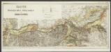
Karte der fluvioglacialen Ablagerungen in der Nordschweiz
1 : 100000 Du Pasquier, Léon Topogr. Anstalt
Blatt III: Liestal, Schaffhausen, uit: Topographische Karte der Schweiz / vermessen und hrsg. ... unter Aufsicht des Generals G.H. Dufour
1 : 100000 Annotatie: Met plaatsnamenregister (bl. V), bladwijzer (bl. XXI) en hoogteregister (bl. XXV); Voor aanwezige bladen zie overzichtsblad Dufour, G. H. [Bern : Eidg. Topogr. Bureau]
185. Freiburg i. Brg., uit: Topographische Uebersichtskarte des Deutschen Reiches / herausgegeben v. d. Kartogr. Abt. d. Königl. Preuß. Landesaufnahme
1 : 200000 titelvariant: Topogr. Übersichtskarte des Deutschen Reiches; Annotatie: Titel boven bladen ook: Topogr. Übersichtskarte des Deutschen Reiches; Annotatie geografische gegevens: Op elk blad twee maatstokken: 10 Kilometer = 5,5 cm; 1 geogr. Meile = 3,6 cm; Legenda onder op elk blad Königlich Preußische Landesaufnahme. Kartographische Abtheilung [S.l : Königlich Preußische Landesaufnahme, Kartographische Abtheilung]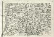
Geographica Provinciarum Sveviae Descriptio =
Mollova mapová sbírka Hurter, Johann Christoph Bodenehr, Johann Georg
Topographische Karte der Schweiz
1 : 100000 25 Karten vermessen und hrsg. auf Befehl der Eidgenössischen Behörden ; aufgenommen unter der Aufsicht des Generals G.H. Dufour Eidg. Topographisches Bureau, [Genève], [später: Bern]
Kloster Rheinau: Übersichtskarte
Originaltitel: Kleggovia Landgraviatus cum Confiniis Monasterii Rhenaugiensis. Charta Geographica Monastery Rhenaugiensis Cum Suis Fundationibus.
12. Laurater-Basler Gelegenheit
Švýcarsko
Liestal, Schaffhausen
1 : 100000 1 Karte geologische Aufnahmen von C. Moesch, U. Stutz u. Insp. Vogelgesang [Wurster & Randegger], [Winterthur]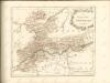
Topographische Karte der Schweiz (Dufour-Karte): Den Kanton Zürich betreffende Blätter: Blatt III: Liestal, Schaffhausen
1 : 100000 Erstausgabe 1849; Nachführung 1866. Leitung: Dufour, Guillaume-Henri (1787-1875), General, Politiker, Ingenieur und Kartograf, von Genf; Eidgenössisches Topographisches Bureau, in Genf Stich: Bressanini, Rinaldo (1803-1864), Kupferstecher und Kartograf, von Italien; Müllhaupt, Heinrich (1820-1894), Kupferstecher und Kartograf, von Hofstetten Druck: Koegel, Henri (1816-1867)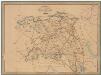
Kanton Aargau: Trigonometrisches Netz
Benz, Joh., Ingenieur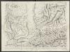
Le Canton de Basle, et parties des cantons d'Argauvie et Soleure du Frikthal et frontières
1 : 108000 Weiss, Johann Heinrich ; Scheuermann, Johann Jakob ; Meyer, Johann Rudolf J. R. Meyer
Taschen-Atlas der Schweiz
1 Atlas (25 S., 20 Taf.) gezeichnet und gestochen von Emil Wagner = Atlas de poche de la Suisse : 26 cartes en couleurs / dessinées et gravées par Émile Wagner Eggimann, Genf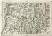
Geographica Provinciarum Sveviae Descriptio =
Mollova mapová sbírka Hurter, Johann Christoph Bodenehr, Gabriel
Basiliensis territorii descriptio nova
1 Karte : Kupferdruck ; 31 x 23 cm Münster; Ortelius s.n.
Basiliensis territorii descriptio nova
1 Karte : Kupferdruck ; 31 x 23 cm Münster; Ortelius s.n.
Territory Basiliensis nova descriptio
1 Karte : Kupferdruck ; 34 x 47 cm Keere; Schenk; Valck penes Gerardum Valk et Petrum Schenk
<<Die>> Cantone Solothurn und Basel
1 : 275000 1 Karte gest. v. J.J. Scheurmann Orell, Füssli & Cp., Zürich
![Meßtischblatt [8314] : Görwihl, 1925](https://images-2.georeferencer.com/images/iiif/711341038352/full/,300/0/native.jpg)

