Maps of Miltzow

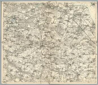
Composite: 88. Grimmen. (Germany)
1 : 100000 Reichsamt fur Landesaufnahme
88. Grimmen. (Germany)
1 : 100000 Reichsamt fur Landesaufnahme
Meßtischblatt 512, neue Nr. 1844 : Grimmen, 1937
1 : 250000 Grimmen. - Aufn. 1885, bericht. 1920. - 1:25000. - [Berlin]: Reichsamt für Landesaufnahme, 1937. - 1 Kt.
Meßtischblatt 512 : Grimmen, 1887
1 : 250000 Grimmen. - Aufn. 1885. - 1:25000. - [Berlin]: Reichsamt für Landesaufnahme, 1887. - 1 Kt.
Meßtischblatt 511, neue Nr. 1843 : Franzburg, 1935
1 : 250000 Franzburg. - Hrsg. 1886, bericht. 1925. - 1:25000. - [Berlin]: Reichsamt für Landesaufnahme, 1935. - 1 Kt.
Meßtischblatt 591 : Gr. Rakow, 1937
1 : 250000 Gr. Rakow. - Hrsg. 1887, bericht. 1920, einz. Nachtr. 1932. - 1:25000. - [Berlin]: Reichsamt für Landesaufnahme, 1937. - 1 Kt.
Meßtischblatt 590 : Glewitz, 1932
1 : 250000 Glewitz. - Hrsg. 1886, bericht. 1925, einz. Nachtr. 1932. - 1:25000. - [Berlin]: Reichsamt für Landesaufnahme, 1932. - 1 Kt.
Meßtischblatt 590 : Glewitz, 1886
1 : 250000 Glewitz. - Aufn. 1884. - 1:25000. - [Berlin]: Reichsamt für Landesaufnahme, 1886. - 1 Kt.
Meßtischblatt 513 : Horst, 1934
1 : 250000 Horst. - Hrsg. 1887, bericht. 1920, einz. Nachtr. 1932. - 1:25000. - [Berlin]: Reichsamt für Landesaufnahme, 1934. - 1 Kt.
Meßtischblatt 592, neue Nr. 1945 : Griebenow, 1932
1 : 250000 Griebenow. - Hrsg. 1887, bericht. 1925, einz. Nachtr. 1932. - 1:25000. - [Berlin]: Reichsamt für Landesaufnahme, 1932. - 1 Kt.
Meßtischblatt 592 : Griebenow, 1911
1 : 250000 Griebenow. - Aufn. 1885, hrsg. 1887, einz. Nachtr. 1911. - 1:25000. - [Berlin]: Reichsamt für Landesaufnahme, 1911. - 1 Kt.
Meßtischblatt 592 : Griebenow, 1888
1 : 250000 Griebenow. - Aufn. 1885, hrsg. 1887, einz. Nachtr. 1888. - 1:25000. - [Berlin]: Reichsamt für Landesaufnahme, 1888. - 1 Kt.
Meßtischblatt 438 : Richtenberg, 1931
1 : 250000 Richtenberg. - Hrsg. 1885, bericht. 1925. - 1:25000. - [Berlin]: Reichsamt für Landesaufnahme, 1931. - 1 Kt.
Meßtischblatt 439, neue Nr. 1744 : Elmenhorst, 1937
1 : 250000 Elmenhorst. - Hrsg. 1887, bericht. 1925, einz. Nachtr. 1937. - 1:25000. - [Berlin]: Reichsamt für Landesaufnahme, 1937. - 1 Kt.
Meßtischblatt 1745 : Stahlbrode, 1925
1 : 250000 Stahlbrode. - Aufn. 1885, bericht. 1925. - 1:25000. - [Berlin]: Reichsamt für Landesaufnahme, 1925. - 1 Kt.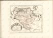

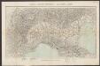
Theatrum belli in Pomerania citeriore
1 : 220000 Mollova mapová sbírka Berger
Stralsund 23, uit: Special-Karte von Mittel-Europa / nach amtlichen Quellen bearbeitet von W. Liebenow
1 : 300000 titelvariant: W. Liebenow's Mittel-Europa; Annotatie: Titel boven de bladen: W. Liebenow's Mittel-Europa Johannes Wilhelm Liebenow 1822-1897 Frankfurt a. M. : Ludwig Ravenstein
Mappa Ducatus Megalopolitani Nova :
1 : 190000 Mollova mapová sbírka
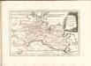
Karte von Neu-Vorpommern und der Insel Rügen
1 : 200000 Přední Pomořansko (Německo) Hagenow, Fr. von Hube, C. A. Fr. v. Hagenow
Rugiae, Usedomiae, Et Iulinae, Wandalicarum insularum vera descriptio. [Karte], in: Theatrum orbis terrarum, S. 121.
1 Karte aus Atlas Ortelius, Abraham

Insulae et principatus Rugiae cum vicinis Pomeraniae littoribus nova tabula
1 : 215000 Pomořansko (Německo a Polsko) Homann, Johann Baptist J. B. Homann
Insulae et principatus Rugiae cum vicinis Pomeraniae littoribus nova tabula
1 : 215000 Pomořansko (Německo a Polsko) Homann, Johann Baptist â Ioh. Baptista Homanno
Rugia Insula Ac Ducatus accuratissime descripta [Karte], in: Novus atlas absolutissimus, Bd. 2, S. 48.
1 Karte aus Atlas Janssonius Offizin
Rugia Insula Ac Ducatus accuratissimè descritpta [...] [Karte], in: Theatrum orbis terrarum, sive, Atlas novus, Bd. 1, S. 171.
1 Karte aus Atlas Blaeu, Joan Blaeu, Willem Janszoon
Rugia Insula Ac Ducatus accuratissimè descripta ab E. Lubino. [Karte], in: Le théâtre du monde, ou, Nouvel atlas contenant les chartes et descriptions de tous les païs de la terre, Bd. 1, S. 122.
1 Karte aus Atlas Blaeu, Willem Janszoon und Blaeu, Joan Blaeu, Willem Janszoon
RVGIA | INSVLA AC DVCATVS
accuratissimè descripta ab E. Lubino. | Adjecta sunt ad utrumque latus Baronum et Nobilium | antiquissimarum familiarum in Insula Rugia habi- | tantium, juxta alphabeti ordinem, Insignia. Amsterdami | Apud Guiljelmum Blaeuw.