Maps of Grafton County

White Mtns. & vicinity.
1 : 1150000 Central Vermont Railroad Company
Map of the White Mountains, New Hampshire : from original surveys
1 : 105000 Boardman, Harvey J.H. Bufford
The White Mountains of New Hampshire
1 : 190000 New Hampshire National Geographic Society
Grafton County, N.H.
1 : 230400 D.H. Hurd & Co.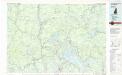
Lake Winnipesaukee
1 : 100000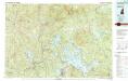
Lake Winnipesaukee
1 : 100000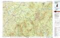
Mount Washington
1 : 100000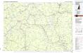
Mount Washington
1 : 100000
Carroll County, N.H.
1 : 211200 D.H. Hurd & Co.
White Mtns. topo map.
1 : 285120 Portland & Ogdensburg Railroad Company
(Topographic and glacial feature map of New Hampshire. Sheet 3)
1 : 154800 New Hampshire. Geological Survey
Map of the White Mountains of New Hampshire
1 : 100000 Boston : Forbes
Belknap County, N.H.
1 : 158400 D.H. Hurd & Co.
Freedom, Tuftonborough.
1 : 51000 D.H. Hurd & Co.
Map of the Ammonoosuc Mining District.
1 : 17000 New Hampshire. Geological Survey
Bethlehem, Bethlehem P.O., Maplewood P.O.
1 : 62000 D.H. Hurd & Co.
Wolfeboro
1 : 62500
Wolfeboro
1 : 62500
Cardigan
1 : 62500
Cardigan
1 : 62500
Cardigan
1 : 62500
Holderness
1 : 62500
Holderness
1 : 62500
Holderness
1 : 62500
Winnipesaukee
1 : 62500
Winnipesaukee
1 : 62500
Winnipesaukee
1 : 62500
Winnipesaukee
1 : 62500
Cardigan
1 : 62500
Cardigan
1 : 62500
Cardigan
1 : 62500
Cardigan
1 : 62500
Cardigan
1 : 62500
Cardigan
1 : 62500
Cardigan
1 : 62500
Wolfeboro
1 : 62500
Wolfeboro
1 : 62500
Wolfeboro
1 : 62500
Wolfeboro
1 : 62500
Wolfeboro
1 : 62500
Wolfeboro
1 : 62500
Wolfeboro
1 : 62500
Cardigan
1 : 62500
Holderness
1 : 62500
Holderness
1 : 62500
Holderness
1 : 62500
Holderness
1 : 62500
Holderness
1 : 62500
Holderness
1 : 62500
Holderness
1 : 62500
Winnipesaukee
1 : 62500
Winnipesaukee
1 : 62500
Winnepesaukee
1 : 62500
Winnepesaukee
1 : 62500
Winnepesaukee
1 : 62500
Winnipesaukee
1 : 62500
Winnepesaukee
1 : 62500
Winnepesaukee
1 : 62500


