Maps of Massachusetts

Massachusetts and Rhode Island.
1 : 800000 Tanner, Henry S.
Neueste Karte von Massachusetts und Rhode Island
Grosser Hand-Atlas über alle Theile der Erde in 170 Karten Meyer, J. Verlag des Bibliographischen Instituts
State of Massachusetts.
1 : 680000 Winterbotham, W.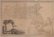
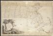
Map of Massachusetts proper : compiled from actual surveys made by order of the General Court
1 : 253440 Carleton, Osgood, 1742-1816 [B. & J. Loring]
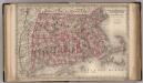
National topographic map of Massachusetts and Rhode Island : showing counties, townships, cities, villages and post offices ... according to the latest census.
1 : 253440 National Map Company National Map Company
Mass., R.I.
1 : 800000 Tanner, Henry S.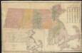
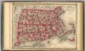
A map of Massachusetts showing the congressional districts, as proposed by the Senate of 1852

Massachusetts.
1 : 696960 Carey, Mathew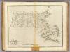
State of Massachusetts.
1 : 696960 Carey, Mathew
State of Massachusetts.
1 : 696960 Lewis, Samuel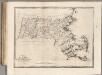
State of Massachusetts.
1 : 696960 Carey, Mathew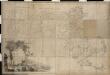
Map of Massachusetts proper compiled from actual surveys made by order of the General Court

Map of Massachusetts and Rhode Island
1 : 810000 Desilver, Charles Desilver, Charles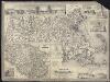
Map of Massachusetts
A new map of Massachusetts compiled from the latest and best authorities
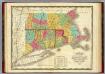
Massachusetts, Connecticut, and Rhode Island.
1 : 850000 Colton, G.W.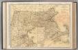
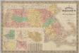
Massachusetts.
1 : 444000 Rand McNally and Company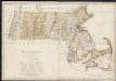
Massachusetts

Colton's Massachusetts and Rhode Island
1 : 800000 G.W. & C.B. Colton & Co. G.W. & C.B. Colton & Co.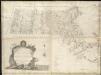
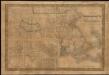
An accurate map of the Commonwealth of Massachusetts exclusive of the District of Maine, compiled pursuant to an act of the General Court from actual surveys of the several towns &c. taken by their order, exhibiting the boundary lines of the Commonwealth

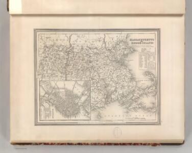
Massachusetts and Rhode Island.
1 : 785000 Colton, G.W.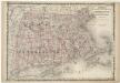
Johnson's Massachusetts Connecticut and Rhode Island

Carte géographique, statistique et historique de Massachusetts
Map of Massachusetts proper
Massachusetts Connecticut And Rhode Island.
1 : 570240 Johnson, A.J.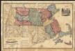
Russell's map of Massachusetts
New map of Massachusetts : compiled from the latest and best authorities and corrected by permission from the survey ordered by the legislation in 1830, carefully revised and additions made in 1841
1 : 422400 Nathl. Dearborn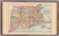
Mass., Conn., R.I.
1 : 620000 Mitchell, Samuel Augustus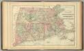
Mass., Conn., R.I.
1 : 620000 Mitchell, Samuel Augustus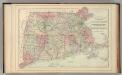
Mass., Conn., R.I.
1 : 620000 Mitchell, Samuel Augustus Jr.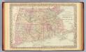
Mass., Conn., R.I.
1 : 620000 Mitchell, Samuel Augustus
Mass., Conn., R.I.
1 : 920000 Mitchell, Samuel Augustus
Massachusetts. Rhode Island. And Connecticut.
1 : 1647360 Burr, David H., 1803-1875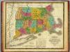
Map of Massachusetts, Connecticut, and Rhode Island.
1 : 675000 Mitchell, Samuel Augustus