Maps of Los Angeles County
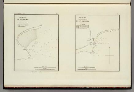
Mouillage De San Pedro. No. 12. (with) Mouillage De La Mission De Sta. Barbara. No. 13. Publie Par Arthus Bertrand. Voyage de Mr. Duflot de Mofras.
Duflot de Mofras, Eugene
Wilmington
1 : 24000
Wilmington
1 : 24000
Wilmington
1 : 24000
Wilmington
1 : 24000
Los Angeles Harbor and Vicinity
1 : 140000 Includes index of berth numbers and locations of steamship companies operating from the port of Los Angeles, bunker oil companies, and general Information; location inset, and inset of Los Angeles region. Los Angeles (Calif.). Harbor Department. [Los Angeles, Calif.] : Harbor Department of the City of Los Angeles
San Pedro
1 : 24000
San Pedro
1 : 24000
San Pedro
1 : 24000
San Pedro
1 : 24000
San Pedro
1 : 24000
San Pedro Harbor, Calif.
1 : 30000 Bache, A. D.
Compton. Detail Irrigation Map.
1 : 42240 California Department of Engineering
Street Map of Long Beach and Los Angeles Southern Section.
1 : 44352 Shell Oil Company
Map of Los Angeles Historical and Recreational.
Mora, Jo (1876-1947)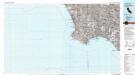
Long Beach
1 : 100000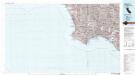
Long Beach
1 : 100000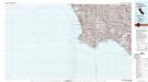
Long Beach
1 : 100000
Map showing territory annexed to the city of Los Angeles, California
1 : 1225000 Includes chart showing history of annexed territory, numbered 1-83. "Mar. 14, 1935"--Last line of history chart. Lloyd, Aldrich, 1886-1967 [Los Angeles, Calif. : City Engineer]
Map of Beaches and Nearby Point of Interest, City of Los Angeles.
Security Savings Bank
[Map of Los Angeles County, California].
Shows the central, western, and southern areas of Los Angeles County divided into seven numbered districts. [California?]
Pictorial map of the Los Angeles metropolitan district: a complete geographical guide to the fastest growing territory in the entire world / drawn for the Los Angeles times by Charles H. Owens.
"Showing in accurate detail and in relief the location of cities, towns, highways, railroads, water courses, coast developments, parks, airports, government stations, oil fields, natural landmarks, etc." Includes index. Owens, Charles H. Los Angeles, Calif.] : Los Angeles times
Map Showing Territory Annexed to the City of Los Angeles, California
1 : 1225000 Includes chart showing history of annexed territory, numbered 1-83. "Mar. 14, 1935"--Last line of history chart. Aldrich, Lloyd, 1886-1967. [Los Angeles, Calif. : City Engineer]
Population distribution in the Los Angeles area as of 1920
Map prepared by the Engineering Department, Automobile Club of Southern California. Automobile Club of Southern California. Engineering Dept. The Department
Population distribution in the Los Angeles area as of 1910
Map prepared by the Engineering Department, Automobile Club of Southern California.| Automobile Club of Southern California. Engineering Dept. The Department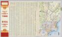
Los Angeles and Vicinity.
1 : 285120 Shell Oil Company
Verso: Los Angeles, California.
Hill, E. F.
Southern portion of Los Angeles County showing historical trails and landmarks
1 : 1275000 Mapped by D.C. Newmarch. Federal Writers' Project. Kirkman, George W. [California? : s.n.]
California Freeway and Expressway System, January 1967.
1 : 1192107 California Department of Transportation, Division of Highways