Maps of Kentucky
(Indiana, Ohio, Kentucky)
1 : 4200000 Moore, M. B. (Marinda Branson), 1829-1864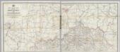
Post Route Map Of Kentucky And Tennessee
1 : 510000 Von Haake, A.
Neueste Karte von Kentucky mit seinen Strassen, Entfernungen der Hauptpunkte & Routen für Dampfschiffe
Grosser Hand-Atlas über alle Theile der Erde in 170 Karten Meyer, J. Verlag des Bibliographischen Instituts
County Map Of Ohio, And Indiana.
1 : 2300000 Mitchell, Samuel Augustus
Ohio and Indiana.
1 : 1712000 Schonberg & Co.
County map of Ohio and Indiana
1 : 1800000 Mitchell, Samuel Augustus Jr.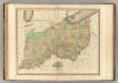
Ohio and Indiana.
1 : 1110000 Tanner, Henry S.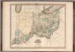
Ohio and Indiana.
1 : 1100000 Tanner, Henry S.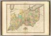
Ohio And Indiana.
1 : 1140480 Tanner, Henry S.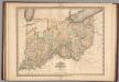
Ohio and Indiana.
1 : 1100000 Tanner, Henry S.
Ohio and Indiana.
1 : 1100000 Tanner, Henry S.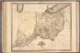
Ohio and Indiana.
1 : 1100000 Tanner, Henry S.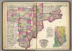
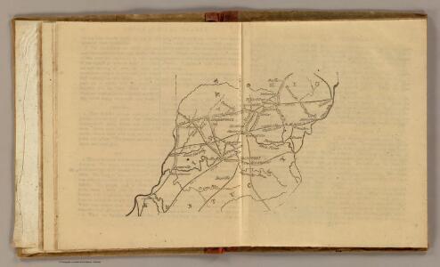
Lawrence, Jackson, Jennings, Washington, Scott, Jefferson, Harrison, Switzerland, Floyd, Clarke, Ohio counties.
1 : 320000 Brown, R. T.
Ohio & Indiana.
1 : 1300000 Asher & Adams
E. United States 4.
1 : 1774080 Letts, Son & Co.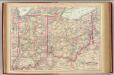
Ohio, Indiana.
1 : 1267200 Asher & Adams
Ohio, Kentucky, Virginia.
1 : 1770000 Society for the Diffusion of Useful Knowledge (Great Britain)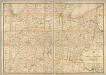
Post route map of the states of Ohio and Indiana with Cinncinnati and environs.
1 : 506880 United States. Post Office Dept.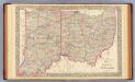
Ohio, Indiana.
1 : 1300000 Mitchell, Samuel Augustus
Ohio, Indiana.
1 : 1800000 Mitchell, Samuel Augustus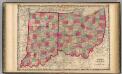
Ohio And Indiana.
1 : 1190000 Johnson, A.J.
Indiana und Ohio.
1 : 2750000 Lange, Henry, 1821-1893.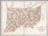
Map of Ohio And Indiana.
1 : 633600 Burr, David H., 1803-1875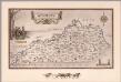
An historical and geographical map of the state of Kentucky
1 : 66597 Smith, Karl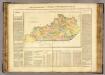
Kentucky.
1 : 13800000 Buchon, J. A. C.; Carey, H. C.; Lea, I.
Kentucky.
1 : 3674880 Scott, Joseph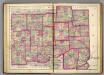
Hendrickson, Marion, Hancock, Henry, Wayne, Morgan, Johnson, Shelby, Rush, Fayette, Union, Monroe, Brown, Bartholomew, Decatur, Franklin, Ripley, Dearborn, Ohio counties.
1 : 320000 Asher, Adams & Higgins; Higgins & Ryan
Kentucky.
1 : 1550000 Cram, George Franklin; Davis, Ellis Arthur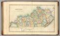
Kentucky.
1 : 1320000 Lucas, Fielding Jr.