Maps of Missouri

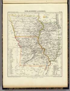
Iowa, Missouri u. Illinois.
1 : 3900000 Lange, Henry, 1821-1893.
Illinois, Missouri, Iowa, Nebraska And Kansas.
1 : 3600000 Mitchell, Samuel Augustus
Iowa, Missouri.
1 : 1700000 Mitchell, Samuel Augustus
Iowa, Missouri.
1 : 1700000 Mitchell, Samuel Augustus
Milwaukee.
Mitchell, Samuel Augustus Jr.
Iowa, Missouri.
1 : 1700000 Mitchell, Samuel Augustus Jr.
Iowa, Missouri.
1 : 1700000 Mitchell, Samuel Augustus
Iowa, Missouri.
1 : 2600000 Mitchell, Samuel Augustus
Map of Illinois & Missouri.
1 : 633600 Burr, David H., 1803-1875
Illinois And Missouri.
1 : 1140480 Tanner, Henry S.
Illinois and Missouri.
1 : 1120000 Tanner, Henry S.
Illinois, Iowa, and Missouri.
1 : 3651000 Fisher, Richard Swainson
Illinois and Missouri.
1 : 1200000 Tanner, Henry S.
Illinois and Missouri.
1 : 1200000 Tanner, Henry S.
Illinois and Missouri.
1 : 1200000 Tanner, Henry S.
Illinois and Missouri.
1 : 1200000 Tanner, Henry S.
Shell Sectional Map No. 7 - South Central States.
1 : 1710720 Shell Oil Company
Chicago and Alton R.R.
1 : 3304100 Chicago & Alton Railroad Company
Parties des Etats-Unis. Amer. Sep. 49.
1 : 1641836 Vandermaelen, Philippe, 1795-1869
Map of the States of Illinois & Missouri.
1 : 1520640 Beck, Lewis C.
Illinois And Missouri.
1 : 1140480 Tanner, Henry S.
Missouri.
1 : 1780000 Mitchell, Samuel Augustus
Missouri.
1 : 1780000 Mitchell, Samuel Augustus
(Iowa, Illinois) Railroad Map of the United States.
1 : 506880 Rand McNally and Company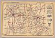
Missouri.
1 : 1800000 Rand McNally and Company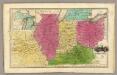
Western States. (with) inset map of Upper Michigan.
1 : 3000000 Smiley, Thomas T.
Missouri.
Rand McNally and Company
Missouri.
1 : 1700000 Colton, G.W.
Missouri.
1 : 1850000 Tanner, Henry S.