Maps of Spain

Spanien u. Portugal.
1 : 2500000 Ziegler, J. M.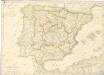
Spanien und Portugal
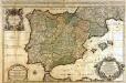
L'Espagne
1 Karte : Kupferdruck ; 53 x 85 cm Sanson; Jaillot chez H. Iaillot joignant les grands Augustins aux deux globes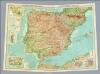
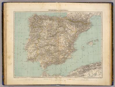
Composite: Spain, Portugal.
1 : 2000000 John Bartholomew and Son
Carte des routes de postes et itinéraires d'Espagne et de Portugal
1 : 2500000 par Ch. Picquet dressée par Lapie, Ingr. géographe, d'après les cartes de Lopez, Tofino et autres documents authentiques. Paris : chez Ch. Picquet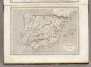
Espagne et Portugal.
1 : 3200000 Montemont, A.
Hispania antiqua in tres præcipuas partes
1 Karte : Kupferdruck ; 46 x 64 cm Sanson; Remondini; Robert de Vaugondy; Santini apud Franc.m Santini chez Mr. Remondini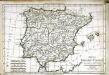
Mappa Hispaniæ antiquæ descripta
1 Karte : Kupferdruck ; 21 x 31 cm Bonne; Perrier; André s.n.
Hispania antiqua in tres præcipuas partes
1 Karte : Kupferdruck ; 46 x 56 cm Robert de Vaugondy; Sanson; Delahaye G. et D. Robert de Vaugondy
Carte de l'Espagne ancienne
1 Karte : Kupferdruck ; 39 x 49 cm Robert de Vaugondy G. Robert de Vaugondy
Hispania antiqua
1 Karte : Kupferdruck ; 40 x 52 cm Sanson; Robert de Vaugondy chés le Sr. Robert geog. ord. du roy sur le quay de l'horloge du palais
Hispania vetvs
1 Karte : Kupferdruck ; 31 x 38 cm Weigel Christoph Weigel
Hispaniae veteris descriptio
1 Karte : Kupferdruck ; 36 x 47 cm Ortelius s.n.
[Iberische Halbinsel]
Pyrenejský poloostrov
Spanien und Portugal
Geographischer Atlas über alle Theile der Erde Ziegler, Jakob Melchior Verlag von Joh. Wurster um Comp.
L'Espagne divisée en tous ses royaumes, principautés, &c à l'usage de monseigneur le duc de Bourgogne
1 : 2535000 par [...] H. Iaillot A Amsterdam : chez R. & J. Ottens
[Spanien und Portugal, Iberische Halbinsel]
[Allgemeiner Atlas über alle Theile der Erde in 29 Blättern] Ziegler, Jakob Melchior Top. Anstalt v. J. Wurster u. Comp.
España: comunicaciones terrestres
Datat al 1950 aproximadament. 0 Seix y Barral
Mapa general de España antigua
1 Karte : Kupferdruck ; 33 x 38 cm López se hallarà con todàs las obras del autor y las de su padre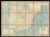
Carta itineraria de España
1 : 1500000 Depósito Central de Planos de la Dirección General de Obras Públicas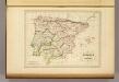
Espagne Ancienne.
1 : 4850000 Malte-Brun, Conrad, 1775-1826
Království španělské
Portugalsko tisk a sklad Hynka Fuchse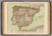
Spain, Portugal
1 : 3000000 Andree, Richard; Times (London, England)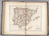
Spain and Portugal.
1 : 3300000 Carey, Mathew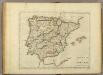
Spain And Portugal.
1 : 3300000 Carey, Mathew
Spain and Portugal.
1 : 3358080 Carey, Mathew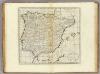
Spain and Portugal.
1 : 3294720 Carey, Mathew
Spain and Portugal.
1 : 3294720 Carey, Mathew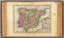
Spain and Portugal.
1 : 6000000 Moll, Herman, d. 1732