Maps of Iran
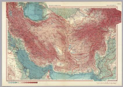
Iran, Afghanistan. Pergamon World Atlas.
1 : 5000000 Polish Army Topography Service
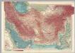
Persia and Afghanistan.
1 : 7200000 Hughes, William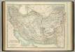
Persia and Afghanistan.
1 : 4311000 Johnston, W. & A.K.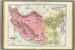
Persia, Afghanistan, Baluchistan.
1 : 3800000 Rand McNally and Company
Persia.
1 : 5200000 Hall, S. (Sidney)
92. Persia, Afghanistan.
1 : 7500000 Touring club italiano
Royaume de Perse et du Royaume de Afghanistan.
1 : 8000000 Vivien de St Martin, L.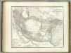
Iran, Afghanistan, Beludschistan.
1 : 4780000 Weiland, C. F. (Carl Ferdinand), d. 1847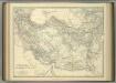
Persia and Afghanistan.
1 : 4311000 Johnston, Alexander Keith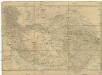
Central-Asien
1 : 4600000 Asie střední Arrowsmith, John Burnes, Alex Geographisches Institut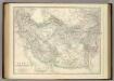
Persia and Afghanistan.
1 : 4311000 Johnston, Alexander Keith
Iran, Afghanistan und Beludschistan
1 : 5400000 entworfen und gezeichnet von C.F. Weiland Weimar : Verlag des Geograph. Instituts
143-144. Iran, Afghanistan, West Pakistan. The World Atlas.
1 : 5000000 USSR (Union of Soviet Socialist Republics).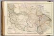
Central Asia.
1 : 4435200 Arrowsmith, John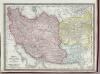
Persia, Afghanistan, and Beluchistan.
1 : 7900000 Rand McNally and Company
Asia occidental II
1 mapa. Datat al s.XIX. 0 Gras y compañía, editores. Madrid

Iran & Turan
Adolf Stieler's Handatlas über alle Theile der Erde und über das Weltgebäude Stieler, Adolf Justus Perthes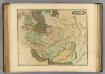
Persia.
1 : 6200000 Lizars, Daniel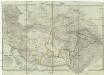
Central-Asien nemlich Bokhara, Cabool, Persien, der Indus Strom und die oestlich des selben gelegenen Laender
1 : 4600000 Asie střední Arrowsmith, John Burnes, Alex Geographisches Institut
[Iran & Turan oder Persien, Afghanistan, Balutschistan, Turkestan]
Handatlas über alle Theile der Erde und über das Weltgebäude Stieler, Adolf Justus Perthes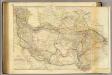
Central Asia.
1 : 4400000 Burnes, Alexander, Sir.
Iran, Turan, Afghanistan, Beludschistan, Turkestan.
1 : 9500000 Radefeld, Carl Christian Franz, 1788-1874
W. Hochasien.
1 : 7500000 Flemming, Carl
Terra Inter Euphratem et Indum Antiqua
Schul-Atlas der alten Welt bei Justus Perthes
Iran & Turan Oder: Persien, Afghanistan, Balutschistan, Turkestan.
1 : 7500000 Petermann, A.
[Jran Turan, Persien, Afghanistan, Beludschistan, Turkestan]
Grosser Hand-Atlas über alle Theile der Erde in 170 Karten Meyer, J. Verlag des Bibliographischen Instituts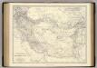
Persia, Afghanistan.
1 : 4311000 Johnston, Alexander Keith, 1804-1871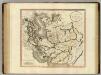
Persia.
1 : 6100000 Cary, John, ca. 1754-1835