Maps of Wisconsin

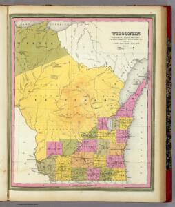
Wisconsin.
1 : 1340000 Mitchell, Samuel Augustus
Wisconsin.
1 : 1030000 Rand McNally and Company
Wisconsin.
1 : 2100000 Rand McNally and Company
Climatological map of Wisconsin.
1 : 1520640 Snyder, Van Vechten & Co.
Map of the State of Wisconsin.
1 : 1140480 Snyder, Van Vechten & Co.
State of Wisconsin.
1 : 760320 U.S. General Land Office
Geological map of Wisconsin.
1 : 1520640 Snyder, Van Vechten & Co.
Map of Wisconsin showing congressional and judicial districts.
1 : 1520640 Snyder, Van Vechten & Co.
Map of Wisconsin showing senatorial districts.
1 : 1520640 Snyder, Van Vechten & Co.
Map of Wisconsin, showing assembly districts.
1 : 1520640 Snyder, Van Vechten & Co.
Wisconsin.
1 : 1330560 Cram Atlas Company
Wisconsin.
1 : 1140480 U.S. General Land Office
Wisconsin.
1 : 1600000 Grassl, J. (Joseph)
Wisconsin
Map of Wisconsin with drawings illustrating historic places and events throughout the state. The Great Seal of the State of Wisconsin appears at the top right and the flags of Spain (1600), France (1700), England (1794), and a U.S. flag (1805) appear at left. There is a key explaining all 104 drawings at the bottom of the map. Kishner, Mel Wisconsin Tales and Trails, Inc.
Preliminary traffic map, showing annual 24 hour average traffic, state of Wisconsin
1 : 1198000 This blue line print map shows highways, the scale of traffic volume, and average 24 hour traffic. Also included are inset maps of Appleton, Neenah, and Menasha, Waukesha County, Milwaukee County, Racine County, Kenosha County, Washington County, and Ozaukee County. Wisconsin. State Highway Commission Wisconsin. State Highway Commission
Historical map of Wisconsin
Pictorial map showing historical events and locations within the state of Wisconsin, as well as waterways and counties. Original caption on the bottom margin reads:"Published by the Milwaukee Sentinel commemorating its one hundredth anniversary June 27, 1937. Approved by the Wisconsin Conservation Commission. Checked and approved by Dr. Joseph Shafer, superintendent of the Historical Society of Wisconsin, and Dr. Louise Phelps Kellogg, senior research associate. Endorsed by the Wisconsin State Chamber of Commerce. Litho. in U.S.A." Bohlman, Nina S. Milwaukee Map Service Inc.
Wisconsin.
1 : 2000000 Colton, G.W.
Wisconsin.
1 : 3000000 Colton, G.W.
Wisconsin.
1 : 1650000 Colton, G.W.
Wisconsin.
1 : 1647360 Colton, G.W.
Wisconsin.
1 : 1651000 Colton, G. Woolworth
Wisconsin.
1 : 1340000 Tanner, Henry S.
Wisconsin.
1 : 1014000 Rand McNally and Company
Wisconsin.
1 : 1900000 Tanner, Henry S.
AutoTrails Map, Wisconsin, Northern Illinois, Northern Michigan.
1 : 928000 Rand McNally and Company
Map of Wisconsin

Wisconsin.
1 : 1254000 Hammond, C.S.
Wisconsin. Milwaukee.
Rand McNally and Company
Wisconsin.
1 : 1600440 Colton, G.W.