Maps of North Carolina

l'Armee du Sud, in la Virginie, dans les deux Carolines, et dans la Georgie.
1 : 2000000 Marshall, John
Virginiae item et Floridae Americae provinciarum, nova descriptio.
from Charts and maps Printed by H. Hondius and J. Johnson: [Amsterdam]; Jansson, Jan; Hondius, Jodocus,
Virginiae item et Floridae Americae provinciarum, nova descriptio.
from Parts Ian Ianssen?: [Amsterdam]; Mercator, Gerhard -- Geographer (not in Relator list); Hondius, Jodocus,
Virginiae item et Floridae Americae provinciarum, nova descriptio.
from John H. Levine Collection H. Hondius?: [Amsterdam]; Mercator, Gerhard -- Geographer (not in Relator list); Hondius, Jodocus,
Virginiae item et Floridae Americae provinciarum, nova descriptio.
from Parts Hondius?: [Amsterdam]; Mercator, Gerhard -- Geographer (not in Relator list); Hondius, Jodocus,
Monitor map, showing the whole seacoast from Chesapeake Bay, down to Savannah harbor, and the whole country between Richmond & Savannah, with map on large scale of the harbor of Charleston
L. Prang & Co.
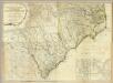
North Carolina. South Carolina.
1 : 2012000 Gray, Ormando Willis
Virginia, North Carolina, South Carolina.
1 : 1584000 Smith, J. Calvin
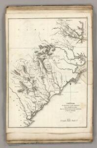
The marches of Lord Cornwallis in the southern provinces, now states of North America, comprehending the two Carolinas, with Virginia and Maryland, and the Delaware counties
1 : 1525000 Faden, William Faden, William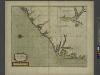
A new mapp of CAROLINA
from The sea-atlas : containing an hydrographical description of most of the sea-coasts of the known parts of the world.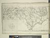
A map of North Carolina, from the best authorities.
from The American geography; or, A view of the present situation of the United States of America: containing astronomical geography; geographical definitions, discovery, and general description ... By Jedidiah Morse, A.M.
North Carolina.
1 : 2050000 Colton, G.W.
North Carolina.
1 : 1960000 Mitchell, Samuel Augustus
North Carolina.
1 : 1960000 Mitchell, Samuel Augustus
Virginia, North Carolina, South Carolina, & Georgia, Operations of the Southern Armies.
1 : 2000000 Marshall, John
N. & S. Carolina.
1 : 1770000 Society for the Diffusion of Useful Knowledge (Great Britain)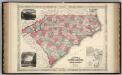
North And South Carolina.
1 : 1530000 Johnson, A.J.
North Carolina.
1 : 2000000 Colton, G.W.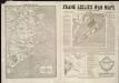
Frank Leslie's war maps
Leslie, Frank
North Carolina.
1 : 2000000 Colton, G.W.
North Carolina.
1 : 2500000 Tanner, Henry S.
North Carolina.
1 : 1267000 Colton, G.W.
E. United States 3.
1 : 1774080 Letts, Son & Co.
North Carolina.
1 : 2600000 Finley, Anthony
North Carolina.
1 : 2012000 Colton, G. Woolworth
Virginiae item et Floridae Americae Provinciarum, nova descriptio.
The map portrays an area extending from Chesapeake Bay in Virginia to St. Augustine, Florida. Small illustrations of American Indians, local wildlife, ships and sea creatures appear on the map. There is a large rectangular cartouche in the upper left corner with an oval on each side that show differences in the buildings and fortifications between settlements in Florida and Virginia. Captions in lower left and throughout. Mercator, Gerhard, 1512-1594.; Hondius, Hendrik, 1597-1651.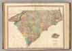
North & South Carolina.
1 : 1100000 Tanner, Henry S.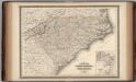
North Carolina and South Carolina.
1 : 1550000 Johnson, A.J.
Virginiae item et Floridae Americae Provinciarum, nova descriptio
Covers coast from Chesapeake to St. Augustine. Relief shown pictorially. Shows Native American settlements throughout North Carolina (named Virginia on the map). Also includes many drawings of ships, animals, sea monsters, and Native Americans. The cartouche includes a view of a Florida Indian village on the left, and a Virginia Indian village on the right. Mercator, Gerhard, 1512-1594.;Hondius, Hendrik, 1597-1651. [Hondius and Johnson]