Maps of Putnam County

Carmel. Towners Station. South East Centre. Mill Town, New York.
Beers, Frederick W.
Lake Carmel
1 : 24000
Lake Carmel
1 : 24000
Lake Carmel
1 : 24000
Lake Carmel
1 : 24000
Lake Carmel
1 : 31680
Lake Carmel
1 : 31680
Lake Carmel
1 : 24000
Carmel, Town.
1 : 31680 Beers, F. W. (Frederick W.)
Small folder - S2
from Atlas of New York and vicinity : from actual surveys / by and under the direction of F. W. Beers, assisted by A. B. Prindle & others
Small folder - S2
from Atlas of New York and vicinity : from actual surveys / by and under the direction of F. W. Beers, assisted by A. B. Prindle & others
Carmel
1 : 62500
Carmel
1 : 62500
Carmel
1 : 62500
Carmel
1 : 62500
Carmel
1 : 62500
Carmel
1 : 62500
Carmel
1 : 62500
Carmel
1 : 62500
Carmel
1 : 62500
Carmel
1 : 62500
Carmel
1 : 62500
Carmel
1 : 62500
Carmel
1 : 62500
Carmel
1 : 62500
23. Carmel sheet.
1 : 62500 Geological Survey (U.S.)
Carmel
1 : 62500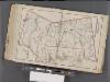
Westchester, Double Page Plate No. 31 [Map of Town of Poundridge, Lewisbord and North Salem] / prepared under the direction of Joseph R. Bien, from general surveys and official records.
From Atlas of Westchester County, New York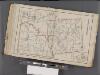
Westchester, Double Page Plate No. 30 [Map of Town of Bedford and Somers] / prepared under the direction of Joseph R. Bien, from general surveys and official records.
From Atlas of Westchester County, New York


