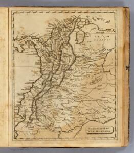
Maps of Colombia

New Granada.
1 : 8800000 Arrowsmith, Aaron; Lewis, Samuel
Venezuela, New Grenada & Equador.
1 : 6800000 Mitchell, Samuel Augustus
Venezuela, New Grenada & Equador.
1 : 6800000 Mitchell, Samuel Augustus
South America 2.
1 : 2800000 Arrowsmith, Aaron
New Grenada, Venezuela, and Ecuador.
1 : 9360000 Greenleaf, Jeremiah
Colombia.
1 : 9504000 Greenleaf, Jeremiah
Columbia.
1 : 9504000 Burr, David H., 1803-1875
Sheet 1. South America.
1 : 3000000 Delarochette, Louis Stanislas d'Arcy
Geographisch-statistische und historische Charte von Columbia
1 : 8230000 C.F. Weiland del. Weimar : Verlag des Geographischen Instituts
Venezuela, New Grenada & Equador.
1 : 6969600 Tanner, Henry S.
Venezuela, New Grenada & Equador.
1 : 6969600 Tanner, Henry S.
Colombia.
1 : 4900000 Arrowsmith, John
Colombia
1 : 4900000 Arrowsmith, John
New Grenada.
1 : 3400000 Pinkerton, John, 1758-1826
South America 1.
1 : 6969600 Letts, Son & Co.
Venezuela, New Granada And Ecuador.
1 : 7159680 Colton, G.W.
Colombia.
1 : 4752000 Lucas, Fielding Jr.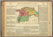
Colombia.
1 : 10200000 Lea, I.
Die Staaten Neu - Granada, Ecuador und Venezuela

Venezuela, Colombia and Ecuador.
1 : 7000000 Colton, G.W.
Terra Firma et Novum Regnum Granatense et Popayan
from America: being the latest, and most accurate description of the Nevv vvorld; containing the original of the inhabitants, and the remarkable voyages thither. The conquest of the vast empires of Mexico and Peru, and other large provinces and territories, with the several European plantations in those parts. Also their cities, fortresses, towns, temples, mountains, and rivers. Their habits, customs, manners, and religions. Their plants, beasts, birds, and serpents. With an appendix, containing, besides several other considerable additions, a brief survey of what hath been discover'd of the vnknown south-land and the Arctick region. Collected from most authentick authors, augmented with later observations, and adorn'd with maps and sculptures, by John Ogilby ...
Venezuela, New Granada (Colombia) and Ecuador.
1 : 7200000 Colton, G.W.
Venezuela, Colombia, Ecuador.
1 : 7500000 Colton, G.W.
Geographical, Statistical and Historical Map of Colombia
1 : 11000000 Este es uno de los primeros mapas impresos sobre la República de Colombia (la ahora llamada Gran Colombia, que incluyó las actuales Colombia, Ecuador, Panamá y Venezuela), entonces separada en tres departamentos: Quito, Cundinamarca y Venezuela. Fue publicado en Filadelfia el mismo año que el presidente James Monroe reconoció diplomáticamente la independencia de los países hispanoamericanos, y poco antes de que se diera a conocer la denominada “Doctrina Monroe”, según la cual toda nueva incursión europea en el continente americano sería entendida como una amenaza a la seguridad de los EEUU, bajo el lema de “América para los americanos”. En este contexto, no deja de ser significativo que el atlas de Carey & Lea fuese el primero elaborado en los EEUU para describir el continente americano. Allí cada mapa viene rodeado con una descripción de la geografía, las estadísticas y la historia de cada región, incluyendo los acontecimientos políticos y militares más recientes de los territorios iberoamericanos. Así, en el mapa de Colombia se menciona la victoria de las tropas colombianas dirigidas por Bolívar sobre el mariscal español Miguel de la Torre, durante la batalla de Carabobo el 21 de junio de 1821. También se resalta que a inicios de 1822 quedaban algunos remanentes españoles en Puerto Cabello, Venezuela y el Ismo de Panamá, pero destacando que “parece haber suficientes razones para creer que la independencia ha quedado finalmente establecida en este país (“there appears to be considerable reason to believe that the independence of this country is now finally established”). El Atlas de Carey & Lea fue todo un éxito editorial en EEUU y tuvo múltiples ediciones europeas, como la versión abreviada inglesa de 1823, la alemana de 1824 y 1828 y la francesa de 1825, entre otras, en las cuales los mapas tuvieron algunas ligeras variaciones. H.C. Carey & I. Lea (empresa) Finlayson, John (1770-1854)
Colombia
Este es un buen ejemplo de la reimpresión tardía de un mapa de las primeras décadas del siglo XIX para ser usado en atlas económicos destinados al público general británico. Llama la atención que el mapa contiene un error tipográfico en la escritura de Ecuador, que aparece como “ESCUDOR”. Dower, J. Orr & Compy. (empresa)
Venezuela, Colombia and Ecuador.
1 : 7000000 Colton, G.W.
Venezuela, New Granada and Ecuador.
1 : 7000000 Colton, G.W.
Venezuela, New Granada, and Ecuador.
1 : 7000000 Colton, G.W.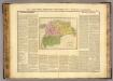
Colombie.
1 : 10700000 Buchon, J. A. C.; Carey, H. C.; Lea, I.