Maps of Rock Hall

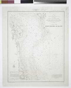
Mouth of Chester River : (Harbor of Refuge no. ) / from a trigonometrical survey under the direction of A.D. Bache, superintendent of the Survey of the Coast of the United States ; triangulation by J. Ferguson and J.E. Johnston, capt. topl. engrs. assist
from Maryland
Mouth, Chester River.
1 : 40000 Bache, A. D.
Love Point
1 : 31680
Langford Creek
1 : 24000
Langford Creek
1 : 24000
Langford Creek
1 : 24000
Langford Creek
1 : 24000
Langford Creek
1 : 31680
North Point
1 : 62500
North Point
1 : 62500
North Point
1 : 62500
North Point
1 : 62500
North Point
1 : 62500
North Point
1 : 62500
North Point
1 : 62500
North Point
1 : 62500
North Point
1 : 62500
North Point
1 : 62500
Kent Island
1 : 31680
Kent Island
1 : 24000
Kent Island
1 : 24000
Kent Island
1 : 24000
Swan Point
1 : 24000
Swan Point
1 : 31680
The harbor of Annapolis / founded upon a trigonometrical survey under the direction of A.D. Bache, superintendent of the Survey of the Coast of the United States ; triangulation by James Ferguson and Ferd. H. Gerdes, assistants ; the hydrography under th
from Maryland
Topographical atlas of Maryland: counties of Caroline, Queen Anne and Talbot.
1 : 221760 Walling, H. F.
Tolchester
1 : 125000
Tolchester
1 : 125000
Tolchester
1 : 125000
Tolchester
1 : 125000
Tolchester
1 : 125000