Maps of Brittany
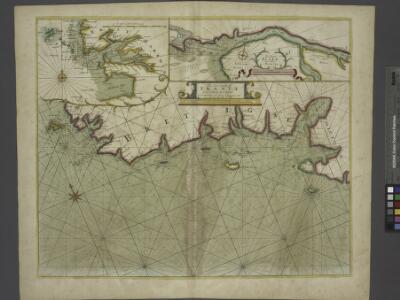
The sea coast of FRANCE from Ushent to Olone
from The sea-atlas : containing an hydrographical description of most of the sea-coasts of the known parts of the world.
France Flle. Ouest.
1 : 1000000 Vivien St Martin, L.
Carte de la république de France, no. 3
1 Blatt : 41 x 59 cm s.n.
Neueste Generalkarte von Frankreich, 3
1 Blatt : 55 x 78 cm F.A. Schrämbl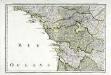
Troisieme feuille contenant une partie de la Bretagne, l'Anjou, la Touraine, le Poitou, la Saintonge, la Marche et le Limosin
1 Blatt : 34 x 55 cm Bourgoin

Schauplaz des Krieges der Vendeer und Chouans
1 Karte : Kupferdruck ; 36 x 40 cm Abel s.n.
Carte de France, 5
2 Blätter : Kupferdruck ; 53 x 44 cm Crepy
Tabula ducatus Brittaniae Gallis
1 : 511000 Bretaň (Francie) Homann, Johann Baptist Ioh. Bapt. Homanno
Duché et gouvernement de Bretagne
1 Karte : Kupferdruck ; 25 x 34 cm Merian Caspar Merian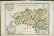
Duché, et gouvernement de Bretagne
1 Karte : Kupferdruck ; 36 x 49 cm Sanson; Mariette; Cordier chez Pierre Mariette rue St. Iacques alèsperance
Duche de Bretaigne [Karte], in: Novus atlas absolutissimus, Bd. 4, S. 138.
1 Karte aus Atlas Janssonius Offizin
Tabula ducatus Britanniae Gallis le gouvernem.t general de Bretagne
1 : 631700 Bretaň (Francie) Homann, Johann Baptist Ioh. Bapt. Homann
Tabula ducatus Britanniae Gallis le gouvernem.t general de Bretagne
1 : 631700 Bretaň (Francie) Homann, Johann Baptist editore Ioh. Bapt. Homanno
TABULA DUCATUS BRITANNIAE Gallis LE GOUVERNEM.t GENERAL DE BRETAGNE
1 : 600000 Bretaň (Francie) Homann, Johann Baptist Ioh. Bapt. Homanno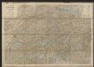
Duche de Bretaigne [Karte], in: Gerardi Mercatoris et I. Hondii Newer Atlas, oder, Grosses Weltbuch, Bd. 2, S. 74.
1 Karte aus Atlas Mercator, Gerhard und Hondius, Jodocus Jansson, Jan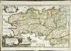
La Bretagne
1 Karte : Kupferdruck ; 36 x 57 cm Duval; Duval chez M.elle Du-Val fille de l'auteur sur le quay de l'Orloge pres le coin de la Rüe de Harlay a l'ancien Büis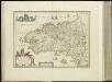
[15][15] Duche de Bretaigne, uit: Atlas sive Descriptio terrarum orbis
Annotatie: Gedigitaliseerde versie. Amsterdam. Heiloo : Picturae (vervaardiger), 2015. tiff-bestand. Gedigitaliseerd: 07-01-2015; Origineel: Universiteitsbibliotheek Vrije Universiteit (XL.05127.-) ; Netherlands; Titelpagina ontbreekt Wit, Frederik de Amsterdam : Frederick de Wit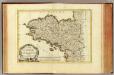
Bretagne.
1 : 930000 Bonne, Rigobert, 1727-1794
Carte de la France (NO)
1 : 345600 Cassini family
Gouvernement de Bretagne
1 : 5920000 Bretaň (Francie) Bonne, Rigobert André
Tabula ducatus Britanniæ Gallis
1 Karte : Kupferdruck ; 47 x 56 cm Homann editore Ioh. Bapt. Homanno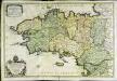
La Bretagne
1 Karte auf 2 Blättern : Kupferdruck ; 52 x 78 cm Sanson s.n.
La Bertagne Divisée En Ses Neuf Eveschés Qui Font Aussi L'Estendue Des Receptes De La Generalité De Nantes. [Karte], in: Atlas nouveau, contenant toutes les parties du monde [...], Bd. 1, S. 122.
1 Karte aus Atlas Sanson, Nicolas Jaillot, Alexis Hubert und Mortier, Pieter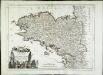
Carte du gouvernement de Bretagne
1 Karte : Kupferdruck ; 41 x 56 cm Bonne; Santini; Remondini chez Mr. Remondini
Il governo di Bretagna
1 Karte : Kupferdruck ; 30 x 40 cm Zatta; Zuliani; Pasquali presso Antonio Zatta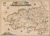
Britannia Ducatus. Duché de Bretaigne. [Karte], in: Novus Atlas, das ist, Weltbeschreibung, Bd. 2, S. 124.
1 Karte aus Atlas Blaeu, Joan Blaeu, Willem Janszoon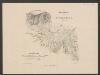
Britannia Ducatus. Duché de Bretaigne. [Karte], in: Le théâtre du monde, ou, Nouvel atlas contenant les chartes et descriptions de tous les païs de la terre, Bd. 2, S. 123.
1 Karte aus Atlas Blaeu, Willem Janszoon und Blaeu, Joan Blaeu, Willem Janszoon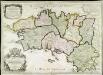
La Bretagne
1 Karte : Kupferdruck ; 45 x 63 cm Jaillot; Denis; Cordier; Basset; Basset chés Basset rue St. Jacques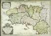
La Bretagne
1 Karte : Kupferdruck ; 44 x 63 cm Jaillot; Denis; Cordier; Basset; Basset chés Basset rue St. Jacques
Gouvernement general du Duché de Bretagne
1 Karte : Kupferdruck ; 45 x 59 cm Fer; Danet; Starckman; Guérard se vend chez Danet gendree de l'auteur sur le Pont Notre Dame a la sphere royale