Maps of okres Břeclav

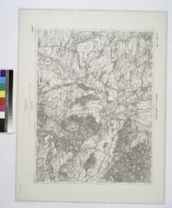
Auspitz und Nikolsburg.
from Spezialkarte der osterreichisch-ungarischen Monarchie.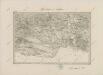
II. vojenské mapování 17
1 : 144000
Generální mapa okresních hejtmanství
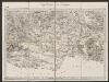
Umgebungen von Znaym
1 : 144000 K.K. Militärisches Geographisches Institut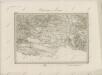
II. vojenské mapování 17
1 : 144000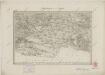
II. vojenské mapování 17
1 : 144000
Zone 10, Col. XV, Auspitz und Nikolsburg, uit: Geologische Karte der im Reichsrathe vertretenen Königreiche und Länder der Österreich-Ungarischen Monarchie : auf Grundlage der Specialkarte i.M. 1:75.000 des k.u.k. Militär-geographischen Institutes / neu bearb. und als Kartenwerk von 341 Blattnummern in zwanglosen Lfg. hrsg. durch die k.k. Geologische Reichsanstalt in Wien
1 : 75000 titelvariant: Geologische Spezialkarte der im Reichsrate vertretenen Königreiche und Länder der Österreichisch-Ungarischen Monarchie; Geologische Specialkarte der im Reichsrathe vertretenen Königreiche und Länder der Österreichisch-Ungarischen Monarchie; Annotatie: Titel bovenaan kaartblad: Geologische Spezialkarte der im Reichsrate vertretenen Königreiche und Länder der Österreichisch-Ungarischen Monarchie en Geologische Specialkarte der im Reichsrathe vertretenen Königreiche und Länder der Österreichisch-Ungarischen Monarchie; Annotatie geografische gegevens: Coördinaten gebaseerd op nulmeridiaan van Ferro (Hierro) Kaiserlich-Königliche Geologische Reichsanstalt, Wenen Wien : K.K. Geologische Reichsanstalt
Auspitz und Nikolsburg
1 : 75000 Hustopeče (Česko : oblast) Jersche K. u. k. Militärgeographisches Institut
III. vojenské mapování 4457
1 : 75000
Mikulov
1 : 75000 Mikulov (Břeclav, Česko : oblast) Vojenský zeměpisný ústav
Podrobná mapa Markrabství moravského a Vévodství slezského
1 : 100000 Břeclav (Česko : oblast) Srp, Jan Jos. R. Vilímek
Podrobná místopisná mapa Království Českého

[Eisenbahnlinie von Raigern bis Hohenau]
Hohenau an der March (Rakousko) Pernold, Adolf dolf [Pernold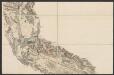
Eisenbahn Karte Wien-Dresden, Ollmütz-Trübau
1 : 72000 Blatt 4 Minarzik, Anselm J. Rauh
[Mapový list]
1 : 25000 Hrušovany nad Jevišovkou-oblast (Česko) Vojenský zeměpisný ústav
[Mapový list]
1 : 25000 Hrušovany nad Jevišovkou-oblast (Česko) Vojenský zeměpisný ústav
Politický okres hustopečský
Boček, Bohumil
III. vojenské mapování 4457/3, 4557/1
1 : 25000
Gradkartenblatt
1 : 25000 Hustopeče-oblast (Česko) Bulla, Eduard
[Mapový list]
1 : 25000 Morava (Česko) Vojenský zeměpisný ústav
[Gradkartenblatt]
1 : 25000 Hustopeče-oblast (Česko) Vojenský zeměpisný ústav
[Gradkartenblatt]
1 : 25000 Hustopeče-oblast (Česko) Vojenský zeměpisný ústav
[Mapový list]
1 : 25000 Mikulov-oblast (Břeclav, Česko) Vojenský zeměpisný ústav
III. vojenské mapování 4457/4
1 : 25000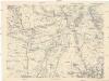
[Gradkartenblatt]
1 : 25000 Drnholec (Česko : oblast) Kartographisches Institut

III. vojenské mapování 4457/2
1 : 25000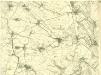
III. vojenské mapování 4457/1
1 : 25000