Maps of okres Šumperk

Freiwaldeau.
from Spezialkarte der osterreichisch-ungarischen Monarchie.
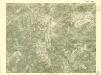
Jeseníky

Jeseníky

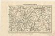
Generální mapa okresních hejtmanství
Kralický sněžník a Jeseníky

Freiwaldau
1 : 75000 Jeseník (Česko : oblast) Richter K. u. k. Militärgeographisches Institut
III. vojenské mapování 3958
1 : 75000
Kreis Habelschwerdt, Regierungs-Bezirk Breslau
1 : 100000 Jeseník-oblast (Česko) Alt, Wilhelm
Frývaldov
1 : 75000 Jeseník (Česko : oblast) Vojenský zeměpisný ústav
Frývaldov
1 : 75000 Jeseník (Česko : oblast) Vojenský zeměpisný ústav
Frývaldov a okolí
1 : 75000 Jeseník (Česko : oblast) Vojenský zeměpisný ústav

Podrobná mapa Markrabství moravského a Vévodství slezkého
1 : 100000 Bruntál (Česko : oblast) Srp, Jan Jos. R. Vilímek
[Vilímkovy místopisné mapy zemí Koruny české]
1 : 100000 Králíky (Ústí nad Orlicí, Česko : oblast) Srp, Jan Jos. R. Vilímek
Podrobná mapa Království českého
1 : 100000 Králíky (Ústí nad Orlicí, Česko : oblast) Srp, Jan Jaroslav Bursík


III. vojenské mapování 3958/2
1 : 25000
[Kartenblatt]
1 : 25000 Jeseníky (Česko : pohoří) Reichsamt für Landesaufnahme
III. vojenské mapování 3958/1
1 : 25000
[Kartenblatt]
1 : 25000 Hanušovice (Česko : oblast) Reichsamt für Landesaufnahme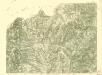
III. vojenské mapování 3958/1
1 : 25000
[Kartenblatt]
1 : 25000 Bělá pod Pradědem (Česko : oblast) Reichsamt für Landesaufnahme
III. vojenské mapování 3958/2
1 : 25000
III. vojenské mapování 3958/3
1 : 25000
[Kartenblatt]
1 : 25000 Králický Sněžník (Česko a Polsko : pohoří) Reichsamt für Landesaufnahme


