Maps of Jáchymov

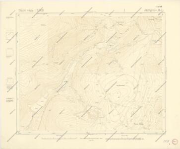
Státní mapa 1:5000

Joachimsthal - c2735-1-018 - Kaiserpflichtexemplar der Landkarten des stabilen Katasters
1 : 2880
Joachimsthal - c2735-1-020 - Kaiserpflichtexemplar der Landkarten des stabilen Katasters
1 : 2880
Joachimsthal - c2735-1-013 - Kaiserpflichtexemplar der Landkarten des stabilen Katasters
1 : 2880
Joachimsthal - c2735-1-001 - Kaiserpflichtexemplar der Landkarten des stabilen Katasters
1 : 2880
Joachimsthal - c2735-1-017 - Kaiserpflichtexemplar der Landkarten des stabilen Katasters
1 : 2880
Joachimsthal - c2735-1-010 - Kaiserpflichtexemplar der Landkarten des stabilen Katasters
1 : 2880
Joachimsthal - c2735-1-016 - Kaiserpflichtexemplar der Landkarten des stabilen Katasters
1 : 2880
Joachimsthal - c2735-1-006 - Kaiserpflichtexemplar der Landkarten des stabilen Katasters
1 : 2880
Joachimsthal - c2735-1-002 - Kaiserpflichtexemplar der Landkarten des stabilen Katasters
1 : 2880
Joachimsthal - c2735-1-012 - Kaiserpflichtexemplar der Landkarten des stabilen Katasters
1 : 2880
Joachimsthal - c2735-1-011 - Kaiserpflichtexemplar der Landkarten des stabilen Katasters
1 : 2880
Joachimsthal - c2735-1-009 - Kaiserpflichtexemplar der Landkarten des stabilen Katasters
1 : 2880
Joachimsthal - c2735-1-005 - Kaiserpflichtexemplar der Landkarten des stabilen Katasters
1 : 2880
Joachimsthal - c2735-1-014 - Kaiserpflichtexemplar der Landkarten des stabilen Katasters
1 : 2880
Joachimsthal - c2735-1-015 - Kaiserpflichtexemplar der Landkarten des stabilen Katasters
1 : 2880
Joachimsthal - c2735-1-003 - Kaiserpflichtexemplar der Landkarten des stabilen Katasters
1 : 2880
Joachimsthal - c2735-1-007 - Kaiserpflichtexemplar der Landkarten des stabilen Katasters
1 : 2880
Joachimsthal - c2735-1-004 - Kaiserpflichtexemplar der Landkarten des stabilen Katasters
1 : 2880
Joachimsthal - c2735-1-019 - Kaiserpflichtexemplar der Landkarten des stabilen Katasters
1 : 2880
Joachimsthal - c2735-1-008 - Kaiserpflichtexemplar der Landkarten des stabilen Katasters
1 : 2880
Státní mapa 1:5000

Státní mapa 1:5000

Joachimsthaler Vicariat
Jáchymov-oblast (Karlovy Vary, Česko)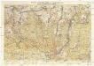
Wander- und Wintersportkarte des Erzgebirges
1 : 30000 Fichtelberg (Krušné hory, Německo : hora) G.A. Kaufmanns Buchhandlung
Lichtenstädter Vikariat
Hroznětín (Karlovy Vary, Česko)
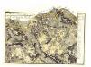
Kaaden und Joachimsthal
1 : 75000 Jáchymov (Karlovy Vary, Česko : oblast) Leitner K. u. k. militär-geographisches Institut
Kaaden und Joachimsthal
1 : 75000 Jáchymov (Karlovy Vary, Česko : oblast) Leitner K. u. k. Militärgeographisches Institut