Maps of Loučná pod Klínovcem

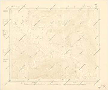
Státní mapa 1:5000

Stolzenhann - c1747-2-005 - Kaiserpflichtexemplar der Landkarten des stabilen Katasters
1 : 2880
Stolzenhann - c1747-2-001 - Kaiserpflichtexemplar der Landkarten des stabilen Katasters
1 : 2880
Stolzenhann - c1747-2-007 - Kaiserpflichtexemplar der Landkarten des stabilen Katasters
1 : 2880
Stolzenhann - c1747-2-002 - Kaiserpflichtexemplar der Landkarten des stabilen Katasters
1 : 2880
Stolzenhann - c1747-2-004 - Kaiserpflichtexemplar der Landkarten des stabilen Katasters
1 : 2880
Stolzenhann - c1747-2-006 - Kaiserpflichtexemplar der Landkarten des stabilen Katasters
1 : 2880
Stolzenhann - c1747-2-008 - Kaiserpflichtexemplar der Landkarten des stabilen Katasters
1 : 2880
Stolzenhann - c1747-2-010 - Kaiserpflichtexemplar der Landkarten des stabilen Katasters
1 : 2880
Stolzenhann - c1747-2-011 - Kaiserpflichtexemplar der Landkarten des stabilen Katasters
1 : 2880
Stolzenhann - c1747-2-009 - Kaiserpflichtexemplar der Landkarten des stabilen Katasters
1 : 2880
Stolzenhann - c1747-2-003 - Kaiserpflichtexemplar der Landkarten des stabilen Katasters
1 : 2880
Státní mapa 1:5000
III. vojenské mapování 3850/1
1 : 25000
[Kartenblatt]
1 : 25000 Boží Dar (Karlovy Vary, Česko : oblast) Reichsamt für Landesaufnahme
III. vojenské mapování 3850/1, 3750/3
1 : 25000
Joachimsthaler Vicariat
Jáchymov-oblast (Karlovy Vary, Česko)
Wander- und Wintersportkarte des Erzgebirges
1 : 30000 Fichtelberg (Krušné hory, Německo : hora) G.A. Kaufmanns Buchhandlung
Kaaden und Joachimsthal
1 : 75000 Jáchymov (Karlovy Vary, Česko : oblast) Leitner K. u. k. militär-geographisches Institut
Kaaden und Joachimsthal
1 : 75000 Jáchymov (Karlovy Vary, Česko : oblast) Leitner K. u. k. Militärgeographisches Institut
Kaaden und Joachimsthal
1 : 75000 Jáchymov (Karlovy Vary, Česko : oblast) K. u. k. Militärgeographisches Institut
Kadaň a Jáchymov
1 : 75000 Jáchymov (Karlovy Vary, Česko : oblast) Vojenský zeměpisný ústav
III. vojenské mapování 3850
1 : 75000
Ostrov u Karlových Varů a okolí
1 : 75000 Karlovy Vary (Česko : oblast) Vojenský zeměpisný ústav
Podrobná mapa Království českého
1 : 100000 Jáchymov (Karlovy Vary, Česko : oblast) Srp, Jan Jos. R. Vilímek
[Vilímkovy místopisné mapy zemí Koruny české]
1 : 100000 Jáchymov (Karlovy Vary, Česko : oblast) Srp, Jan Jos. R. Vilímek
Mapy plánování ČSR

Kaaden und St. Joachimsthal.
from Spezialkarte der osterreichisch-ungarischen Monarchie.