Maps of Quartier de Bercy

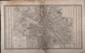
Plan de la ville de Paris

Östliche Hälfte von Paris
Grosser Hand-Atlas über alle Theile der Erde in 170 Karten Meyer, J. Verlag des Bibliographischen Instituts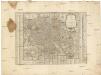
Nouveau plan de Paris et de ses faubourgs
Paříž (Francie) Löwe, Cornelius Mondhare, Louis-Joseph Mondhare
Lutetia Parisorum urbs, toto orbe celeberrima notissimaque, caput regni Franciae / [Claes Jansz. Visscher]
1 : 2000 Annotatie: Facs. van de uitg.: [Amsterdam] : C.J. Visscher excudebat, 1618; Met 8 afbeelding van klederdrachten Visscher, Claes Jansz. [Paris : IGN]

Grand Plan de Paris et de ses Evirons VI.

[Linkerhelft], uit: La ville, cité, université de Paris
1 : 4500 titelvariant: Le plan de Paris par Truschet et Hoyau; Annotatie: Bijlage bij: Le plan de Paris par Truschet et Hoyau ... - Zürich : Seefeld, 1980; Facs. van de uitg.: A Paris : par Olivier Truchet, & Germain Hoyau, [1550] Olivier Truschet; Germain Hoyau Zürich : Seefeld
Plan Monumental de Paris au XVII siécle I.
Paris au XVIII siécle 5
Paris au XVIII siécle 3

Grundriss des Friedhofes Pére la Chaise

La Topographie de Paris ou Plan détaillé de la Ville de Paris 13
La Topographie de Paris ou Plan détaillé de la Ville de Paris 8

La Topographie de Paris ou Plan détaillé de la Ville de Paris 18
Paris au XVIII siécle 10

La Topographie de Paris ou Plan détaillé de la Ville de Paris 19-20

Grand Plan de Paris et de ses Evirons V.

Plan de la Riviere de Seine dans Paris
1 : 1
La Topographie de Paris ou Plan détaillé de la Ville de Paris 9

La Topographie de Paris ou Plan détaillé de la Ville de Paris 3

La Topographie de Paris ou Plan détaillé de la Ville de Paris 17

La Topographie de Paris ou Plan détaillé de la Ville de Paris 7

La Topographie de Paris ou Plan détaillé de la Ville de Paris 11-14

Le plan de Paris ses faubourgs et ses environs divisé suivant ses meridiens et paralleles par minutes et secondes = Grund-Riss der Stadt Paris, welcher dieselbe nach ihren Mittags und Parallel Linien in Minuten und Secunden abtheilet
1 : 10200 Seutter, Matthaeus, 1678-1756 Matthieu Seutter
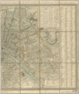
Nouveau plan ou guide de l'étranger dans Paris
Paříž (Francie) Duchez, Eugene Aug[us]te Logerot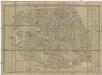
Nouveau plan ou guide de l'étranger dans Paris
Paříž (Francie) Duchez, Eugene Aug[us]te Logerot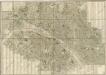
Nouveau plan routier de la ville et des Faubourgs de Paris
Plan de la ville de Paris
Girard, Xavier; Vicq, J. M.; Pélicier, A. Goujon [u.a.]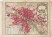
Plan de Paris : divisé en seize quartiers en execution de l'ordonnance du bureau de la ville du 24 Fevrier 1744
1 : 10000 Lagrive, Jean de, 1689-1757 de l'imprimiere Charbonnier