Maps of Salzburg-Umgebung
Carte des Herzogthums Salzburg...
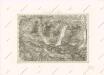
[Salzkammergut]
Solná komora (Rakousko)
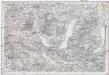
Gmunden und Schafberg.
from Spezialkarte der osterreichisch-ungarischen Monarchie.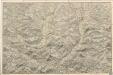
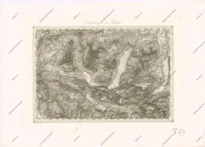
Reliefkarte des Salzkammergutes

Archiducatus Austriae Superioris Geographica Descriptio. facta Anno 1667
1 : 150000 Mollova mapová sbírka Vischer, Georg Matthaeus Küssel, Melchior
Attersee und Mondsee
1 : 100000 Horní Rakousko (Rakousko) Freytag & Berndt
Mondsee und St. Wolfgang-See
1 : 100000 Horní Rakousko (Rakousko) Freytag & Berndt
Bairische Landtafeln XXIIII. Darinnē das hochlöblich Furstenthumb Obern unnd Nidern Bayrn sambt der Obern Pflaz Erz unnd Stifft Salzburg Eichstet unnd andern mehrern anstossenden Herschafftē]
1 : 145000 Mollova mapová sbírka Apian, Philipp Amman, Jost Apian, Petrus
Wegweiser fur die näheren und entfernteren Unterhaltungs-Punkte von Ischl
Bad Ischl (Rakousko) Kumntner, Carl Oberer, Joseph
Wegweiser fur die näheren und entfernteren Unterhaltungs-Punkte von Ischl
Bad Ischl (Rakousko) Kumntner, Carl Oberer, Joseph
Attersee
1 : 50000 Horní Rakousko (Rakousko) Kartographisches Institu
Straszwalchen
1 : 50000 Salcbursko (Rakousko) Kartographisches Institut
Straszwalchen
1 : 50000 Salcbursko (Rakousko) Kartographisches Institut
Bad Ischl und Umgebung
1 : 100000 Bad Ischl (Rakousko) Freytag & Berndt
Seekirchen
1 : 25000 Hauptvermessungsabteilung XIV
Attersee
1 : 25000 Hauptvermessungsabteilung XIV
Ebenau
1 : 25000 Kartographisches Institut
Frankenmart
1 : 25000 Kartographisches Institut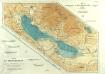
Atlas der österreichischen Alpenseen

Mondsee
1 : 25000 Mondsee (Rakousko : jezero) Hauptvermessungsabteilung XIV
Unterach
1 : 25000 Kartographisches Institut
Straszwalchen
1 : 25000 Kartographisches Institut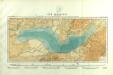
Atlas der österreichischen Alpenseen

St. Wolfgang
1 : 25000 Kartographisches Institut
Schörfling
1 : 25000 Horní Rakousko (Rakousko) Kartographisches Institut
Hintersee
1 : 25000 Hauptvermessungsabteilung XIV
Schörfling
1 : 25000 Hauptvermessungsabteilung XIV
Bad Ischl
1 : 25000 Bad Ischl (Rakousko) Kartographisches Institut
Bad Ischl
1 : 25000 Bad Ischl (Rakousko) Hauptvermessungsabteilung XIV