Maps of Černá v Pošumaví
Bez titulu: Katastrální plán – Horní Planá

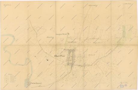
Oberplan - c2118-1-003 - Kaiserpflichtexemplar der Landkarten des stabilen Katasters
1 : 2880
Oberplan - c2118-1-009 - Kaiserpflichtexemplar der Landkarten des stabilen Katasters
1 : 2880
Oberplan - c2118-1-005 - Kaiserpflichtexemplar der Landkarten des stabilen Katasters
1 : 2880
Oberplan - c2118-1-002 - Kaiserpflichtexemplar der Landkarten des stabilen Katasters
1 : 2880
Oberplan - c2118-1-007 - Kaiserpflichtexemplar der Landkarten des stabilen Katasters
1 : 2880
Oberplan - c2118-1-001 - Kaiserpflichtexemplar der Landkarten des stabilen Katasters
1 : 2880
Oberplan - c2118-1-006 - Kaiserpflichtexemplar der Landkarten des stabilen Katasters
1 : 2880
Oberplan - c2118-1-004 - Kaiserpflichtexemplar der Landkarten des stabilen Katasters
1 : 2880
Oberplan - c2118-1-008 - Kaiserpflichtexemplar der Landkarten des stabilen Katasters
1 : 2880
III. vojenské mapování 4452/3
1 : 25000
[Mapový list]
1 : 25000 Horní Planá-oblast (Česko) Vojenský zeměpisný ústav
[Gradkartenblatt]
1 : 25000 Horní Planá (Česko : oblast) Kartographisches Institut
Schulwandkarte des politischen Bezirkes Krumau Blatt 3


Schulwandkarte des politischen Bezirkes Krumau Blatt 3

Podrobné mapy zemí Koruny české v měřítku 1:75.000 a mapa vzdáleností všech míst při silnici ležících - Hor. Planá - Vyšší Brod. Průvodce statisticko-historický po všech místech na těchto mapách uvedených a rejstřík věcný názvů hor, potoků, řek, rybníků atd. Sešit 26. List 48,
1 : 75000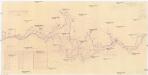
Zátopová plocha vodního díla Lipno
1 : 51600 Lipno (Česko : vodní nádrž : oblast)
III. vojenské mapování 4452
1 : 75000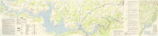
Lipenská přehrada

Český Krumlov
1 : 75000 Čechy (Česko) Vojenský zeměpisný ústav
Český Krumlov
1 : 75000 Čechy (Česko) Vojenský zeměpisný ústav
Krumau und Wallern
1 : 75000 Volary (Česko : oblast) Kohout, F. K. u. k. militär geographisches Institut
Krumau und Wallern
1 : 75000 Volary (Česko : oblast) K. u. k. Militärgeographisches Institut
Podrobná mapa království Českého: Prachatice – Volary - Hor. Planá

Prachatice - Volary - Hor. Planá
1 : 100000 Horní Planá-oblast (Česko)
II. vojenské mapování 34
1 : 144000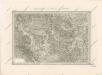
Special - Karte des Koenigreiches Boehmen

Krumau und Wallern.
from Spezialkarte der osterreichisch-ungarischen Monarchie.