Maps of Cheshire
Cheshire, Sheet 12 - Bartholomew's "Half Inch to the Mile Maps" of England & Wales
1 : 126720 Topographic maps Bartholomew, John George John Bartholomew & Co
Sheets 40-41. (Cary's England, Wales, and Scotland).
1 : 360000 Cary, John, ca. 1754-1835
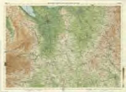
Stoke on Trent - OS One-Inch Map
1 : 63360 Topographic maps Ordnance Survey Ordnance Survey
Chester - OS One-Inch Map
1 : 63360 Topographic maps Ordnance Survey Ordnance Survey
Shrewsbury - OS One-Inch Map
1 : 63360 Topographic maps Ordnance Survey Ordnance Survey
Chester 26
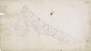
1 : 31680 This plan follows the meandering River Dee from Chester, at the top of the map, to Overton and Ruabon, at the bottom left. A section of the Shropshire Union Canal, running from Chester to Waverton, is shown in blue. At the bottom left of the map, an area calculation table survives in black ink. The pencil gridlines running through Chester were most likely guides for making enlarged or reduced copies of the map. Field, John
Market Drayton
1 : 31680 This plan covers the Shropshire,Northern Plain, near the border with Cheshire and Staffordshire. The area,is characterised by small woodlands, formal parkland, meres (lakes), mosses, pools and other wetland habitats. Mills are indicated near the town of Market Drayton, central towards the top,,where about two hundred workers were employed in the manufacture of horse-hair products. Stevens, Henry
Oswestry
1 : 31680 This drawing is formally titled. The scale of the drawing isgiven and the area of the land noted as 145.9838 square miles., A triangulation diagram appears on the reverse of the manuscript., This enabled draughtsmen to plot the exact location of topographical features., Archaeological sites are named in gothic script., Colour washes are combined with numerical annotations to indicate the relative relief and overall height of hills. Dawson, Robert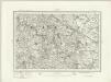
Flint (Outline) - OS One-Inch Revised New Series
1 : 63360 Topographic maps Ordnance Survey Ordnance Survey
Flint (Hills) - OS One-Inch Revised New Series
1 : 63360 Topographic maps Ordnance Survey Ordnance Survey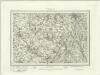
Macclesfield (Outline) - OS One-Inch Revised New Series
1 : 63360 Topographic maps Ordnance Survey Ordnance Survey
Macclesfield (Hills) - OS One-Inch Revised New Series
1 : 63360 Topographic maps Ordnance Survey Ordnance Survey
Wrexham (Hills) - OS One-Inch Revised New Series
1 : 63360 Topographic maps Ordnance Survey Ordnance Survey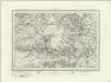
Wrexham (Outline) - OS One-Inch Revised New Series
1 : 63360 Topographic maps Ordnance Survey Ordnance Survey
Stoke upon Trent (Hills) - OS One-Inch Revised New Series
1 : 63360 Topographic maps Ordnance Survey Ordnance Survey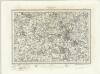
Stoke upon Trent (Outline) - OS One-Inch Revised New Series
1 : 63360 Topographic maps Ordnance Survey Ordnance Survey
Oswestry (Hills) - OS One-Inch Revised New Series
1 : 63360 Topographic maps Ordnance Survey Ordnance Survey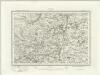
Oswestry (Outline) - OS One-Inch Revised New Series
1 : 63360 Topographic maps Ordnance Survey Ordnance Survey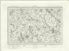
Stafford (Outline) - OS One-Inch Revised New Series
1 : 63360 Topographic maps Ordnance Survey Ordnance Survey
Stafford (Hills) - OS One-Inch Revised New Series
1 : 63360 Topographic maps Ordnance Survey Ordnance Survey
Chester (Hills) - OS One-Inch Revised New Series
1 : 63360 Topographic maps Ordnance Survey Ordnance Survey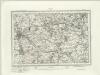
Chester (Outline) - OS One-Inch Revised New Series
1 : 63360 Topographic maps Ordnance Survey Ordnance Survey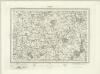
Nantwich (Outline) - OS One-Inch Revised New Series
1 : 63360 Topographic maps Ordnance Survey Ordnance Survey
Nantwich (Hills) - OS One-Inch Revised New Series
1 : 63360 Topographic maps Ordnance Survey Ordnance Survey
Wem (Outline) - OS One-Inch Revised New Series
1 : 63360 Topographic maps Ordnance Survey Ordnance Survey
Wem (Hills) - OS One-Inch Revised New Series
1 : 63360 Topographic maps Ordnance Survey Ordnance Survey
Cyrn y Brain
1 : 31680 The county boundary of Denbighshire and Flintshire is indicated here by a red pecked line. The plan is formally titled, with a note in the top left corner explaining that it has been copied from the original protraction with north facing upwards instead of true. A triangulation diagram appears on the reverse of the drawing: this enabled the draughtsman to plot with prominent topographical features with precision. Many pencil lines radiate from a trigonometrical point at Cefny Fedw, indicated by a dot within a triangle. These represent the angular measurements taken from this point. Giles, John C.
Actual Survey of the County of Salop
Rocque, John
Betley
1 : 31680 .A triangulation diagram appears on the reverse of this drawing. This was an essential tool enabling draughtsmen to plot the exact location of prominent features of the landscape. A section of the Shropshire Union Canal is shown in blue near Audlem at the bottom left of the map. Stevens, Henry