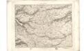
Maps of Inverness
Central Ross, Sheet 20 - Bartholomew's "Half Inch to the Mile Maps" of Scotland
1 : 126720 Topographic maps John Bartholomew & Son, Ltd John Bartholomew & Son, Ltd
Central Ross & Cromarty, Sheet 20 - Bartholomew's "Half Inch to the Mile Maps" of Scotland
1 : 126720 Topographic maps Bartholomew, John George John Bartholomew & Co
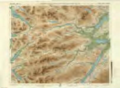
Strathpeffer - OS One-Inch Map
1 : 63360 Topographic maps Ordnance Survey Ordnance Survey
Inverness - Bartholomew's 'Survey Atlas of Scotland'
1 : 126720 Topographic maps John Bartholomew & Son, Ltd John Bartholomew & Son, Ltd
Lochcarron - OS One-Inch Map
1 : 63360 Topographic maps Ordnance Survey Ordnance Survey
Strome Ferry, Gairloch - Bartholomew's 'Survey Atlas of Scotland'
1 : 126720 Topographic maps John Bartholomew & Son, Ltd John Bartholomew & Son, Ltd
Loch Maree & Achnasheen (26) - OS One-Inch map
1 : 63360 Topographic maps Ordnance Survey Ordnance Survey
Loch Maree & Achnasheen (26) - OS One-Inch map
1 : 63360 Topographic maps Ordnance Survey Ordnance Survey
Lochcarron & Dornie (36) - OS One-Inch map
1 : 63360 Topographic maps Ordnance Survey Ordnance Survey
Lochcarron & Dornie (36) - OS One-Inch map
1 : 63360 Topographic maps Ordnance Survey Ordnance Survey
Volume 2: Sheet 82 - Lochcarron
1 : 63360 Farquharson, J.
Strathpeffer & Invergordon (27) - OS One-Inch map
1 : 63360 Topographic maps Ordnance Survey Ordnance Survey
Strathpeffer & Invergordon (27) - OS One-Inch map
1 : 63360 Topographic maps Ordnance Survey Ordnance Survey
Lochcarron - OS One-Inch map
1 : 63360 Topographic maps Ordnance Survey Ordnance Survey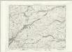
Lochcarron - OS One-Inch map
1 : 63360 Topographic maps Ordnance Survey Ordnance Survey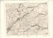
Lochcarron - OS One-Inch map
1 : 63360 Topographic maps Ordnance Survey Ordnance Survey
Inverness - OS One-Inch map
1 : 63360 Topographic maps Ordnance Survey Ordnance Survey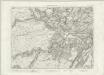
Inverness - OS One-Inch map
1 : 63360 Topographic maps Ordnance Survey Ordnance Survey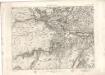
Inverness - OS One-Inch map
1 : 63360 Topographic maps Ordnance Survey Ordnance Survey
Inverness (37) - OS One-Inch map
1 : 63360 Topographic maps Ordnance Survey Ordnance Survey
Inverness (37) - OS One-Inch map
1 : 63360 Topographic maps Ordnance Survey Ordnance Survey
Fort Augustus - OS One-Inch map
1 : 63360 Topographic maps Ordnance Survey Ordnance Survey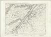
Fort Augustus - OS One-Inch map
1 : 63360 Topographic maps Ordnance Survey Ordnance Survey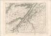
Fort Augustus - OS One-Inch map
1 : 63360 Topographic maps Ordnance Survey Ordnance Survey
Inverbroom - OS One-Inch map
1 : 63360 Topographic maps Ordnance Survey Ordnance Survey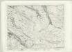
Inverbroom - OS One-Inch map
1 : 63360 Topographic maps Ordnance Survey Ordnance Survey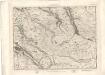
Inverbroom - OS One-Inch map
1 : 63360 Topographic maps Ordnance Survey Ordnance Survey
Cluanie - OS One-Inch map
1 : 63360 Topographic maps Ordnance Survey Ordnance Survey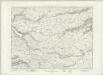
Cluanie - OS One-Inch map
1 : 63360 Topographic maps Ordnance Survey Ordnance Survey