Maps of Grampound with Creed

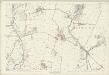
SW95 - OS 1:25,000 Provisional Series Map
1 : 25000 Topographic maps Ordnance Survey Ordnance Survey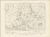
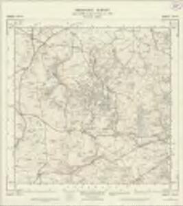
Cornwall XLI.SW - OS Six-Inch Map
1 : 10560 Topographic maps Ordnance Survey Ordnance Survey
Cornwall XLI.SW - OS Six-Inch Map
1 : 10560 Topographic maps Ordnance Survey Ordnance Survey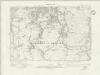
Cornwall L.NW - OS Six-Inch Map
1 : 10560 Topographic maps Ordnance Survey Ordnance Survey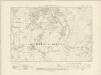
Cornwall L.NW - OS Six-Inch Map
1 : 10560 Topographic maps Ordnance Survey Ordnance Survey
Cornwall L.NW - OS Six-Inch Map
1 : 10560 Topographic maps Ordnance Survey Ordnance Survey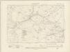
Cornwall L.SW - OS Six-Inch Map
1 : 10560 Topographic maps Ordnance Survey Ordnance Survey
Cornwall L.SW - OS Six-Inch Map
1 : 10560 Topographic maps Ordnance Survey Ordnance Survey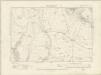
Cornwall XLIX.NE - OS Six-Inch Map
1 : 10560 Topographic maps Ordnance Survey Ordnance Survey
Cornwall XLIX.NE - OS Six-Inch Map
1 : 10560 Topographic maps Ordnance Survey Ordnance Survey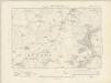
Cornwall XL.SE - OS Six-Inch Map
1 : 10560 Topographic maps Ordnance Survey Ordnance Survey
Cornwall XL.SE - OS Six-Inch Map
1 : 10560 Topographic maps Ordnance Survey Ordnance Survey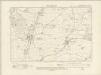
Cornwall XLIX.SE - OS Six-Inch Map
1 : 10560 Topographic maps Ordnance Survey Ordnance Survey
Cornwall XLIX.SE - OS Six-Inch Map
1 : 10560 Topographic maps Ordnance Survey Ordnance Survey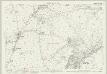
Cornwall XL.12 (includes: St Columb Major; St Dennis; St Enoder) - 25 Inch Map
1 : 2500 Topographic maps Ordnance Survey Ordnance Survey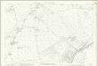
Cornwall XL.12 (includes: St Columb Major; St Dennis; St Enoder) - 25 Inch Map
1 : 2500 Topographic maps Ordnance Survey Ordnance Survey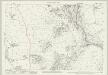
Cornwall XL.16 (includes: St Dennis; St Enoder; St Stephen in Brannel) - 25 Inch Map
1 : 2500 Topographic maps Ordnance Survey Ordnance Survey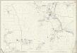
Cornwall XL.16 (includes: St Dennis; St Enoder; St Stephen in Brannel) - 25 Inch Map
1 : 2500 Topographic maps Ordnance Survey Ordnance Survey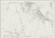
Cornwall XLIX.4 (includes: Ladock; St Enoder; St Stephen in Brannel) - 25 Inch Map
1 : 2500 Topographic maps Ordnance Survey Ordnance Survey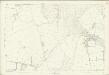
Cornwall XLIX.4 (includes: Ladock; St Enoder; St Stephen in Brannel) - 25 Inch Map
1 : 2500 Topographic maps Ordnance Survey Ordnance Survey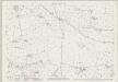
Cornwall XLIX.8 (includes: Ladock; St Enoder; St Stephen in Brannel) - 25 Inch Map
1 : 2500 Topographic maps Ordnance Survey Ordnance Survey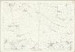
Cornwall XLIX.8 (includes: Ladock; St Enoder; St Stephen in Brannel) - 25 Inch Map
1 : 2500 Topographic maps Ordnance Survey Ordnance Survey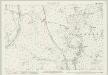
Cornwall XLI.9 (includes: St Columb Major; St Dennis) - 25 Inch Map
1 : 2500 Topographic maps Ordnance Survey Ordnance Survey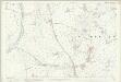
Cornwall XLI.9 (includes: St Columb Major; St Dennis) - 25 Inch Map
1 : 2500 Topographic maps Ordnance Survey Ordnance Survey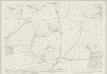
Cornwall XLIX.12 (includes: Ladock; Probus; St Stephen in Brannel) - 25 Inch Map
1 : 2500 Topographic maps Ordnance Survey Ordnance Survey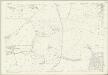
Cornwall XLIX.12 (includes: Ladock; Probus; St Stephen in Brannel) - 25 Inch Map
1 : 2500 Topographic maps Ordnance Survey Ordnance Survey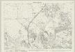
Cornwall XLI.13 (includes: St Dennis; St Stephen in Brannel) - 25 Inch Map
1 : 2500 Topographic maps Ordnance Survey Ordnance Survey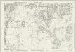
Cornwall L.1 (includes: St Stephen in Brannel) - 25 Inch Map
1 : 2500 Topographic maps Ordnance Survey Ordnance Survey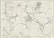
Cornwall L.5 (includes: St Stephen in Brannel) - 25 Inch Map
1 : 2500 Topographic maps Ordnance Survey Ordnance Survey
Cornwall L.5 (includes: St Stephen in Brannel) - 25 Inch Map
1 : 2500 Topographic maps Ordnance Survey Ordnance Survey